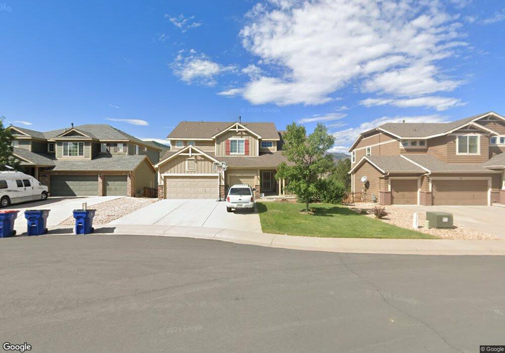
7793 Verandah Ct Littleton, CO 80125
Estimated Value: $823,245 - $936,000
4
Beds
4
Baths
3,007
Sq Ft
$288/Sq Ft
Est. Value
About This Home
This home is located at 7793 Verandah Ct, Littleton, CO 80125 and is currently estimated at $866,311, approximately $288 per square foot. 7793 Verandah Ct is a home located in Douglas County with nearby schools including Roxborough Elementary School, Roxborough Intermediate School, and Ranch View Middle School.
Ownership History
Date
Name
Owned For
Owner Type
Purchase Details
Closed on
May 6, 2010
Sold by
The Ryland Group Inc
Bought by
Peavy Eric J and Peavy Rory V
Current Estimated Value
Home Financials for this Owner
Home Financials are based on the most recent Mortgage that was taken out on this home.
Original Mortgage
$353,184
Outstanding Balance
$241,880
Interest Rate
5.5%
Mortgage Type
FHA
Estimated Equity
$624,431
Purchase Details
Closed on
Jul 1, 2008
Sold by
Signature Roxborough Llc
Bought by
Ryland Group Inc
Create a Home Valuation Report for This Property
The Home Valuation Report is an in-depth analysis detailing your home's value as well as a comparison with similar homes in the area
Home Values in the Area
Average Home Value in this Area
Purchase History
| Date | Buyer | Sale Price | Title Company |
|---|---|---|---|
| Peavy Eric J | $385,681 | Ryland Title Company | |
| Ryland Group Inc | $750,000 | -- |
Source: Public Records
Mortgage History
| Date | Status | Borrower | Loan Amount |
|---|---|---|---|
| Open | Peavy Eric J | $353,184 |
Source: Public Records
Tax History Compared to Growth
Tax History
| Year | Tax Paid | Tax Assessment Tax Assessment Total Assessment is a certain percentage of the fair market value that is determined by local assessors to be the total taxable value of land and additions on the property. | Land | Improvement |
|---|---|---|---|---|
| 2024 | $5,245 | $53,870 | $7,530 | $46,340 |
| 2023 | $5,280 | $53,870 | $7,530 | $46,340 |
| 2022 | $4,405 | $42,110 | $5,520 | $36,590 |
| 2021 | $4,604 | $42,110 | $5,520 | $36,590 |
| 2020 | $4,463 | $38,500 | $6,020 | $32,480 |
| 2019 | $4,534 | $38,500 | $6,020 | $32,480 |
| 2018 | $5,462 | $37,880 | $4,520 | $33,360 |
| 2017 | $5,248 | $37,880 | $4,520 | $33,360 |
| 2016 | $4,860 | $34,640 | $5,570 | $29,070 |
| 2015 | $5,020 | $34,640 | $5,570 | $29,070 |
| 2014 | $5,022 | $32,230 | $5,170 | $27,060 |
Source: Public Records
Map
Nearby Homes
- 7832 Elmwood St
- 7597 Bison Ct
- 7888 Canvasback Cir
- 7627 Halleys Dr
- 7653 Kyle Way
- 8032 Mount Ouray Rd
- 7680 Elmwood St
- 7719 Jared Way
- 7910 Jared Way
- 8109 Mount Ouray Rd
- 8129 Locust Dr
- 7575 Elmwood St
- 7217 Red Mesa Ct
- 8145 Monte Vista Cir
- 9650 Fox Den Dr
- 7191 Red Mesa Dr
- 8176 Locust Dr
- 9753 Middle Peak St
- 8132 Mount Harvard Rd
- 7712 Brown Bear Way
- 7783 Verandah Ct
- 7805 Verandah Ct
- 7742 Rampart Way
- 7773 Verandah Ct
- 7752 Rampart Way
- 7734 Rampart Way
- 7767 Verandah Ct
- 7760 Verandah Ct
- 7722 Rampart Way
- 7761 Verandah Ct
- 7746 Verandah Ct
- 10093 Rampart Ct
- 10101 Rampart Ct
- 7710 Rampart Way
- 7747 Verandah Ct
- 10111 Rampart Ct
- 7690 Rampart Way
- 7698 Rampart Way
- 7740 Verandah Ct
- 7742 Verandah Ct