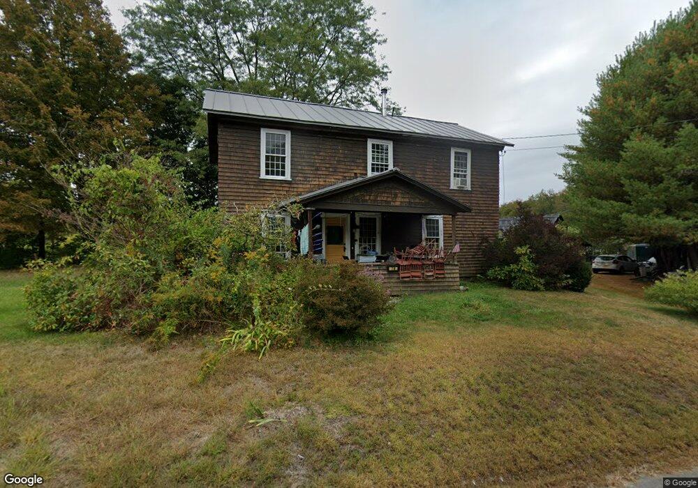
78 Ashfield Rd Shelburne Falls, MA 01370
Buckland NeighborhoodEstimated Value: $302,000 - $381,000
3
Beds
1
Bath
2,130
Sq Ft
$161/Sq Ft
Est. Value
About This Home
This home is located at 78 Ashfield Rd, Shelburne Falls, MA 01370 and is currently estimated at $342,497, approximately $160 per square foot. 78 Ashfield Rd is a home with nearby schools including Mohawk Trail Regional High School.
Ownership History
Date
Name
Owned For
Owner Type
Purchase Details
Closed on
May 23, 2007
Sold by
John E Nelson T
Bought by
Kontrabecki Stacy L
Current Estimated Value
Home Financials for this Owner
Home Financials are based on the most recent Mortgage that was taken out on this home.
Original Mortgage
$138,960
Outstanding Balance
$84,985
Interest Rate
6.27%
Mortgage Type
Purchase Money Mortgage
Estimated Equity
$257,512
Create a Home Valuation Report for This Property
The Home Valuation Report is an in-depth analysis detailing your home's value as well as a comparison with similar homes in the area
Home Values in the Area
Average Home Value in this Area
Purchase History
| Date | Buyer | Sale Price | Title Company |
|---|---|---|---|
| Kontrabecki Stacy L | $193,000 | -- |
Source: Public Records
Mortgage History
| Date | Status | Borrower | Loan Amount |
|---|---|---|---|
| Open | Kontrabecki Stacy L | $138,960 |
Source: Public Records
Tax History Compared to Growth
Tax History
| Year | Tax Paid | Tax Assessment Tax Assessment Total Assessment is a certain percentage of the fair market value that is determined by local assessors to be the total taxable value of land and additions on the property. | Land | Improvement |
|---|---|---|---|---|
| 2025 | $4,647 | $274,300 | $49,800 | $224,500 |
| 2024 | $4,532 | $258,100 | $49,800 | $208,300 |
| 2023 | $3,993 | $235,700 | $49,800 | $185,900 |
| 2022 | $3,955 | $235,700 | $49,800 | $185,900 |
| 2021 | $3,759 | $210,700 | $49,800 | $160,900 |
| 2020 | $3,658 | $197,500 | $49,800 | $147,700 |
| 2019 | $3,441 | $184,700 | $49,800 | $134,900 |
| 2018 | $3,359 | $178,200 | $49,800 | $128,400 |
| 2017 | $3,217 | $178,200 | $49,800 | $128,400 |
| 2016 | $3,047 | $180,300 | $49,800 | $130,500 |
| 2015 | $3,029 | $180,300 | $49,800 | $130,500 |
Source: Public Records
Map
Nearby Homes
- 2151 Route 2
- 2155 Massachusetts 2
- 31 W Oxbow Rd
- 24 W Oxbow Rd
- 156 Ashfield Rd
- 7 Hog Hollow Rd
- 33 Williams St
- 10 Deerfield Ave Unit 5
- 10 Deerfield Ave Unit 2
- 105 - 107 Bridge St
- 0 W Oxbow Rd Unit 73453651
- 0 Upper St
- 102 Elm St
- 143 Charlemont Rd
- 0 Ashfield Rd
- 32 Navaho Ln
- 3+5 Church St
- 139 Taylor Brook Rd
- 14 South Rd
- 6 Chippewa Dr