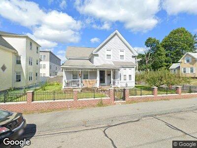
78 Freeman St Stoughton, MA 02072
Estimated Value: $537,000 - $606,000
3
Beds
2
Baths
1,637
Sq Ft
$346/Sq Ft
Est. Value
About This Home
This home is located at 78 Freeman St, Stoughton, MA 02072 and is currently estimated at $567,199, approximately $346 per square foot. 78 Freeman St is a home located in Norfolk County with nearby schools including Wilkins Elementary School, O'Donnell Middle School, and Stoughton High School.
Ownership History
Date
Name
Owned For
Owner Type
Purchase Details
Closed on
Aug 19, 2016
Sold by
Baptista Maria J
Bought by
Maria J Baptista Irt and Pimentel
Current Estimated Value
Purchase Details
Closed on
Mar 3, 1972
Bought by
Baptista Epifanio B and Baptista Maria J
Create a Home Valuation Report for This Property
The Home Valuation Report is an in-depth analysis detailing your home's value as well as a comparison with similar homes in the area
Home Values in the Area
Average Home Value in this Area
Purchase History
| Date | Buyer | Sale Price | Title Company |
|---|---|---|---|
| Maria J Baptista Irt | -- | -- | |
| Maria J Baptista Irt | -- | -- | |
| Maria J Baptista Irt | -- | -- | |
| Baptista Epifanio B | -- | -- |
Source: Public Records
Mortgage History
| Date | Status | Borrower | Loan Amount |
|---|---|---|---|
| Open | Palmer Christopher M | $200,000 | |
| Previous Owner | Palmer Christopher M | $100,000 |
Source: Public Records
Tax History Compared to Growth
Tax History
| Year | Tax Paid | Tax Assessment Tax Assessment Total Assessment is a certain percentage of the fair market value that is determined by local assessors to be the total taxable value of land and additions on the property. | Land | Improvement |
|---|---|---|---|---|
| 2025 | $5,729 | $462,800 | $197,800 | $265,000 |
| 2024 | $5,669 | $445,300 | $180,300 | $265,000 |
| 2023 | $5,489 | $405,100 | $167,500 | $237,600 |
| 2022 | $5,284 | $366,700 | $153,200 | $213,500 |
| 2021 | $4,965 | $328,800 | $138,800 | $190,000 |
| 2020 | $4,824 | $324,000 | $134,000 | $190,000 |
| 2019 | $4,674 | $304,700 | $134,000 | $170,700 |
| 2018 | $4,356 | $294,100 | $127,600 | $166,500 |
| 2017 | $3,905 | $269,500 | $121,200 | $148,300 |
| 2016 | $3,786 | $252,900 | $111,700 | $141,200 |
| 2015 | $3,730 | $246,500 | $105,300 | $141,200 |
| 2014 | $3,620 | $230,000 | $95,700 | $134,300 |
Source: Public Records
Map
Nearby Homes
- 78 Freeman St
- 74 Freeman St
- 86 Freeman St
- 66 Freeman St
- 79 Freeman St Unit 81
- 143 Porter St
- 143 Porter St Unit 3
- 143 Porter St Unit 2
- 143 Porter St Unit 1
- 75 Freeman St
- 83 Freeman St
- 147 Porter St
- 52 Freeman St
- 105 Porter St
- 105 Porter St
- 105 Porter St Unit 1D
- 105 Porter St Unit 2H
- 105 Porter St Unit 3D
- 105 Porter St Unit 3E
- 105 Porter St Unit 2F