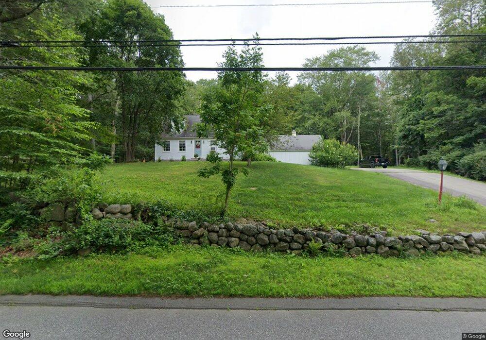
78 MacK Hill Rd Amherst, NH 03031
Estimated Value: $543,000 - $670,000
2
Beds
2
Baths
2,125
Sq Ft
$274/Sq Ft
Est. Value
About This Home
This home is located at 78 MacK Hill Rd, Amherst, NH 03031 and is currently estimated at $583,109, approximately $274 per square foot. 78 MacK Hill Rd is a home located in Hillsborough County with nearby schools including Wilkins Elementary School, Amherst Middle School, and Souhegan Cooperative High School.
Ownership History
Date
Name
Owned For
Owner Type
Purchase Details
Closed on
Dec 14, 2009
Sold by
Knettell Beverly L
Bought by
Lancaster Thomas J
Current Estimated Value
Home Financials for this Owner
Home Financials are based on the most recent Mortgage that was taken out on this home.
Original Mortgage
$255,375
Interest Rate
5.02%
Mortgage Type
Purchase Money Mortgage
Create a Home Valuation Report for This Property
The Home Valuation Report is an in-depth analysis detailing your home's value as well as a comparison with similar homes in the area
Home Values in the Area
Average Home Value in this Area
Purchase History
| Date | Buyer | Sale Price | Title Company |
|---|---|---|---|
| Lancaster Thomas J | $250,000 | -- |
Source: Public Records
Mortgage History
| Date | Status | Borrower | Loan Amount |
|---|---|---|---|
| Open | Lancaster Thomas J | $257,280 | |
| Closed | Lancaster Thomas J | $255,375 | |
| Previous Owner | Lancaster Thomas J | $165,000 |
Source: Public Records
Tax History Compared to Growth
Tax History
| Year | Tax Paid | Tax Assessment Tax Assessment Total Assessment is a certain percentage of the fair market value that is determined by local assessors to be the total taxable value of land and additions on the property. | Land | Improvement |
|---|---|---|---|---|
| 2024 | $7,966 | $347,400 | $158,100 | $189,300 |
| 2023 | $7,601 | $347,400 | $158,100 | $189,300 |
| 2022 | $7,341 | $347,400 | $158,100 | $189,300 |
| 2021 | $7,403 | $347,400 | $158,100 | $189,300 |
| 2020 | $7,040 | $247,200 | $126,500 | $120,700 |
| 2019 | $6,665 | $247,200 | $126,500 | $120,700 |
| 2018 | $6,731 | $247,200 | $126,500 | $120,700 |
| 2017 | $6,430 | $247,200 | $126,500 | $120,700 |
| 2016 | $6,205 | $247,200 | $126,500 | $120,700 |
| 2015 | $6,631 | $250,400 | $143,300 | $107,100 |
| 2014 | $6,676 | $250,400 | $143,300 | $107,100 |
| 2013 | $6,623 | $250,400 | $143,300 | $107,100 |
Source: Public Records
Map
Nearby Homes
- 3 Renee Dr
- 2A Renee Dr
- 36 MacK Hill Rd
- 23 Bloody Brook Rd
- 4 Bloody Brook Rd
- 135 Amherst St Unit 28
- 37 Baboosic Lake Rd
- 24 Brook Rd
- 6 Whittemore Ln
- 7 Miles Rd
- 2-47 Old Amherst Rd
- 17 Kittredge Rd
- 26 N Main St Unit 3
- 26 N Main St Unit 5
- 26 N Main St Unit 7
- 4 Milford St
- 1A Debbie Ln
- 4 Trow Rd
- 9 Northfield Rd
- 57 Patch Hill Ln
- 82 MacK Hill Rd
- 80 MacK Hill Rd
- 1 High Meadow Ln
- 5 High Meadow Ln
- 71 MacK Hill Rd
- 86 MacK Hill Rd
- 7 High Meadow Ln
- 2 Upper Flanders Rd
- 4 Upper Flanders Rd
- 69 MacK Hill Rd
- 9 High Meadow Ln
- 6 Upper Flanders Rd
- 9 Upper Flanders Rd
- 11 High Meadow Ln
- 13 Indian Pond Ln
- 3 Upper Flanders Rd
- 2 High Meadow Ln
- 4 High Meadow Ln
- 5 Upper Flanders Rd
- 11 Indian Pond Ln