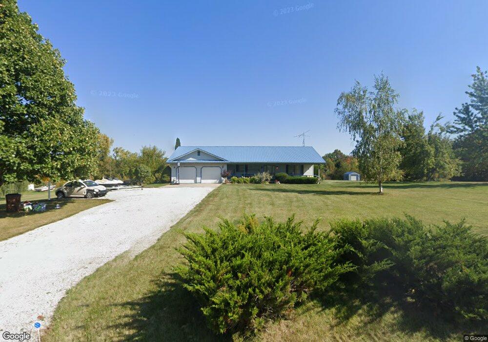
780 Eckstein Rd Crestline, OH 44827
Estimated Value: $238,000 - $316,000
2
Beds
2
Baths
2,089
Sq Ft
$133/Sq Ft
Est. Value
About This Home
This home is located at 780 Eckstein Rd, Crestline, OH 44827 and is currently estimated at $278,464, approximately $133 per square foot. 780 Eckstein Rd is a home located in Richland County with nearby schools including Stingel Elementary School, Ontario Middle School, and Ontario High School.
Ownership History
Date
Name
Owned For
Owner Type
Purchase Details
Closed on
Apr 4, 2003
Sold by
Cooper Teresa G and Vidmar Teresa G
Bought by
Cooper Teresa G
Current Estimated Value
Home Financials for this Owner
Home Financials are based on the most recent Mortgage that was taken out on this home.
Original Mortgage
$123,100
Outstanding Balance
$43,416
Interest Rate
5.5%
Mortgage Type
New Conventional
Estimated Equity
$235,048
Purchase Details
Closed on
Aug 1, 1997
Sold by
Bissman Benjamin F
Bought by
Vidmar Jerry A and Vidmar Teresa G
Home Financials for this Owner
Home Financials are based on the most recent Mortgage that was taken out on this home.
Original Mortgage
$82,500
Interest Rate
7.71%
Mortgage Type
New Conventional
Purchase Details
Closed on
Aug 5, 1993
Sold by
Scarbrough Jimmie
Bought by
Bissman Benjamin F
Purchase Details
Closed on
Jan 19, 1990
Create a Home Valuation Report for This Property
The Home Valuation Report is an in-depth analysis detailing your home's value as well as a comparison with similar homes in the area
Home Values in the Area
Average Home Value in this Area
Purchase History
| Date | Buyer | Sale Price | Title Company |
|---|---|---|---|
| Cooper Teresa G | -- | -- | |
| Vidmar Jerry A | $112,500 | -- | |
| Bissman Benjamin F | $89,000 | -- | |
| -- | $11,900 | -- |
Source: Public Records
Mortgage History
| Date | Status | Borrower | Loan Amount |
|---|---|---|---|
| Open | Cooper Teresa G | $123,100 | |
| Closed | Vidmar Jerry A | $82,500 |
Source: Public Records
Tax History
| Year | Tax Paid | Tax Assessment Tax Assessment Total Assessment is a certain percentage of the fair market value that is determined by local assessors to be the total taxable value of land and additions on the property. | Land | Improvement |
|---|---|---|---|---|
| 2024 | $3,617 | $73,960 | $15,680 | $58,280 |
| 2023 | $3,693 | $73,960 | $15,680 | $58,280 |
| 2022 | $3,492 | $60,170 | $14,260 | $45,910 |
| 2021 | $3,498 | $60,170 | $14,260 | $45,910 |
| 2020 | $3,734 | $60,170 | $14,260 | $45,910 |
| 2019 | $3,497 | $50,990 | $12,080 | $38,910 |
| 2018 | $2,970 | $50,990 | $12,080 | $38,910 |
| 2017 | $3,001 | $50,990 | $12,080 | $38,910 |
| 2016 | $3,079 | $53,410 | $11,720 | $41,690 |
| 2015 | $3,076 | $53,410 | $11,720 | $41,690 |
| 2014 | $3,082 | $53,410 | $11,720 | $41,690 |
| 2012 | $1,444 | $55,060 | $12,080 | $42,980 |
Source: Public Records
Map
Nearby Homes
- 4310 Snodgrass Rd
- 0 Snodgrass Rd
- 3872 Snodgrass Rd
- 5263 Lincoln Hwy
- 3880 Horizon Dr
- 3670 Pearl St
- 0 Rudy Rd
- 3560 Park Ave W
- 1689 Ohio 314
- 1689 State Route 314
- 1260 Thrush Rd
- 3767 Cookton Grange Rd
- 3320 Oakstone Dr
- 3308 Park Ave W
- 3516 Muirfield
- 3516 Muirfield Dr
- 820 South St
- 714 South St
- 2990 Hemlock Place
- 847 S Horning Rd
Your Personal Tour Guide
Ask me questions while you tour the home.