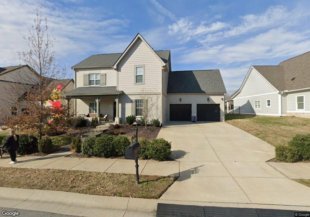
780 Plowson Rd Unit 434 Mount Juliet, TN 37122
Estimated Value: $820,962 - $893,000
--
Bed
4
Baths
4,239
Sq Ft
$204/Sq Ft
Est. Value
About This Home
This home is located at 780 Plowson Rd Unit 434, Mount Juliet, TN 37122 and is currently estimated at $865,241, approximately $204 per square foot. 780 Plowson Rd Unit 434 is a home located in Wilson County with nearby schools including Stoner Creek Elementary School, West Wilson Middle School, and Mt. Juliet High School.
Ownership History
Date
Name
Owned For
Owner Type
Purchase Details
Closed on
Aug 18, 2020
Sold by
Caruso Anthony J and Caruso Divina
Bought by
Humphreys Kristen Pike and Humphreys Christopher Ryan
Current Estimated Value
Home Financials for this Owner
Home Financials are based on the most recent Mortgage that was taken out on this home.
Original Mortgage
$312,000
Outstanding Balance
$249,459
Interest Rate
3%
Mortgage Type
New Conventional
Estimated Equity
$615,782
Purchase Details
Closed on
Aug 28, 2018
Sold by
Jackson Hioll Partner Sllc
Bought by
Caruso Anthony J and Caruso Divina
Home Financials for this Owner
Home Financials are based on the most recent Mortgage that was taken out on this home.
Original Mortgage
$344,100
Interest Rate
4.5%
Mortgage Type
New Conventional
Purchase Details
Closed on
Feb 12, 2015
Sold by
Propst Realty Nashville Llc
Bought by
Propst Realty Nashville Llc
Create a Home Valuation Report for This Property
The Home Valuation Report is an in-depth analysis detailing your home's value as well as a comparison with similar homes in the area
Home Values in the Area
Average Home Value in this Area
Purchase History
| Date | Buyer | Sale Price | Title Company |
|---|---|---|---|
| Humphreys Kristen Pike | $562,000 | Homeland Title Llc | |
| Caruso Anthony J | $488,859 | Windmill Title Llc | |
| Propst Realty Nashville Llc | $7,100,000 | -- |
Source: Public Records
Mortgage History
| Date | Status | Borrower | Loan Amount |
|---|---|---|---|
| Open | Humphreys Kristen Pike | $312,000 | |
| Previous Owner | Caruso Anthony J | $344,100 |
Source: Public Records
Tax History Compared to Growth
Tax History
| Year | Tax Paid | Tax Assessment Tax Assessment Total Assessment is a certain percentage of the fair market value that is determined by local assessors to be the total taxable value of land and additions on the property. | Land | Improvement |
|---|---|---|---|---|
| 2024 | $2,837 | $148,625 | $20,000 | $128,625 |
| 2022 | $2,837 | $148,625 | $20,000 | $128,625 |
| 2021 | $2,979 | $148,625 | $20,000 | $128,625 |
| 2020 | $3,177 | $147,550 | $20,000 | $127,550 |
| 2019 | $436 | $118,325 | $16,250 | $102,075 |
| 2018 | $436 | $117,850 | $16,250 | $101,600 |
| 2017 | $409 | $16,250 | $16,250 | $0 |
Source: Public Records
Map
Nearby Homes
- 309 Croft Way
- 270 Croft Way
- 27 Yearling Way
- 243 Croft Way
- 247 Croft Way
- 863 Plowson Rd
- 1012 Zane Dr
- 1010 Zane Dr
- 1019 Zane Dr
- Weston Plan at Bradshaw Farms - Estates
- Ansley Plan at Bradshaw Farms - Estates
- Buchanan Plan at Bradshaw Farms - Estates
- Kingston Plan at Bradshaw Farms - Estates
- Ashford Plan at Bradshaw Farms - Estates
- 1014 Zane Dr
- 1015 Zane Dr
- 1018 Zane Dr
- 1022 Zane Dr
- 1101 Codah Dr
- 1100 Codah Dr
- 780 Plowson Rd
- 780 Plowson Rd
- 782 Plowson Rd
- 782 Plowson Rd Unit 433
- 778 Plowson Rd Unit 435
- 781 Plowson Rd
- 784 Plowson Rd Unit 432
- 784 Plowson Rd
- 779 Plowson Rd
- 784 Plowson Rd
- 781 Plowson Rd Unit 412
- 781 Plowson Rd
- 777 Plowson Rd
- 60 Haystack Way
- 128 Vanner Rd Unit 436
- 128 Vanner Rd
- 779 Plowson Rd Unit 411
- 779 Plowson Rd
- 126 Vanner Rd Unit 437
- 126 Vanner Rd