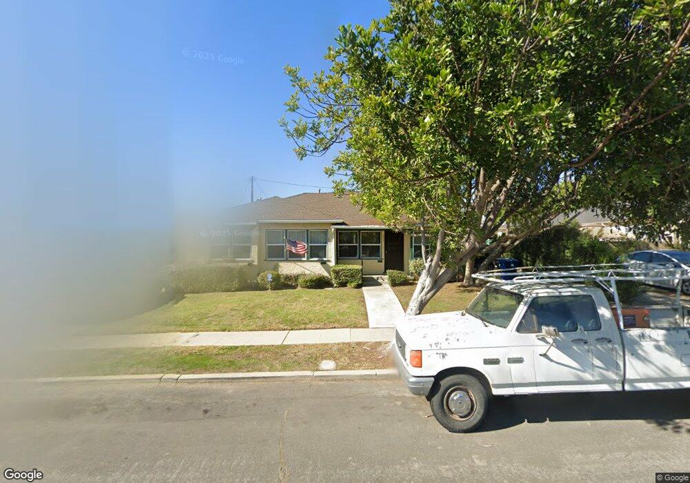
7817 Flight Ave Los Angeles, CA 90045
Westchester NeighborhoodEstimated Value: $1,186,000 - $1,471,555
4
Beds
2
Baths
1,795
Sq Ft
$744/Sq Ft
Est. Value
About This Home
This home is located at 7817 Flight Ave, Los Angeles, CA 90045 and is currently estimated at $1,335,889, approximately $744 per square foot. 7817 Flight Ave is a home located in Los Angeles County with nearby schools including Westport Heights Elementary, Wright Middle School STEAM Magnet, and Westchester Enriched Sciences Magnets.
Ownership History
Date
Name
Owned For
Owner Type
Purchase Details
Closed on
Sep 4, 2019
Sold by
Laponza William Anthony and Laponza Audrey Louise
Bought by
Laponza William Anthony and Laponza Audrey Louise
Current Estimated Value
Create a Home Valuation Report for This Property
The Home Valuation Report is an in-depth analysis detailing your home's value as well as a comparison with similar homes in the area
Home Values in the Area
Average Home Value in this Area
Purchase History
| Date | Buyer | Sale Price | Title Company |
|---|---|---|---|
| Laponza William Anthony | -- | None Available |
Source: Public Records
Tax History Compared to Growth
Tax History
| Year | Tax Paid | Tax Assessment Tax Assessment Total Assessment is a certain percentage of the fair market value that is determined by local assessors to be the total taxable value of land and additions on the property. | Land | Improvement |
|---|---|---|---|---|
| 2025 | $1,485 | $101,433 | $66,162 | $35,271 |
| 2024 | $1,485 | $99,445 | $64,865 | $34,580 |
| 2023 | $1,465 | $97,496 | $63,594 | $33,902 |
| 2022 | $1,409 | $95,586 | $62,348 | $33,238 |
| 2021 | $1,379 | $93,713 | $61,126 | $32,587 |
| 2019 | $1,344 | $90,935 | $59,314 | $31,621 |
| 2018 | $1,261 | $89,152 | $58,151 | $31,001 |
| 2016 | $1,189 | $85,693 | $55,894 | $29,799 |
| 2015 | $1,174 | $84,407 | $55,055 | $29,352 |
| 2014 | $1,194 | $82,755 | $53,977 | $28,778 |
Source: Public Records
Map
Nearby Homes
- 7803 Flight Ave
- 5858 Abernathy Dr
- 7840 Boeing Ave
- 5600 W 78th St
- 5723 W 74th St
- 5966 Abernathy Dr
- 8130 Grimsby Ave
- 7701 Toland Ave
- 8312 Barnsley Ave
- 8313 Kittyhawk Ave
- 8332 Barnsley Ave
- 5845 W 74th St
- 5988 W 76th St
- 5467 W 76th St
- 7832 Bleriot Ave
- 5529 W 79th St
- 5530 Thornburn St Unit 102
- 6040 W 76th St
- 7842 Croydon Ave
- 7701 Hindry Ave
- 7813 Flight Ave
- 7821 Flight Ave
- 5816 Compass Dr
- 7809 Flight Ave
- 5820 Compass Dr
- 7825 Flight Ave
- 5812 Compass Dr
- 5808 Compass Dr
- 7816 Flight Ave
- 7818 Flight Ave
- 5824 Compass Dr
- 7805 Flight Ave
- 7829 Flight Ave
- 7812 Flight Ave
- 7822 Flight Ave
- 5807 W 78th Place
- 7824 Flight Ave
- 5802 Compass Dr
- 5828 Compass Dr
- 7808 Flight Ave