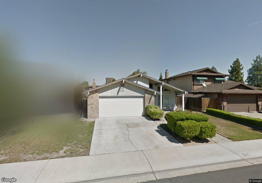
783 Meadow Way Manteca, CA 95336
Downtown Manteca NeighborhoodEstimated Value: $338,000 - $539,000
3
Beds
2
Baths
1,475
Sq Ft
$319/Sq Ft
Est. Value
About This Home
This home is located at 783 Meadow Way, Manteca, CA 95336 and is currently estimated at $470,523, approximately $318 per square foot. 783 Meadow Way is a home located in San Joaquin County with nearby schools including Shasta Elementary School, Manteca High School, and St. Anthony's Catholic School.
Ownership History
Date
Name
Owned For
Owner Type
Purchase Details
Closed on
Nov 28, 2001
Sold by
Mcghee Jerry L and Mcghee Ardean V
Bought by
Reed Joseph W and Reed Rebecca L
Current Estimated Value
Home Financials for this Owner
Home Financials are based on the most recent Mortgage that was taken out on this home.
Original Mortgage
$196,000
Outstanding Balance
$77,156
Interest Rate
6.67%
Estimated Equity
$393,367
Purchase Details
Closed on
Nov 16, 2001
Sold by
Va
Bought by
Mcgee Jerry L and Mcghee Ardean V
Home Financials for this Owner
Home Financials are based on the most recent Mortgage that was taken out on this home.
Original Mortgage
$196,000
Outstanding Balance
$77,156
Interest Rate
6.67%
Estimated Equity
$393,367
Create a Home Valuation Report for This Property
The Home Valuation Report is an in-depth analysis detailing your home's value as well as a comparison with similar homes in the area
Home Values in the Area
Average Home Value in this Area
Purchase History
| Date | Buyer | Sale Price | Title Company |
|---|---|---|---|
| Reed Joseph W | $245,000 | Alliance Title Company | |
| Mcgee Jerry L | -- | Alliance Title Company |
Source: Public Records
Mortgage History
| Date | Status | Borrower | Loan Amount |
|---|---|---|---|
| Open | Reed Joseph W | $196,000 |
Source: Public Records
Tax History Compared to Growth
Tax History
| Year | Tax Paid | Tax Assessment Tax Assessment Total Assessment is a certain percentage of the fair market value that is determined by local assessors to be the total taxable value of land and additions on the property. | Land | Improvement |
|---|---|---|---|---|
| 2025 | $4,035 | $361,914 | $107,834 | $254,080 |
| 2024 | $3,921 | $354,819 | $105,720 | $249,099 |
| 2023 | $3,874 | $347,863 | $103,648 | $244,215 |
| 2022 | $3,816 | $341,043 | $101,616 | $239,427 |
| 2021 | $3,775 | $334,357 | $99,624 | $234,733 |
| 2020 | $3,622 | $330,930 | $98,603 | $232,327 |
| 2019 | $3,575 | $324,442 | $96,670 | $227,772 |
| 2018 | $3,527 | $318,081 | $94,775 | $223,306 |
| 2017 | $3,476 | $311,845 | $92,917 | $218,928 |
| 2016 | $3,393 | $305,733 | $91,096 | $214,637 |
| 2015 | $3,082 | $275,000 | $82,000 | $193,000 |
| 2014 | $2,535 | $237,000 | $71,000 | $166,000 |
Source: Public Records
Map
Nearby Homes
- 1003 Alfonso Ln
- 1015 Lucio St
- 521 Emperor Ct
- 1292 Laurel Dr
- 743 Larkmont St
- 396 Lancaster Dr
- 1129 E Alameda St
- 200 Dan St
- Residence 3 Plan at Dawn at The Collective 55+
- 344 Rose Garden Ct
- Residence 1 Plan at Origin at The Collective 55+
- Residence 2 Plan at Origin at The Collective 55+
- 1361 Marceline Dr
- 931 E North St
- 1110 Aldwina Ln
- 1023 Marsh Creek Ln
- 762 Conrad St
- 732 Conrad St
- 732 Conrad Ct
- 757-847 N Main St
- 791 Meadow Way
- 777 Meadow Way
- 780 Evergreen Way
- 792 Evergreen Way
- 772 Evergreen Way
- 765 Meadow Way
- 1339 Dorona Ln
- 1365 Dorona Ln
- 1440 Dorona Ln
- 1446 Dorona Ln
- 1353 Dorona Ln
- 1389 Dorona Ln
- 1461 Dorona Ln
- 1437 Dorona Ln
- 1418 Dorona Ln
- 1380 Dorona Ln
- 1323 Dorona Ln
- 786 Meadow Way
- 778 Meadow Way
- 766 Evergreen Way