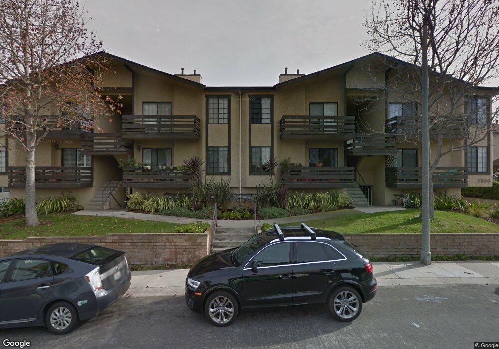
7836 Flight Ave Unit 203 Los Angeles, CA 90045
Westchester NeighborhoodEstimated Value: $452,490 - $558,000
1
Bed
1
Bath
774
Sq Ft
$643/Sq Ft
Est. Value
About This Home
This home is located at 7836 Flight Ave Unit 203, Los Angeles, CA 90045 and is currently estimated at $497,373, approximately $642 per square foot. 7836 Flight Ave Unit 203 is a home located in Los Angeles County with nearby schools including Westport Heights Elementary, Wright Middle School STEAM Magnet, and Westchester Enriched Sciences Magnets.
Ownership History
Date
Name
Owned For
Owner Type
Purchase Details
Closed on
Aug 20, 2002
Sold by
Micone Elizabeth Bearden and Bearden Elizabeth A
Bought by
Butters Virginia
Current Estimated Value
Home Financials for this Owner
Home Financials are based on the most recent Mortgage that was taken out on this home.
Original Mortgage
$128,000
Outstanding Balance
$49,574
Interest Rate
5.37%
Mortgage Type
Purchase Money Mortgage
Estimated Equity
$447,799
Create a Home Valuation Report for This Property
The Home Valuation Report is an in-depth analysis detailing your home's value as well as a comparison with similar homes in the area
Home Values in the Area
Average Home Value in this Area
Purchase History
| Date | Buyer | Sale Price | Title Company |
|---|---|---|---|
| Butters Virginia | $160,000 | First American Title Co |
Source: Public Records
Mortgage History
| Date | Status | Borrower | Loan Amount |
|---|---|---|---|
| Open | Butters Virginia | $128,000 |
Source: Public Records
Tax History Compared to Growth
Tax History
| Year | Tax Paid | Tax Assessment Tax Assessment Total Assessment is a certain percentage of the fair market value that is determined by local assessors to be the total taxable value of land and additions on the property. | Land | Improvement |
|---|---|---|---|---|
| 2025 | $2,772 | $231,709 | $126,284 | $105,425 |
| 2024 | $2,772 | $227,166 | $123,808 | $103,358 |
| 2023 | $2,722 | $222,713 | $121,381 | $101,332 |
| 2022 | $2,598 | $218,347 | $119,001 | $99,346 |
| 2021 | $2,559 | $214,067 | $116,668 | $97,399 |
| 2019 | $2,481 | $207,719 | $113,208 | $94,511 |
| 2018 | $2,462 | $203,647 | $110,989 | $92,658 |
| 2016 | $2,348 | $195,741 | $106,680 | $89,061 |
| 2015 | $2,314 | $192,802 | $105,078 | $87,724 |
| 2014 | $2,328 | $189,026 | $103,020 | $86,006 |
Source: Public Records
Map
Nearby Homes
- 5826 Abernathy Dr
- 5931 W 79th St
- 7901 Winsford Ave
- 5858 Abernathy Dr
- 5600 W 78th St
- 8312 Barnsley Ave
- 8313 Kittyhawk Ave
- 8130 Grimsby Ave
- 8342 Reading Ave
- 5723 W 74th St
- 8418 Belford Ave
- 7701 Toland Ave
- 5821 W 75th St
- 8430 Barnsley Ave
- 5988 W 76th St
- 8512 Belford Ave
- 8106 Bleriot Ave
- 5529 W 79th St
- 7832 Croydon Ave
- 7842 Croydon Ave
- 7836 Flight Ave
- 7836 Flight Ave Unit 208
- 7836 Flight Ave Unit 207
- 7836 Flight Ave Unit 206
- 7836 Flight Ave Unit 205
- 7836 Flight Ave Unit 204
- 7836 Flight Ave Unit 202
- 7836 Flight Ave Unit 201
- 7836 Flight Ave Unit 108
- 7836 Flight Ave Unit 107
- 7836 Flight Ave Unit 106
- 7836 Flight Ave Unit 105
- 7836 Flight Ave Unit 104
- 7836 Flight Ave Unit 103
- 7836 Flight Ave Unit 102
- 7836 Flight Ave Unit 101
- 7832 1/2 Flight Ave
- 7832 Flight Ave
- 7834 1/2 Flight Ave
- 7834 Flight Ave