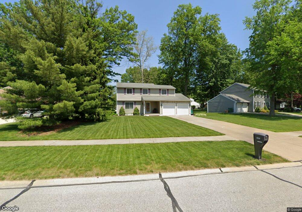
7837 Rutland Dr Mentor, OH 44060
Estimated Value: $315,000 - $376,000
4
Beds
2
Baths
1,096
Sq Ft
$305/Sq Ft
Est. Value
About This Home
This home is located at 7837 Rutland Dr, Mentor, OH 44060 and is currently estimated at $334,069, approximately $304 per square foot. 7837 Rutland Dr is a home located in Lake County with nearby schools including Bellflower Elementary School, Shore Middle School, and Mentor High School.
Ownership History
Date
Name
Owned For
Owner Type
Purchase Details
Closed on
May 29, 2018
Sold by
Lapenta Albert B and Lapenta Lisa M
Bought by
Lapenta Michael A
Current Estimated Value
Purchase Details
Closed on
May 28, 2002
Sold by
Susel Dennis E and Susel Margaret R
Bought by
Lapenta Albert B and Lapenta Lisa M
Home Financials for this Owner
Home Financials are based on the most recent Mortgage that was taken out on this home.
Original Mortgage
$155,000
Outstanding Balance
$66,417
Interest Rate
7%
Estimated Equity
$267,652
Purchase Details
Closed on
Jan 1, 1990
Bought by
Susel Dennis E
Create a Home Valuation Report for This Property
The Home Valuation Report is an in-depth analysis detailing your home's value as well as a comparison with similar homes in the area
Home Values in the Area
Average Home Value in this Area
Purchase History
| Date | Buyer | Sale Price | Title Company |
|---|---|---|---|
| Lapenta Michael A | -- | None Available | |
| Lapenta Albert B | $183,500 | Midland Title Security Inc | |
| Susel Dennis E | -- | -- |
Source: Public Records
Mortgage History
| Date | Status | Borrower | Loan Amount |
|---|---|---|---|
| Open | Lapenta Albert B | $155,000 |
Source: Public Records
Tax History Compared to Growth
Tax History
| Year | Tax Paid | Tax Assessment Tax Assessment Total Assessment is a certain percentage of the fair market value that is determined by local assessors to be the total taxable value of land and additions on the property. | Land | Improvement |
|---|---|---|---|---|
| 2024 | -- | $93,340 | $22,230 | $71,110 |
| 2023 | $8,403 | $80,870 | $18,210 | $62,660 |
| 2022 | $3,821 | $80,870 | $18,210 | $62,660 |
| 2021 | $3,817 | $80,870 | $18,210 | $62,660 |
| 2020 | $3,697 | $68,550 | $15,440 | $53,110 |
| 2019 | $3,701 | $68,550 | $15,440 | $53,110 |
| 2018 | $3,676 | $57,580 | $18,260 | $39,320 |
| 2017 | $3,253 | $57,580 | $18,260 | $39,320 |
| 2016 | $3,231 | $57,580 | $18,260 | $39,320 |
| 2015 | $2,884 | $57,580 | $18,260 | $39,320 |
| 2014 | $2,831 | $55,700 | $18,260 | $37,440 |
| 2013 | $2,834 | $55,700 | $18,260 | $37,440 |
Source: Public Records
Map
Nearby Homes
- 6625 Pear Tree Ln
- 7722 Rutland Dr
- 7979 Bellflower Rd
- 6495 Meadowbrook Dr
- 6843 Chablis Ct
- 6524 Elmwood Rd
- 6853 Colonial Dr Unit D
- 7961 Champaign Dr
- 6883 Colonial Dr Unit B
- 6854 Beacon Dr Unit 67-A
- 8042 Howell Dr
- 8093 Independence Dr Unit D
- 8090 Independence Dr Unit C
- 8109 Puritan Dr Unit A
- 7811 Champaign Dr
- 8136 Bellflower Rd
- 6542 Inland Shores Dr
- 8152 Puritan Dr Unit 44-A
- 6312 Dunbar Dr
- 6592 Edward St
- 7827 Rutland Dr
- 7857 Rutland Dr
- 6650 Durham Ct
- 7817 Rutland Dr
- 7867 Rutland Dr
- 7842 Gallowae Ct
- 6640 Durham Ct
- 7807 Rutland Dr
- 7853 Gallowae Ct
- 7852 Gallowae Ct
- 7858 Rutland Dr
- 6689 N Weatherby Dr
- 6682 Durham Ct
- 7801 Rutland Dr
- 6630 Durham Ct
- 7862 Gallowae Ct
- 6699 N Weatherby Dr
- 6661 Durham Ct
- 6651 Durham Ct
- 6645 Pear Tree Ln