Estimated Value: $257,000 - $536,000
2
Beds
1
Bath
998
Sq Ft
$442/Sq Ft
Est. Value
About This Home
This home is located at 7845 Lake Leander Rd, Britt, MN 55710 and is currently estimated at $441,549, approximately $442 per square foot. 7845 Lake Leander Rd is a home located in St. Louis County with nearby schools including Merritt Elementary School and Mountain Iron-Buhl Secondary School.
Ownership History
Date
Name
Owned For
Owner Type
Purchase Details
Closed on
Sep 23, 2016
Sold by
Plesha Brian J and Plesha Cynthia J
Bought by
Kowal Gregory J and Kowal Susan R
Current Estimated Value
Home Financials for this Owner
Home Financials are based on the most recent Mortgage that was taken out on this home.
Original Mortgage
$180,725
Outstanding Balance
$93,869
Interest Rate
3.43%
Mortgage Type
New Conventional
Estimated Equity
$416,373
Create a Home Valuation Report for This Property
The Home Valuation Report is an in-depth analysis detailing your home's value as well as a comparison with similar homes in the area
Home Values in the Area
Average Home Value in this Area
Purchase History
| Date | Buyer | Sale Price | Title Company |
|---|---|---|---|
| Kowal Gregory J | $243,724 | Up North Title Inc |
Source: Public Records
Mortgage History
| Date | Status | Borrower | Loan Amount |
|---|---|---|---|
| Open | Kowal Gregory J | $180,725 |
Source: Public Records
Tax History Compared to Growth
Tax History
| Year | Tax Paid | Tax Assessment Tax Assessment Total Assessment is a certain percentage of the fair market value that is determined by local assessors to be the total taxable value of land and additions on the property. | Land | Improvement |
|---|---|---|---|---|
| 2023 | $3,814 | $449,500 | $168,700 | $280,800 |
| 2022 | $2,996 | $447,100 | $168,700 | $278,400 |
| 2021 | $2,980 | $317,000 | $122,000 | $195,000 |
| 2020 | $2,840 | $314,800 | $122,000 | $192,800 |
| 2019 | $2,984 | $302,300 | $122,500 | $179,800 |
| 2018 | $3,478 | $302,300 | $122,500 | $179,800 |
| 2017 | $1,678 | $359,500 | $179,700 | $179,800 |
| 2016 | $2,372 | $212,400 | $83,200 | $129,200 |
| 2015 | $2,077 | $196,900 | $92,300 | $104,600 |
| 2014 | $2,077 | $196,900 | $92,300 | $104,600 |
Source: Public Records
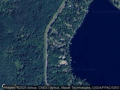
Map
Nearby Homes
- 10281 Sullivan Rd
- TBD Samuelson Rd
- TBD Heino Rd
- 7003 Sherwood Anderson Rd
- 0 Ida Rd
- 7470 S Point Ln
- TBD Samuelson Road-Sec22
- 8835 Highway 25
- 8874 Highway 25
- TBD Samuelson Road - Sec 15
- 7248 Reinertsen Dr
- 7436 Comfort
- 7409 Sand Lake Rd
- 7301 Sand Lake Rd
- 7452 E Donnywood Cir
- Sec: 2 TWP: 61.0 RG:
- 9154 Minnesota 73
- 9154 Highway 73
- 8528 Reid Rd
- 6077 McNiven Rd
- 7845 Lake Leander Rd
- 7847 Lake Leander Rd
- 7841 Lake Leander Rd
- 7839 Lake Leander Rd
- 7851 Lake Leander Rd
- 7837 Lake Leander Rd
- 7835 Lake Leander Rd
- 7855 Lake Leander Rd
- 7833 Lake Leander Rd
- 7857 Lake Leander Rd
- 7831 Lake Leander Rd
- 7827 Lake Leander Rd
- 7859 Lake Leander Rd
- 7743 Lake Leander Rd
- 7821 Lake Leander Rd
- 7861 Lake Leander Rd
- 7819 Lake Leander Rd
- 7863 Lake Leander Rd
- 7865 Lake Leander Rd
- 7817 Lake Leander Rd