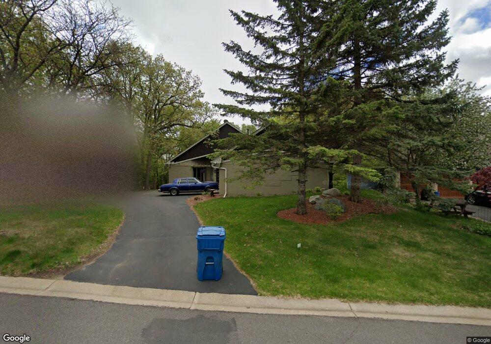
7860 133rd St W Saint Paul, MN 55124
Alimagnet NeighborhoodEstimated Value: $612,884 - $679,000
4
Beds
3
Baths
2,184
Sq Ft
$297/Sq Ft
Est. Value
About This Home
This home is located at 7860 133rd St W, Saint Paul, MN 55124 and is currently estimated at $648,221, approximately $296 per square foot. 7860 133rd St W is a home located in Dakota County with nearby schools including Westview Elementary School, Falcon Ridge Middle School, and Apple Valley Senior High School.
Ownership History
Date
Name
Owned For
Owner Type
Purchase Details
Closed on
Jun 1, 2004
Sold by
Relocation Advantage
Bought by
Larson Timothy Allen and Larson Debra
Current Estimated Value
Purchase Details
Closed on
Dec 1, 2000
Sold by
Miyares Carlos H and Miyares Lora S
Bought by
Barnett Raymond and Barnett Katrina A
Purchase Details
Closed on
Jul 28, 1999
Sold by
Conner Robert D and Conner Susan K
Bought by
Miyares Carlos H and Miyares Lora S
Purchase Details
Closed on
Jun 24, 1996
Sold by
Beech Gerald R
Bought by
Conner Robert D and Conner Susan K
Create a Home Valuation Report for This Property
The Home Valuation Report is an in-depth analysis detailing your home's value as well as a comparison with similar homes in the area
Home Values in the Area
Average Home Value in this Area
Purchase History
| Date | Buyer | Sale Price | Title Company |
|---|---|---|---|
| Larson Timothy Allen | $406,000 | -- | |
| Relocation Advantage | $406,000 | -- | |
| Barnett Raymond | $385,000 | -- | |
| Miyares Carlos H | $309,000 | -- | |
| Conner Robert D | $269,500 | -- |
Source: Public Records
Tax History Compared to Growth
Tax History
| Year | Tax Paid | Tax Assessment Tax Assessment Total Assessment is a certain percentage of the fair market value that is determined by local assessors to be the total taxable value of land and additions on the property. | Land | Improvement |
|---|---|---|---|---|
| 2024 | $7,136 | $600,300 | $165,800 | $434,500 |
| 2023 | $7,136 | $609,200 | $166,200 | $443,000 |
| 2022 | $5,944 | $599,500 | $165,600 | $433,900 |
| 2021 | $5,818 | $508,900 | $144,000 | $364,900 |
| 2020 | $5,874 | $488,600 | $137,200 | $351,400 |
| 2019 | $5,434 | $478,300 | $130,600 | $347,700 |
| 2018 | $5,173 | $461,600 | $124,400 | $337,200 |
| 2017 | $5,288 | $419,800 | $118,500 | $301,300 |
| 2016 | $5,501 | $407,000 | $112,800 | $294,200 |
| 2015 | $5,117 | $417,800 | $110,600 | $307,200 |
| 2014 | -- | $391,021 | $106,090 | $284,931 |
| 2013 | -- | $350,800 | $97,160 | $253,640 |
Source: Public Records
Map
Nearby Homes
- 13420 Gull Ct
- 13199 Gemstone Ct
- 13413 Georgia Cir
- 13715 Grafton Ct
- 7577 138th St W
- 12867 Pennock Ave
- 13101 Heritage Way
- 13868 Glendale Ct
- 13720 Georgia Dr
- 110 Pony Ln E
- 13345 Huntington Cir
- 7291 Upper 136th St W
- 14010 140th Ct
- 13306 Huntington Cir
- 14080 Guthrie Ave
- 7342 Upper 139th St W
- 13761 Hollybrook Cir
- 7090 Gardenia Ct
- 13751 Hollybrook Cir
- 14132 Heywood Path
- 7840 133rd St W
- 7880 133rd St W
- 7820 133rd St W
- 7900 133rd St W
- 7855 133rd St W
- 7800 133rd St W
- 7800 7800 133rd-Street-w
- 7905 133rd St W
- 7835 134th St W
- 7875 133rd St W
- 7885 133rd St W
- 7920 133rd St W
- 7815 134th St W
- 7855 134th St W
- 7815 133rd St W
- 7835 133rd St W
- 13360 Gunflint Path
- 7925 133rd St W
- 7780 7780 133rd-Street-w
- 7795 134th St W