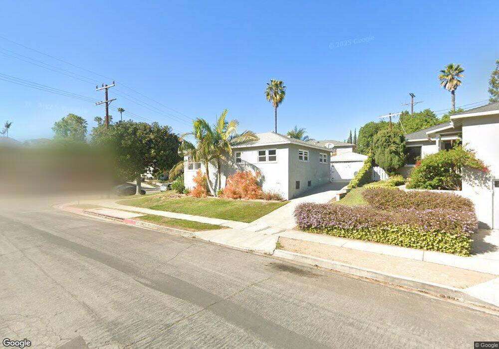
7863 Flight Ave Los Angeles, CA 90045
Westchester NeighborhoodEstimated Value: $1,215,000 - $1,762,092
4
Beds
2
Baths
1,880
Sq Ft
$772/Sq Ft
Est. Value
About This Home
This home is located at 7863 Flight Ave, Los Angeles, CA 90045 and is currently estimated at $1,451,273, approximately $771 per square foot. 7863 Flight Ave is a home located in Los Angeles County with nearby schools including Westport Heights Elementary, Wright Middle School STEAM Magnet, and Westchester Enriched Sciences Magnets.
Ownership History
Date
Name
Owned For
Owner Type
Purchase Details
Closed on
Dec 20, 2016
Sold by
Gonzalez Gary F and Gonzalez Jennifer L
Bought by
Bs On Van Ness Llc
Current Estimated Value
Purchase Details
Closed on
Jun 27, 2013
Sold by
Gonzalez Richard and Gonzalez Esther A
Bought by
Gonzalez Gary F and Gonzalez Jennifer L
Home Financials for this Owner
Home Financials are based on the most recent Mortgage that was taken out on this home.
Original Mortgage
$516,000
Interest Rate
3.79%
Mortgage Type
New Conventional
Purchase Details
Closed on
Apr 16, 2008
Sold by
Arndt Anthony E and Arndt Susan M
Bought by
Gonzalez Gary F and Gonzalez Jennifer L
Home Financials for this Owner
Home Financials are based on the most recent Mortgage that was taken out on this home.
Original Mortgage
$533,850
Interest Rate
5.8%
Mortgage Type
Purchase Money Mortgage
Purchase Details
Closed on
Jun 15, 2007
Sold by
Arndt Anthony
Bought by
Arndt Anthony E and Arndt Susan M
Create a Home Valuation Report for This Property
The Home Valuation Report is an in-depth analysis detailing your home's value as well as a comparison with similar homes in the area
Home Values in the Area
Average Home Value in this Area
Purchase History
| Date | Buyer | Sale Price | Title Company |
|---|---|---|---|
| Bs On Van Ness Llc | $955,000 | Equity Title Company | |
| Gonzalez Gary F | -- | Lawyers Title Company | |
| Gonzalez Gary F | $689,000 | Equity Title Los Angeles | |
| Arndt Anthony E | -- | None Available | |
| Arndt Anthony | -- | None Available |
Source: Public Records
Mortgage History
| Date | Status | Borrower | Loan Amount |
|---|---|---|---|
| Previous Owner | Gonzalez Gary F | $516,000 | |
| Previous Owner | Gonzalez Gary F | $533,850 |
Source: Public Records
Tax History Compared to Growth
Tax History
| Year | Tax Paid | Tax Assessment Tax Assessment Total Assessment is a certain percentage of the fair market value that is determined by local assessors to be the total taxable value of land and additions on the property. | Land | Improvement |
|---|---|---|---|---|
| 2025 | $13,444 | $1,108,355 | $876,241 | $232,114 |
| 2024 | $13,444 | $1,086,623 | $859,060 | $227,563 |
| 2023 | $13,188 | $1,065,317 | $842,216 | $223,101 |
| 2022 | $12,583 | $1,044,429 | $825,702 | $218,727 |
| 2021 | $12,426 | $1,023,951 | $809,512 | $214,439 |
| 2019 | $12,058 | $993,902 | $785,502 | $208,400 |
| 2018 | $11,935 | $974,420 | $770,100 | $204,320 |
| 2016 | $8,515 | $692,904 | $487,274 | $205,630 |
| 2015 | $8,392 | $682,497 | $479,955 | $202,542 |
| 2014 | $8,430 | $669,129 | $470,554 | $198,575 |
Source: Public Records
Map
Nearby Homes
- 7840 Boeing Ave
- 7803 Flight Ave
- 5858 Abernathy Dr
- 8313 Kittyhawk Ave
- 7832 Bleriot Ave
- 8312 Barnsley Ave
- 5966 Abernathy Dr
- 8332 Barnsley Ave
- 7842 Croydon Ave
- 5600 W 78th St
- 5988 W 76th St
- 8130 Grimsby Ave
- 6040 W 76th St
- 7817 Truxton Ave
- 5723 W 74th St
- 6027 W 76th St
- 8512 Belford Ave
- 6017 W 75th St
- 7701 Toland Ave
- 5845 W 74th St
- 7863 Flight Ave
- 7865 Flight Ave
- 7886 Airport Blvd
- 7878 Airport Blvd
- 7859 Flight Ave
- 7872 Airport Blvd
- 7857 Flight Ave
- 7902 Airport Blvd
- 7871 Flight Place
- 5854 W 78th Place
- 5848 W 78th Place
- 5866 W 78th Place
- 7853 Flight Ave
- 7877 Airport Blvd
- 7908 Airport Blvd
- 7870 Flight Place
- 7866 Flight Ave Unit 7866
- 7851 1/2 Flight Ave Unit 7815.5
- 5842 W 78th Place
- 7864 Flight Ave