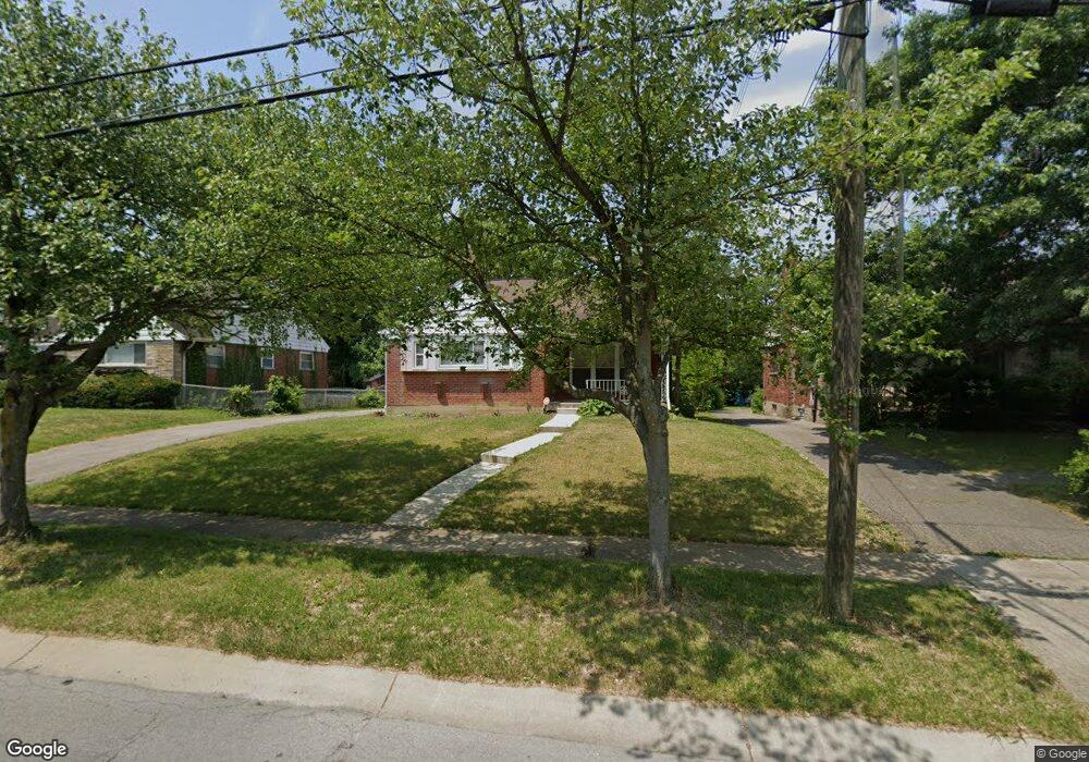
7873 Bobolink Dr Cincinnati, OH 45224
College Hill NeighborhoodEstimated Value: $220,000 - $318,000
2
Beds
1
Bath
1,390
Sq Ft
$195/Sq Ft
Est. Value
About This Home
This home is located at 7873 Bobolink Dr, Cincinnati, OH 45224 and is currently estimated at $271,555, approximately $195 per square foot. 7873 Bobolink Dr is a home located in Hamilton County with nearby schools including Pleasant Hill Elementary School, Robert A. Taft Information Technology High School, and Western Hills High School.
Ownership History
Date
Name
Owned For
Owner Type
Purchase Details
Closed on
Jul 15, 1999
Sold by
Glaspie Deborah L Tr
Bought by
Weems Patricia Diane
Current Estimated Value
Home Financials for this Owner
Home Financials are based on the most recent Mortgage that was taken out on this home.
Original Mortgage
$103,000
Outstanding Balance
$28,806
Interest Rate
7.54%
Estimated Equity
$242,749
Purchase Details
Closed on
Jun 15, 1996
Sold by
Olson Carl F and Olson Nanon S
Bought by
Glaspie Deborah L
Create a Home Valuation Report for This Property
The Home Valuation Report is an in-depth analysis detailing your home's value as well as a comparison with similar homes in the area
Home Values in the Area
Average Home Value in this Area
Purchase History
| Date | Buyer | Sale Price | Title Company |
|---|---|---|---|
| Weems Patricia Diane | $110,000 | -- | |
| Glaspie Deborah L | $93,900 | -- |
Source: Public Records
Mortgage History
| Date | Status | Borrower | Loan Amount |
|---|---|---|---|
| Open | Weems Patricia Diane | $103,000 |
Source: Public Records
Tax History Compared to Growth
Tax History
| Year | Tax Paid | Tax Assessment Tax Assessment Total Assessment is a certain percentage of the fair market value that is determined by local assessors to be the total taxable value of land and additions on the property. | Land | Improvement |
|---|---|---|---|---|
| 2024 | $3,975 | $66,410 | $11,526 | $54,884 |
| 2023 | $4,065 | $66,410 | $11,526 | $54,884 |
| 2022 | $2,633 | $38,480 | $9,384 | $29,096 |
| 2021 | $2,530 | $38,480 | $9,384 | $29,096 |
| 2020 | $2,604 | $38,480 | $9,384 | $29,096 |
| 2019 | $2,497 | $33,754 | $8,232 | $25,522 |
| 2018 | $2,501 | $33,754 | $8,232 | $25,522 |
| 2017 | $2,375 | $33,754 | $8,232 | $25,522 |
| 2016 | $2,852 | $39,988 | $8,782 | $31,206 |
| 2015 | $2,572 | $39,988 | $8,782 | $31,206 |
| 2014 | $2,590 | $39,988 | $8,782 | $31,206 |
| 2013 | $2,715 | $41,227 | $9,055 | $32,172 |
Source: Public Records
Map
Nearby Homes
- 7923 Bobolink Dr
- 1280 Brushwood Ave
- 7929 Cherrywood Ct
- 6596 S Oak Knoll Dr
- 6586 S Oak Knoll Dr
- 6765 Richard Ave
- 6785 Marvin Ave
- 6538 S Oak Knoll Dr
- 1148 Hollywood Ave
- 1140 Hollywood Ave
- 6832 Tarawa Dr
- 6642 Plantation Way
- 1544 W Galbraith Rd
- 1533 Corcoran Place
- 1346 Wittekind Terrace
- 1562 Oak Knoll Dr
- 1406 Wittekind Terrace
- 1063 Roxie Ln
- 6531 Hamilton Ave
- 1575 W Galbraith Rd
- 7879 Bobolink Dr
- 7867 Bobolink Dr
- 7885 Bobolink Dr
- 7863 Bobolink Dr
- 7864 Bankwood Ln
- 7868 Bankwood Ln
- 7860 Bankwood Ln
- 7872 Bankwood Ln
- 7856 Bankwood Ln
- 7889 Bobolink Dr
- 7859 Bobolink Dr
- 7874 Bobolink Dr
- 7868 Bobolink Dr
- 7876 Bankwood Ln
- 7880 Bobolink Dr
- 7852 Bankwood Ln
- 7864 Bobolink Dr
- 7880 Bankwood Ln
- 7886 Bobolink Dr
- 7858 Bobolink Dr