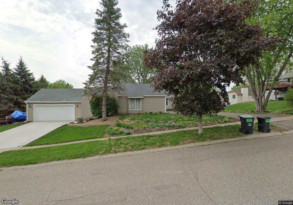
7880 142nd St W Saint Paul, MN 55124
Alimagnet NeighborhoodEstimated Value: $338,000 - $386,972
3
Beds
2
Baths
1,088
Sq Ft
$329/Sq Ft
Est. Value
About This Home
This home is located at 7880 142nd St W, Saint Paul, MN 55124 and is currently estimated at $358,243, approximately $329 per square foot. 7880 142nd St W is a home located in Dakota County with nearby schools including Westview Elementary School, Valley Middle School, and Apple Valley Senior High School.
Ownership History
Date
Name
Owned For
Owner Type
Purchase Details
Closed on
May 3, 2016
Sold by
The Chadwick Group Inc
Bought by
Guzman Stephanie
Current Estimated Value
Home Financials for this Owner
Home Financials are based on the most recent Mortgage that was taken out on this home.
Original Mortgage
$225,040
Outstanding Balance
$178,738
Interest Rate
3.59%
Mortgage Type
New Conventional
Estimated Equity
$179,505
Purchase Details
Closed on
Oct 14, 2015
Sold by
Frouche Diana K
Bought by
The Chadwick Group Inc
Create a Home Valuation Report for This Property
The Home Valuation Report is an in-depth analysis detailing your home's value as well as a comparison with similar homes in the area
Home Values in the Area
Average Home Value in this Area
Purchase History
| Date | Buyer | Sale Price | Title Company |
|---|---|---|---|
| Guzman Stephanie | $232,000 | None Available | |
| The Chadwick Group Inc | $82,500 | Titlesmart Inc |
Source: Public Records
Mortgage History
| Date | Status | Borrower | Loan Amount |
|---|---|---|---|
| Open | Guzman Stephanie | $225,040 |
Source: Public Records
Tax History Compared to Growth
Tax History
| Year | Tax Paid | Tax Assessment Tax Assessment Total Assessment is a certain percentage of the fair market value that is determined by local assessors to be the total taxable value of land and additions on the property. | Land | Improvement |
|---|---|---|---|---|
| 2024 | $3,528 | $319,100 | $65,700 | $253,400 |
| 2023 | $3,528 | $317,100 | $65,800 | $251,300 |
| 2022 | $3,080 | $317,000 | $65,600 | $251,400 |
| 2021 | $2,946 | $273,600 | $57,000 | $216,600 |
| 2020 | $2,858 | $257,400 | $49,400 | $208,000 |
| 2019 | $2,448 | $243,500 | $47,000 | $196,500 |
| 2018 | $2,267 | $221,200 | $44,800 | $176,400 |
| 2017 | $2,138 | $198,800 | $42,700 | $156,100 |
| 2016 | $2,341 | $180,600 | $40,600 | $140,000 |
| 2015 | $2,034 | $177,800 | $39,800 | $138,000 |
| 2014 | -- | $155,600 | $38,400 | $117,200 |
| 2013 | -- | $128,876 | $30,020 | $98,856 |
Source: Public Records
Map
Nearby Homes
- 7803 Glenda Ct
- 14080 Guthrie Ave
- 14242 Glencove Trail
- 14010 140th Ct
- 7662 142nd St W
- 8038 Upper 145th St W
- 13780 Hanover Way
- 14208 Heritage Ln
- 13902 Herald Way
- 13910 Herald Ct
- 14132 Heywood Path
- 14172 Heywood Path
- 7577 138th St W
- 7342 Upper 139th St W
- 13868 Glendale Ct
- 14825 Haven Dr
- 13715 Grafton Ct
- 141 Strese Ln
- 13720 Georgia Dr
- 14620 Garrett Ave Unit 310
- 7876 142nd St W
- 14236 Guthrie Ave
- 14252 Guthrie Ave
- 14270 Guthrie Ave
- 7863 Glenda Ct
- 7873 Glenda Ct
- 7850 142nd St W
- 7862 Glenda Ct
- 14288 Guthrie Ave
- 7836 142nd St W
- 14245 Guthrie Ave
- 7856 Glenda Ct
- 14227 Guthrie Ave
- 14190 Guthrie Ave
- 7843 Glenda Ct
- 7820 142nd St W
- 14306 Guthrie Ave
- 14279 Guthrie Ave
- 7852 Glenda Ct
- 7842 Glenda Ct