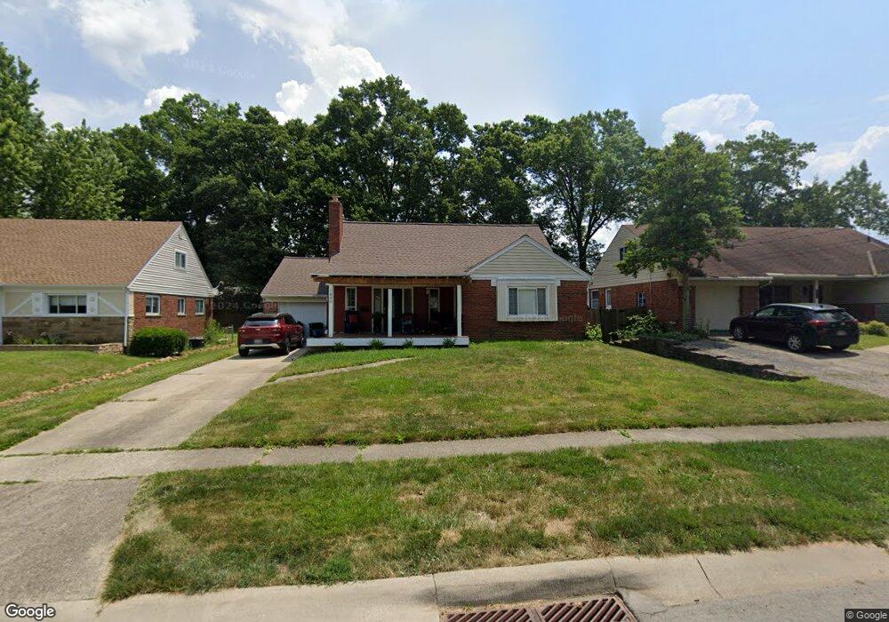
7880 Bobolink Dr Cincinnati, OH 45224
College Hill NeighborhoodEstimated Value: $217,000 - $295,000
4
Beds
2
Baths
1,779
Sq Ft
$145/Sq Ft
Est. Value
About This Home
This home is located at 7880 Bobolink Dr, Cincinnati, OH 45224 and is currently estimated at $258,044, approximately $145 per square foot. 7880 Bobolink Dr is a home located in Hamilton County with nearby schools including Pleasant Hill Elementary School, Robert A. Taft Information Technology High School, and Western Hills High School.
Ownership History
Date
Name
Owned For
Owner Type
Purchase Details
Closed on
Sep 15, 2017
Sold by
Mitchell Nolan and Mitchell Pamela
Bought by
Johnson Jhanel and Johnson Dorsey
Current Estimated Value
Home Financials for this Owner
Home Financials are based on the most recent Mortgage that was taken out on this home.
Original Mortgage
$93,279
Outstanding Balance
$76,817
Interest Rate
3.75%
Mortgage Type
FHA
Estimated Equity
$181,227
Purchase Details
Closed on
May 29, 2009
Sold by
Estate Of Angelina F Vetere
Bought by
Mitchell Nolan
Home Financials for this Owner
Home Financials are based on the most recent Mortgage that was taken out on this home.
Original Mortgage
$85,063
Interest Rate
4.85%
Mortgage Type
FHA
Create a Home Valuation Report for This Property
The Home Valuation Report is an in-depth analysis detailing your home's value as well as a comparison with similar homes in the area
Home Values in the Area
Average Home Value in this Area
Purchase History
| Date | Buyer | Sale Price | Title Company |
|---|---|---|---|
| Johnson Jhanel | $95,000 | None Available | |
| Mitchell Nolan | $88,000 | Prodigy Title Agency |
Source: Public Records
Mortgage History
| Date | Status | Borrower | Loan Amount |
|---|---|---|---|
| Open | Johnson Jhanel | $93,279 | |
| Previous Owner | Mitchell Nolan | $85,063 |
Source: Public Records
Tax History
| Year | Tax Paid | Tax Assessment Tax Assessment Total Assessment is a certain percentage of the fair market value that is determined by local assessors to be the total taxable value of land and additions on the property. | Land | Improvement |
|---|---|---|---|---|
| 2025 | $4,188 | $67,820 | $12,005 | $55,815 |
| 2024 | $4,061 | $67,820 | $12,005 | $55,815 |
| 2023 | $4,152 | $67,820 | $12,005 | $55,815 |
| 2022 | $2,278 | $33,251 | $9,776 | $23,475 |
| 2021 | $2,188 | $33,251 | $9,776 | $23,475 |
| 2020 | $2,252 | $33,251 | $9,776 | $23,475 |
| 2019 | $2,396 | $32,368 | $8,575 | $23,793 |
| 2018 | $2,400 | $32,368 | $8,575 | $23,793 |
| 2017 | $2,391 | $32,368 | $8,575 | $23,793 |
| 2016 | $2,264 | $29,876 | $9,149 | $20,727 |
| 2015 | $2,024 | $29,876 | $9,149 | $20,727 |
| 2014 | $2,035 | $29,876 | $9,149 | $20,727 |
| 2013 | $2,133 | $30,801 | $9,433 | $21,368 |
Source: Public Records
Map
Nearby Homes
- 7873 Bobolink Dr
- 7923 Bobolink Dr
- 1280 Brushwood Ave
- 7866 Bitteroot Ln
- 7929 Cherrywood Ct
- 6669 Kirkland Dr
- 1165 W Galbraith Rd
- 6765 Richard Ave
- 6538 S Oak Knoll Dr
- 1148 Hollywood Ave
- 6785 Marvin Ave
- 6917 Kleindale Ave
- 1088 Pinehollow Ln
- 1533 Corcoran Place
- 6629 Charann Ln
- 6531 Hamilton Ave
- 1491 Reid Ave
- 1584 W Galbraith Rd
- 1006 Hearthstone Dr
- 1503 Southridge Ln
- 7874 Bobolink Dr
- 7868 Bobolink Dr
- 7886 Bobolink Dr
- 7791 Knollwood Ln
- 7767 Knollwood Ln
- 7890 Bobolink Dr
- 7839 Knollwood Ln
- 7743 Knollwood Ln
- 7864 Bobolink Dr
- 7879 Bobolink Dr
- 7885 Bobolink Dr
- 7863 Knollwood Ln
- 7889 Bobolink Dr
- 7858 Bobolink Dr
- 7867 Bobolink Dr
- 7719 Knollwood Ln
- 7896 Bobolink Dr
- 7863 Bobolink Dr
- 7887 Knollwood Ln
- 7897 Bobolink Dr
Your Personal Tour Guide
Ask me questions while you tour the home.