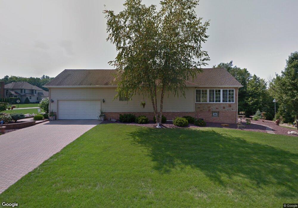
7884 Walnut St Youngstown, OH 44512
Estimated Value: $318,000 - $360,085
3
Beds
3
Baths
1,700
Sq Ft
$196/Sq Ft
Est. Value
About This Home
This home is located at 7884 Walnut St, Youngstown, OH 44512 and is currently estimated at $332,771, approximately $195 per square foot. 7884 Walnut St is a home located in Mahoning County with nearby schools including Robinwood Lane Elementary School, Boardman Glenwood Junior High School, and Boardman High School.
Ownership History
Date
Name
Owned For
Owner Type
Purchase Details
Closed on
Jun 20, 2018
Sold by
Storey Teri M
Bought by
Mcmahon Michael G and The Teri M Storey Revocable Tr
Current Estimated Value
Purchase Details
Closed on
Sep 11, 1998
Sold by
Apco Construction Inc
Bought by
Storey John H
Create a Home Valuation Report for This Property
The Home Valuation Report is an in-depth analysis detailing your home's value as well as a comparison with similar homes in the area
Home Values in the Area
Average Home Value in this Area
Purchase History
| Date | Buyer | Sale Price | Title Company |
|---|---|---|---|
| Mcmahon Michael G | -- | None Available | |
| Storey John H | $32,000 | -- |
Source: Public Records
Mortgage History
| Date | Status | Borrower | Loan Amount |
|---|---|---|---|
| Closed | Storey John H | $0 |
Source: Public Records
Tax History
| Year | Tax Paid | Tax Assessment Tax Assessment Total Assessment is a certain percentage of the fair market value that is determined by local assessors to be the total taxable value of land and additions on the property. | Land | Improvement |
|---|---|---|---|---|
| 2025 | $5,570 | $112,850 | $15,850 | $97,000 |
| 2024 | $5,700 | $112,850 | $15,850 | $97,000 |
| 2023 | $5,624 | $112,850 | $15,850 | $97,000 |
| 2022 | $4,812 | $73,760 | $12,850 | $60,910 |
| 2021 | $4,815 | $73,760 | $12,850 | $60,910 |
| 2020 | $4,840 | $73,760 | $12,850 | $60,910 |
| 2019 | $5,392 | $73,760 | $12,850 | $60,910 |
| 2018 | $4,712 | $73,760 | $12,850 | $60,910 |
| 2017 | $4,408 | $73,760 | $12,850 | $60,910 |
| 2016 | $4,128 | $64,270 | $7,340 | $56,930 |
| 2015 | $4,046 | $64,270 | $7,340 | $56,930 |
| 2014 | $4,057 | $64,270 | $7,340 | $56,930 |
| 2013 | $4,006 | $64,270 | $7,340 | $56,930 |
Source: Public Records
Map
Nearby Homes
- 681 Saddlebrook Dr
- 675 Presidential Dr
- 929 Auburn Hills Dr Unit 1
- 7708 Buchanan Dr
- 221 Stafford Ave
- 218 Boardman Blvd
- 930 Pearson Cir
- 7362 Eisenhower Dr Unit 5
- 901 Pearson Cir Unit 3
- 876 Pearson Cir Unit 2
- 7357 Eisenhower Dr Unit 6
- 828 Woodfield Ct Unit A
- 8129 South Ave
- 852 Pearson Cir Unit 3
- 8002 Sigle Ln
- 8218 Maramont Dr Unit B
- 123 Mayflower Dr
- 179 Southwoods Ave
- 139 Roche Way
- 156 Roche Way
- 7886 Walnut St
- 7877 Walnut St
- 7888 Walnut St
- 7750 Amberwood Trail
- 7879 Walnut St
- 7847 Walnut St Unit B
- 7847 Walnut St Unit A
- 7881 Walnut St
- 7748 Amberwood Trail
- 7890 Walnut St
- 7875 Walnut St Unit B
- 7875 Walnut St Unit A
- 7849 Walnut St Unit B
- 7849 Walnut St Unit A
- 7876 Walnut St Unit A
- 7753 Amberwood Trail
- 7746 Amberwood Trail
- 7887 Walnut St
- 7892 Walnut St
- 7851 Walnut St Unit B
Your Personal Tour Guide
Ask me questions while you tour the home.