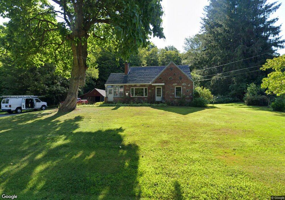
79 Amherst Rd Leverett, MA 01054
Estimated Value: $341,938 - $538,000
3
Beds
2
Baths
1,511
Sq Ft
$293/Sq Ft
Est. Value
About This Home
This home is located at 79 Amherst Rd, Leverett, MA 01054 and is currently estimated at $442,985, approximately $293 per square foot. 79 Amherst Rd is a home located in Franklin County with nearby schools including Leverett Elementary School, Amherst Regional Middle School, and Amherst Regional High School.
Ownership History
Date
Name
Owned For
Owner Type
Purchase Details
Closed on
Aug 8, 2023
Sold by
Paige Ft and Cooper
Bought by
Paige Ft and Cooper
Current Estimated Value
Purchase Details
Closed on
Jan 17, 2023
Sold by
Paige Joyce B
Bought by
Paige Ft and Paige
Purchase Details
Closed on
Dec 8, 2004
Sold by
Stowell Marshall L and Stowell Patricia M
Bought by
Paige Joyce
Home Financials for this Owner
Home Financials are based on the most recent Mortgage that was taken out on this home.
Original Mortgage
$40,000
Interest Rate
5.74%
Create a Home Valuation Report for This Property
The Home Valuation Report is an in-depth analysis detailing your home's value as well as a comparison with similar homes in the area
Home Values in the Area
Average Home Value in this Area
Purchase History
| Date | Buyer | Sale Price | Title Company |
|---|---|---|---|
| Paige Ft | -- | None Available | |
| Paige Ft | -- | None Available | |
| Paige Joyce | -- | -- |
Source: Public Records
Mortgage History
| Date | Status | Borrower | Loan Amount |
|---|---|---|---|
| Previous Owner | Paige Joyce | $172,000 | |
| Previous Owner | Paige Joyce | $40,000 |
Source: Public Records
Tax History
| Year | Tax Paid | Tax Assessment Tax Assessment Total Assessment is a certain percentage of the fair market value that is determined by local assessors to be the total taxable value of land and additions on the property. | Land | Improvement |
|---|---|---|---|---|
| 2025 | $3,982 | $262,300 | $72,000 | $190,300 |
| 2024 | $4,123 | $262,300 | $72,000 | $190,300 |
| 2023 | $4,319 | $269,600 | $87,100 | $182,500 |
| 2022 | $4,437 | $235,500 | $80,500 | $155,000 |
| 2021 | $4,485 | $227,300 | $76,600 | $150,700 |
| 2020 | $4,600 | $224,500 | $76,600 | $147,900 |
| 2019 | $4,485 | $214,700 | $66,800 | $147,900 |
| 2018 | $4,519 | $214,700 | $66,800 | $147,900 |
| 2017 | $4,498 | $214,700 | $66,800 | $147,900 |
| 2016 | $4,382 | $214,700 | $66,800 | $147,900 |
| 2015 | $4,268 | $214,700 | $66,800 | $147,900 |
Source: Public Records
Map
Nearby Homes
- 100 Depot Rd
- 113 Juggler Meadow Rd
- 10 Depot Rd
- Lot A January Hills Rd
- 15 S Plain Rd
- Lot A Kingman Rd
- 12 Teawaddle Ln
- 167 Rolling Ridge Rd
- 6 Shattuck Rd
- 208 Rolling Ridge Rd
- 185 Cherry Ln
- 260 Montague Rd
- 8 Aloha Dr
- 3 Frost Ln
- Lot 3 Roosevelt St
- 50 Mount Pleasant
- 0 Dudleyville Rd
- 242 N East St Unit 24
- 26 Falls Rd
- 0 Red Gate Ln Unit 73348273
Your Personal Tour Guide
Ask me questions while you tour the home.