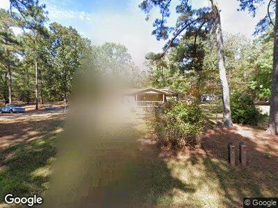
79 Burnette Rd Thomaston, GA 30286
Estimated Value: $75,000 - $246,000
2
Beds
1
Bath
1,460
Sq Ft
$125/Sq Ft
Est. Value
About This Home
This home is located at 79 Burnette Rd, Thomaston, GA 30286 and is currently estimated at $182,000, approximately $124 per square foot. 79 Burnette Rd is a home located in Upson County with nearby schools including Upson-Lee South Elementary School, Upson-Lee North Elementary School, and Upson-Lee Middle School.
Ownership History
Date
Name
Owned For
Owner Type
Purchase Details
Closed on
Aug 15, 2024
Sold by
Nelson Alvin H
Bought by
Gordon Jerry and Gordon Victoria
Current Estimated Value
Purchase Details
Closed on
Apr 10, 2024
Sold by
Nelson Alvin H
Bought by
Gordon Jerry and Gordon Victoria
Home Financials for this Owner
Home Financials are based on the most recent Mortgage that was taken out on this home.
Original Mortgage
$58,315
Interest Rate
6.74%
Mortgage Type
New Conventional
Create a Home Valuation Report for This Property
The Home Valuation Report is an in-depth analysis detailing your home's value as well as a comparison with similar homes in the area
Home Values in the Area
Average Home Value in this Area
Purchase History
| Date | Buyer | Sale Price | Title Company |
|---|---|---|---|
| Gordon Jerry | -- | -- | |
| Gordon Jerry | $70,000 | -- |
Source: Public Records
Mortgage History
| Date | Status | Borrower | Loan Amount |
|---|---|---|---|
| Previous Owner | Gordon Jerry | $58,315 |
Source: Public Records
Tax History Compared to Growth
Tax History
| Year | Tax Paid | Tax Assessment Tax Assessment Total Assessment is a certain percentage of the fair market value that is determined by local assessors to be the total taxable value of land and additions on the property. | Land | Improvement |
|---|---|---|---|---|
| 2024 | $1,433 | $59,578 | $18,513 | $41,065 |
| 2023 | $1,433 | $57,895 | $18,513 | $39,382 |
| 2022 | $953 | $36,374 | $6,496 | $29,878 |
| 2021 | $768 | $31,134 | $6,495 | $24,639 |
| 2020 | $761 | $28,980 | $5,710 | $23,270 |
| 2019 | $763 | $26,903 | $5,710 | $21,193 |
| 2018 | $764 | $26,903 | $5,710 | $21,193 |
| 2017 | $786 | $25,369 | $5,710 | $19,659 |
| 2016 | $857 | $27,063 | $4,758 | $22,305 |
| 2015 | $857 | $27,064 | $4,758 | $22,305 |
| 2014 | $932 | $29,220 | $6,926 | $22,294 |
Source: Public Records
Map
Nearby Homes
- 125 Brookfield Dr
- 228 Franklindale Rd
- 123 Hillview Dr
- 1837 U S 19
- 580 Mountain View Dr
- 675 Mountain View Dr
- 401 Harp Rd
- 0 N Old Alabama Rd Unit 10338960
- 121 David Dr
- 277 N Old Alabama Rd
- 462 Twinwood St
- 111 Marlon St
- 154 Salter Rd
- 105 Salbar St
- 419 W Moores Crossing Rd
- 429 Heath Dr
- 102 W County Rd
- 306 Garner St
- 122 Tyler Ln
- 112 El Prado Cir
- 79 Burnette Rd
- 396 Delray Rd
- 368 Delray Rd
- 134 Burnette Rd
- 434 Delray Rd
- 147 Burnette Rd
- 468 Delray Rd
- 173 Burnette Rd
- 189 Burnette Rd
- 1083 Daniel Rd
- 1125 Daniel Rd
- 492 Delray Rd
- 1163 Daniel Rd
- 1137 Daniel Rd
- 1157 Daniel Rd
- 983 Daniel Rd
- 501 Delray Rd
- 536 Delray Rd
- 299 Franklindale Rd
- 112 Wynnbrook Dr
