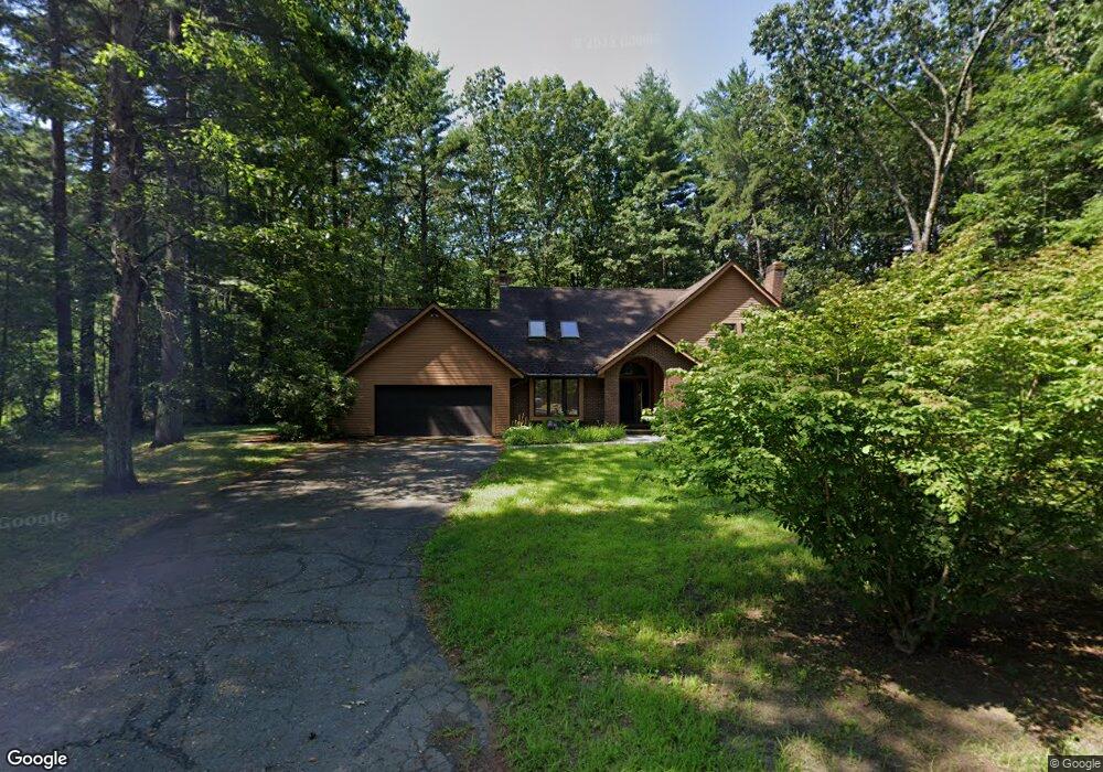
79 N Plain Rd Sunderland, MA 01375
Estimated Value: $510,000 - $748,000
3
Beds
3
Baths
2,109
Sq Ft
$285/Sq Ft
Est. Value
About This Home
This home is located at 79 N Plain Rd, Sunderland, MA 01375 and is currently estimated at $600,177, approximately $284 per square foot. 79 N Plain Rd is a home located in Franklin County with nearby schools including Sunderland Elementary School and Frontier Regional School.
Ownership History
Date
Name
Owned For
Owner Type
Purchase Details
Closed on
Nov 28, 2018
Sold by
Plotnikova Larissa V
Bought by
Plotnikova Larissa V and Tsaplina Lidia
Current Estimated Value
Purchase Details
Closed on
Apr 14, 1995
Sold by
Baric Thomas A and Baric Candyce L
Bought by
Plotnikov Valerian V and Plotnikov Larissa V
Home Financials for this Owner
Home Financials are based on the most recent Mortgage that was taken out on this home.
Original Mortgage
$122,500
Interest Rate
8.49%
Mortgage Type
Purchase Money Mortgage
Purchase Details
Closed on
Mar 26, 1990
Sold by
Sullivan Timothy M
Bought by
Baric Thomas A
Home Financials for this Owner
Home Financials are based on the most recent Mortgage that was taken out on this home.
Original Mortgage
$174,400
Interest Rate
10.15%
Mortgage Type
Purchase Money Mortgage
Create a Home Valuation Report for This Property
The Home Valuation Report is an in-depth analysis detailing your home's value as well as a comparison with similar homes in the area
Home Values in the Area
Average Home Value in this Area
Purchase History
| Date | Buyer | Sale Price | Title Company |
|---|---|---|---|
| Plotnikova Larissa V | -- | -- | |
| Plotnikov Valerian V | $175,000 | -- | |
| Baric Thomas A | $218,000 | -- |
Source: Public Records
Mortgage History
| Date | Status | Borrower | Loan Amount |
|---|---|---|---|
| Previous Owner | Baric Thomas A | $122,500 | |
| Previous Owner | Baric Thomas A | $170,200 | |
| Previous Owner | Baric Thomas A | $174,400 |
Source: Public Records
Tax History
| Year | Tax Paid | Tax Assessment Tax Assessment Total Assessment is a certain percentage of the fair market value that is determined by local assessors to be the total taxable value of land and additions on the property. | Land | Improvement |
|---|---|---|---|---|
| 2025 | $64 | $489,700 | $123,000 | $366,700 |
| 2024 | $6,435 | $489,700 | $123,000 | $366,700 |
| 2023 | $5,788 | $452,200 | $102,300 | $349,900 |
| 2022 | $5,855 | $398,300 | $87,900 | $310,400 |
| 2021 | $5,521 | $356,400 | $82,500 | $273,900 |
| 2020 | $5,500 | $356,200 | $82,500 | $273,700 |
| 2019 | $5,321 | $347,100 | $79,900 | $267,200 |
| 2018 | $4,910 | $327,300 | $76,700 | $250,600 |
| 2017 | $4,747 | $331,000 | $78,900 | $252,100 |
| 2016 | $4,860 | $331,500 | $77,300 | $254,200 |
| 2015 | $4,744 | $331,500 | $77,300 | $254,200 |
| 2014 | $4,634 | $331,500 | $77,300 | $254,200 |
Source: Public Records
Map
Nearby Homes
Your Personal Tour Guide
Ask me questions while you tour the home.