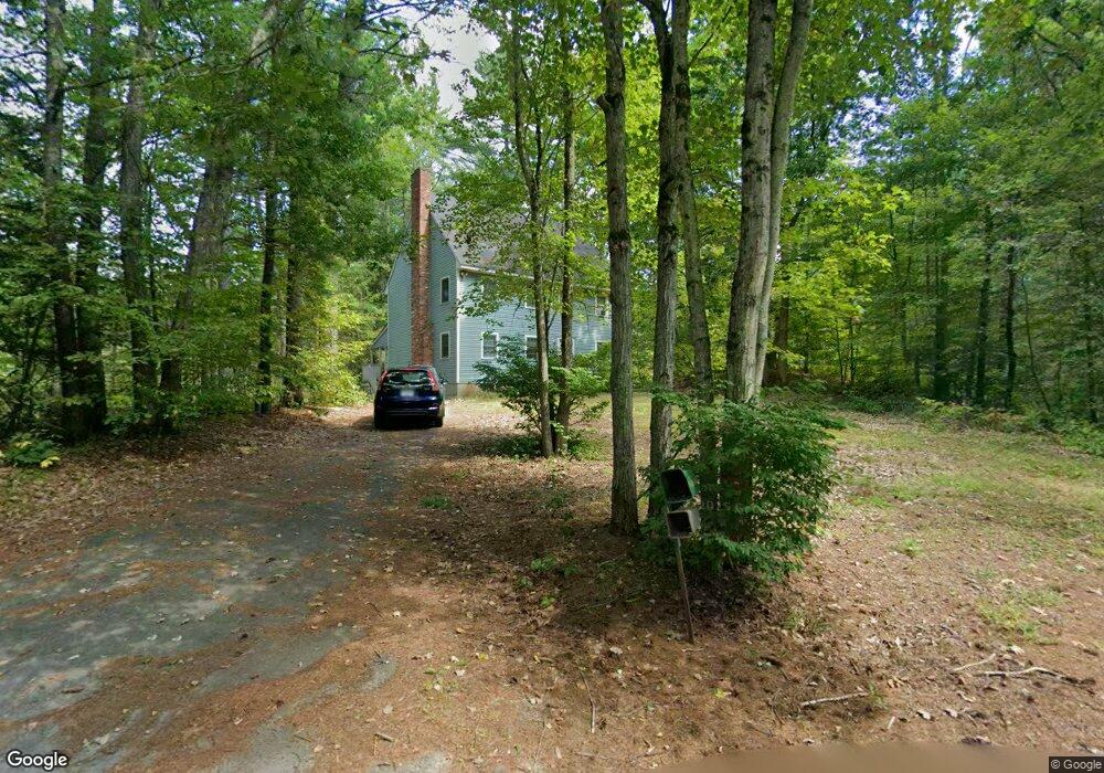
79 Raddin Rd Groton, MA 01450
Estimated Value: $684,000 - $736,000
3
Beds
3
Baths
2,016
Sq Ft
$352/Sq Ft
Est. Value
About This Home
This home is located at 79 Raddin Rd, Groton, MA 01450 and is currently estimated at $709,571, approximately $351 per square foot. 79 Raddin Rd is a home located in Middlesex County with nearby schools including Groton Dunstable Regional High School and Seven Hills At Groton.
Create a Home Valuation Report for This Property
The Home Valuation Report is an in-depth analysis detailing your home's value as well as a comparison with similar homes in the area
Home Values in the Area
Average Home Value in this Area
Tax History Compared to Growth
Tax History
| Year | Tax Paid | Tax Assessment Tax Assessment Total Assessment is a certain percentage of the fair market value that is determined by local assessors to be the total taxable value of land and additions on the property. | Land | Improvement |
|---|---|---|---|---|
| 2025 | $10,246 | $671,900 | $237,500 | $434,400 |
| 2024 | $10,035 | $665,000 | $242,100 | $422,900 |
| 2023 | $9,564 | $611,500 | $237,500 | $374,000 |
| 2022 | $8,875 | $516,300 | $208,200 | $308,100 |
| 2021 | $8,668 | $492,500 | $201,700 | $290,800 |
| 2020 | $8,603 | $495,000 | $201,700 | $293,300 |
| 2019 | $8,106 | $447,600 | $192,600 | $255,000 |
| 2018 | $7,853 | $420,600 | $183,400 | $237,200 |
| 2017 | $7,680 | $420,600 | $183,400 | $237,200 |
| 2016 | $7,664 | $408,100 | $172,600 | $235,500 |
| 2015 | $7,456 | $408,100 | $172,600 | $235,500 |
Source: Public Records
Map
Nearby Homes
- 91 Chicopee Row
- 8 Jamie Rd
- 208 North St
- 0 Old Dunstable Rd
- 660 Old Dunstable Rd
- 2 Wildflower Ln
- 573 Longley Rd
- 20 B Legacy Ln
- 20 A Legacy Ln Unit 20A
- 153 Off Pond St
- 46 Lowell Rd
- 82 Martins Pond Rd
- 23 Shawnee Rd Unit 23
- 452 River St
- 5 June St
- 38 Tarbell St Unit 5B
- 9 Tarbell St
- 34 Shattuck St
- 31 Prospect St
- 319 Pleasant St