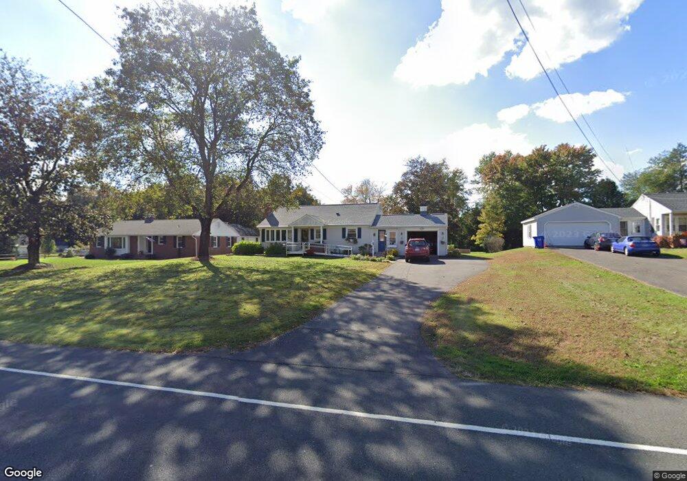
79 Springfield Rd Somers, CT 06071
Estimated Value: $314,000 - $316,264
3
Beds
2
Baths
1,140
Sq Ft
$277/Sq Ft
Est. Value
About This Home
This home is located at 79 Springfield Rd, Somers, CT 06071 and is currently estimated at $315,566, approximately $276 per square foot. 79 Springfield Rd is a home located in Tolland County with nearby schools including Somers Elementary School, Mabelle B. Avery Middle School, and Somers High School.
Ownership History
Date
Name
Owned For
Owner Type
Purchase Details
Closed on
Nov 2, 2012
Sold by
Cole Lauri
Bought by
Descy Matthew J and Descy Mary K
Current Estimated Value
Purchase Details
Closed on
Mar 29, 2004
Sold by
Drouin Duane and Drouin Amy
Bought by
Descy Matthew and Descy Mary
Home Financials for this Owner
Home Financials are based on the most recent Mortgage that was taken out on this home.
Original Mortgage
$118,200
Interest Rate
5.65%
Purchase Details
Closed on
Jul 1, 1994
Sold by
Konopka Helen
Bought by
Moynihan Amy and Drouin Duane
Create a Home Valuation Report for This Property
The Home Valuation Report is an in-depth analysis detailing your home's value as well as a comparison with similar homes in the area
Home Values in the Area
Average Home Value in this Area
Purchase History
| Date | Buyer | Sale Price | Title Company |
|---|---|---|---|
| Descy Matthew J | -- | -- | |
| Descy Matthew J | -- | -- | |
| Descy Matthew | $157,800 | -- | |
| Cole Lauri | $39,400 | -- | |
| Cole Lauri | $39,400 | -- | |
| Moynihan Amy | $114,000 | -- | |
| Moynihan Amy | $114,000 | -- |
Source: Public Records
Mortgage History
| Date | Status | Borrower | Loan Amount |
|---|---|---|---|
| Previous Owner | Moynihan Amy | $60,000 | |
| Previous Owner | Moynihan Amy | $118,200 |
Source: Public Records
Tax History
| Year | Tax Paid | Tax Assessment Tax Assessment Total Assessment is a certain percentage of the fair market value that is determined by local assessors to be the total taxable value of land and additions on the property. | Land | Improvement |
|---|---|---|---|---|
| 2025 | $4,305 | $142,500 | $50,500 | $92,000 |
| 2024 | $4,127 | $142,500 | $50,500 | $92,000 |
| 2023 | $4,034 | $142,500 | $50,500 | $92,000 |
| 2022 | $3,927 | $142,500 | $50,500 | $92,000 |
| 2021 | $3,823 | $143,400 | $50,500 | $92,900 |
| 2020 | $3,876 | $141,600 | $50,500 | $91,100 |
| 2019 | $3,487 | $127,400 | $53,200 | $74,200 |
| 2018 | $3,487 | $127,400 | $53,200 | $74,200 |
| 2017 | $3,245 | $127,400 | $53,200 | $74,200 |
| 2016 | $3,086 | $127,400 | $53,200 | $74,200 |
| 2015 | $2,931 | $125,400 | $56,000 | $69,400 |
| 2014 | $2,931 | $125,400 | $56,000 | $69,400 |
Source: Public Records
Map
Nearby Homes
- 63 Maple Ridge Dr
- 969 Main St
- 142 Turnpike Rd
- 369 Turnpike Rd
- 64 Somerset Ln
- 11 King Rd
- 283 Mountain View Rd
- 139 Hall Hill Rd
- 50 Nutmeg Dr Unit 50
- 20 Shaker Rd
- 5 Cantlewood Dr
- 1040 Main St
- 994 Main St
- 42 Schneider Rd
- 557 Hall Hill Rd
- 200 Hampden Rd
- 175 Stafford Rd
- 169 Stafford Rd
- 80 Brewster Rd
- 56 Brittany Ln
- 83 Springfield Rd
- 75 Springfield Rd
- 71 Springfield Rd
- 86 Springfield Rd
- 88 Springfield Rd
- 91 Springfield Rd
- 67 Springfield Rd
- 97 Springfield Rd
- 92 Springfield Rd
- 83 Maple Ridge Dr
- 77 Maple Ridge Dr
- 84 Maple Ridge Dr
- 63 Springfield Rd
- 88 Maple Ridge Dr
- 74 Maple Ridge Dr
- 78 Maple Ridge Dr
- 75 Maple Ridge Dr
- 96 Springfield Rd
- 90 Maple Ridge Dr
- 0 Bar Restaurant & Pub Unit G584990
Your Personal Tour Guide
Ask me questions while you tour the home.