R
Seller's Agent in 2025
Robin Perschel
Feiner Real Estate
Estimated Value: $1,622,244 - $2,391,000
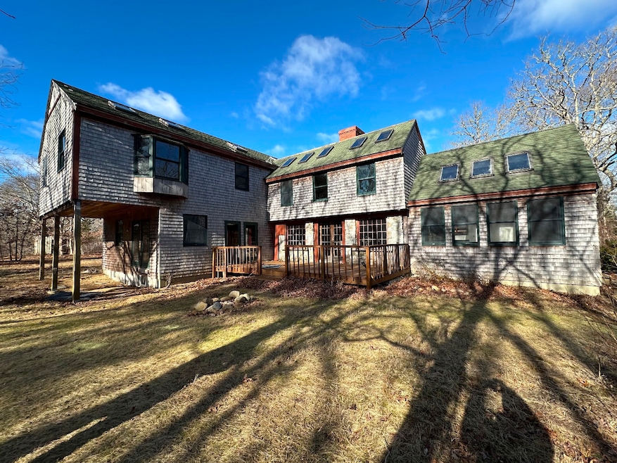
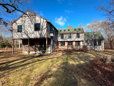
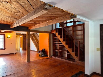
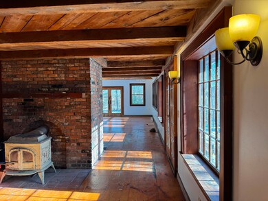
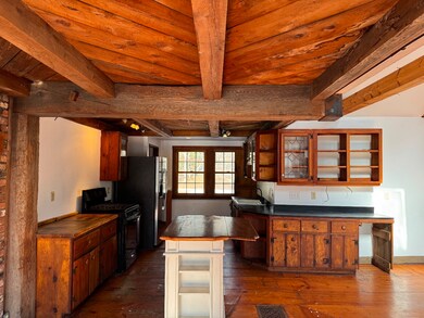
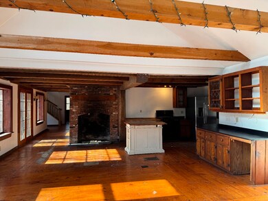
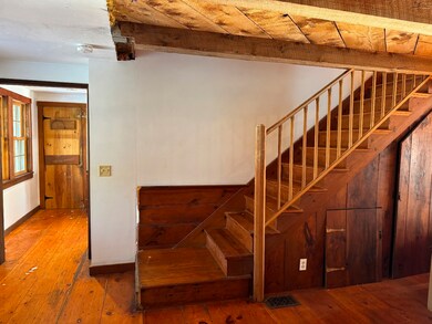
The spacious home is located in a peaceful private setting on a quiet road. This house is directly across the road from 138 acres of protected land owned by Sheriffs Meadow Foundation. Perfectly situated on 3 beautiful open and slightly forested acres of land, you will find this open concept home that might have the opportunity for further bedroom expansion. Current septic is 6 Bedrooms. There is an existing one bedroom apartment over the garage and is accessed by outdoor stairs. The main section of the home features an open family room/ dining room and kitchen with walls of windows and a beautiful brick fireplace. Much of the downstairs offers beautiful wide board pine floors. The living room boasts a wood stove. Some of the areas of the house need flooring and trim. This home needs considerable attention but the end product will be amazing. So much potential to have a real estate gem. This is a property where investing in some renovations will see your appreciation grow!!! Please call to discuss repairs needed. Showings start Saturday January 25th
Last Agent to Sell the Property
Robin Perschel
Feiner Real Estate Listed on: 01/23/2025
Last Buyer's Agent
Wendy Harman
Compass | Point B
| Date | Buyer | Sale Price | Title Company |
|---|---|---|---|
| Flam Molly B | $1,575,000 | None Available | |
| Flam Molly B | $1,575,000 | None Available | |
| Fedele-Rivard Cynthia J | $647,000 | -- | |
| Fedele-Rivard Cynthia J | $647,000 | -- |
| Date | Status | Borrower | Loan Amount |
|---|---|---|---|
| Previous Owner | Fedele-Rivard Cynthia J | $517,600 | |
| Previous Owner | Fedele-Rivard Cynthia J | $178,000 | |
| Previous Owner | Fedele-Rivard Cynthia J | $325,000 |
| Date | Event | Price | List to Sale | Price per Sq Ft |
|---|---|---|---|---|
| 02/25/2025 02/25/25 | Sold | $1,575,000 | 0.0% | $366 / Sq Ft |
| 01/26/2025 01/26/25 | Pending | -- | -- | -- |
| 01/23/2025 01/23/25 | For Sale | $1,575,000 | -- | $366 / Sq Ft |
| Year | Tax Paid | Tax Assessment Tax Assessment Total Assessment is a certain percentage of the fair market value that is determined by local assessors to be the total taxable value of land and additions on the property. | Land | Improvement |
|---|---|---|---|---|
| 2025 | $4,781 | $1,804,100 | $363,200 | $1,440,900 |
| 2024 | $3,958 | $1,552,000 | $363,200 | $1,188,800 |
| 2023 | $4,172 | $1,655,500 | $444,600 | $1,210,900 |
| 2022 | $4,313 | $1,423,400 | $469,300 | $954,100 |
| 2021 | $2,278 | $1,381,200 | $427,100 | $954,100 |
| 2020 | $4,078 | $1,217,200 | $427,100 | $790,100 |
| 2019 | $2,261 | $1,241,600 | $404,600 | $837,000 |
| 2018 | $4,352 | $1,124,500 | $404,600 | $719,900 |
| 2017 | $2,164 | $1,052,300 | $449,500 | $602,800 |
| 2016 | $3,405 | $940,500 | $384,600 | $555,900 |
| 2015 | $2,987 | $860,900 | $384,600 | $476,300 |
R
Seller's Agent in 2025
Robin Perschel
Feiner Real Estate
W
Buyer's Agent in 2025
Wendy Harman
Compass | Point B
Source: LINK (Vineyard)
MLS Number: 42824
APN: EDGA-000025-000017-000001
Ask me questions while you tour the home.