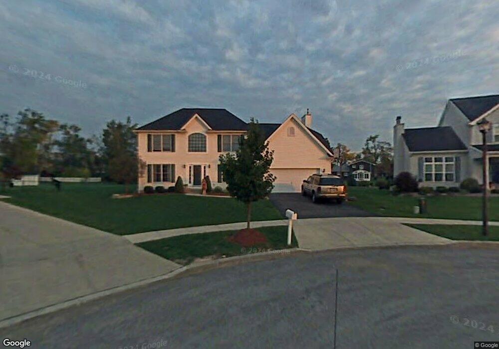
79 Westport Ct Buffalo, NY 14221
South Amherst NeighborhoodEstimated Value: $446,000 - $807,000
4
Beds
3
Baths
2,410
Sq Ft
$238/Sq Ft
Est. Value
About This Home
This home is located at 79 Westport Ct, Buffalo, NY 14221 and is currently estimated at $573,816, approximately $238 per square foot. 79 Westport Ct is a home located in Erie County with nearby schools including Maple West Elementary School, Heim Middle School, and Williamsville North High School.
Ownership History
Date
Name
Owned For
Owner Type
Purchase Details
Closed on
Jun 28, 2001
Sold by
Forbes Homes Inc
Bought by
Lin Xin and You Yun
Current Estimated Value
Home Financials for this Owner
Home Financials are based on the most recent Mortgage that was taken out on this home.
Original Mortgage
$33,750
Interest Rate
6.65%
Mortgage Type
Stand Alone Second
Create a Home Valuation Report for This Property
The Home Valuation Report is an in-depth analysis detailing your home's value as well as a comparison with similar homes in the area
Home Values in the Area
Average Home Value in this Area
Purchase History
| Date | Buyer | Sale Price | Title Company |
|---|---|---|---|
| Lin Xin | $225,000 | -- |
Source: Public Records
Mortgage History
| Date | Status | Borrower | Loan Amount |
|---|---|---|---|
| Previous Owner | Lin Xin | $33,750 | |
| Previous Owner | Lin Xin | $180,000 |
Source: Public Records
Tax History Compared to Growth
Tax History
| Year | Tax Paid | Tax Assessment Tax Assessment Total Assessment is a certain percentage of the fair market value that is determined by local assessors to be the total taxable value of land and additions on the property. | Land | Improvement |
|---|---|---|---|---|
| 2024 | -- | $475,000 | $94,500 | $380,500 |
| 2023 | $9,980 | $301,000 | $84,500 | $216,500 |
| 2022 | $9,428 | $301,000 | $84,500 | $216,500 |
| 2021 | $9,242 | $301,000 | $84,500 | $216,500 |
| 2020 | $8,533 | $301,000 | $84,500 | $216,500 |
| 2019 | $8,388 | $301,000 | $84,500 | $216,500 |
| 2018 | $8,229 | $301,000 | $84,500 | $216,500 |
| 2017 | $3,412 | $301,000 | $84,500 | $216,500 |
| 2016 | $7,942 | $260,000 | $49,700 | $210,300 |
| 2015 | -- | $260,000 | $49,700 | $210,300 |
| 2014 | -- | $260,000 | $49,700 | $210,300 |
Source: Public Records
Map
Nearby Homes
- 114 Robin Hill Dr
- 88 W Klein Rd
- 33 Heim Rd
- 100 Countryside Ln
- 19 Countryside Ct
- 95 Carriage Cir
- 158 Old Farm Cir
- 2110 N Forest Rd
- 22 Candlewood Ln
- 235 Old Lyme Dr
- 180 Crestwood Ln
- 24 Georgian Ln Unit C
- 107 Autumnview Rd
- 30 Georgian Ln Unit C
- 147 Ranch Trail W
- 11 Georgian #3 Ln
- 35 Huntwood Ct
- 179 Old Lyme Dr Unit 7
- 237 Wyeth Dr
- 67 Birchwood Dr
- 80 Westport Ct
- 71 Westport Ct
- 592 Cottonwood Dr
- 598 Cottonwood Dr
- 586 Cottonwood Dr
- 604 Cottonwood Dr
- 63 Westport Ct
- 72 Westport Ct
- 580 Cottonwood Dr
- 610 Cottonwood Dr
- 1731 N Forest Rd
- 64 Westport Ct
- 55 Westport Ct
- 574 Cottonwood Dr
- 616 Cottonwood Dr
- 8 Robin Hill Dr
- 2 Robin Hill Dr
- 16 Robin Hill Dr
- 568 Cottonwood Dr
- 56 Westport Ct