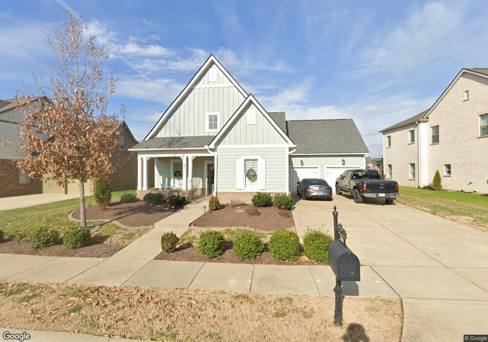
790 Plowson Rd Unit 429 Mount Juliet, TN 37122
Estimated Value: $562,591 - $650,000
3
Beds
2
Baths
2,269
Sq Ft
$274/Sq Ft
Est. Value
About This Home
This home is located at 790 Plowson Rd Unit 429, Mount Juliet, TN 37122 and is currently estimated at $621,648, approximately $273 per square foot. 790 Plowson Rd Unit 429 is a home located in Wilson County with nearby schools including Stoner Creek Elementary School, West Wilson Middle School, and Mt. Juliet High School.
Ownership History
Date
Name
Owned For
Owner Type
Purchase Details
Closed on
Jul 2, 2025
Sold by
Thomas Trust and Thomas Scott Mason
Bought by
790 Plowson Llc
Current Estimated Value
Purchase Details
Closed on
May 26, 2020
Sold by
Thomas Scott M and Thomas Kimberly B
Bought by
Thomas Scott Mason and Thomas Kimberly Brooke
Purchase Details
Closed on
Aug 29, 2018
Sold by
Jackson Hilsl Paertners Llc
Bought by
Thomas Scott M and Thomas Kimberley B
Home Financials for this Owner
Home Financials are based on the most recent Mortgage that was taken out on this home.
Original Mortgage
$208,363
Interest Rate
4.5%
Mortgage Type
New Conventional
Purchase Details
Closed on
Feb 12, 2015
Sold by
Propst Realty Nashville Llc
Bought by
Propst Realty Nashville Llc
Create a Home Valuation Report for This Property
The Home Valuation Report is an in-depth analysis detailing your home's value as well as a comparison with similar homes in the area
Home Values in the Area
Average Home Value in this Area
Purchase History
| Date | Buyer | Sale Price | Title Company |
|---|---|---|---|
| 790 Plowson Llc | -- | None Listed On Document | |
| 790 Plowson Llc | -- | None Listed On Document | |
| Thomas Scott Mason | -- | None Available | |
| Thomas Scott M | $408,363 | Windmill Title Llc | |
| Propst Realty Nashville Llc | $7,100,000 | -- |
Source: Public Records
Mortgage History
| Date | Status | Borrower | Loan Amount |
|---|---|---|---|
| Previous Owner | Thomas Scott M | $208,363 |
Source: Public Records
Tax History Compared to Growth
Tax History
| Year | Tax Paid | Tax Assessment Tax Assessment Total Assessment is a certain percentage of the fair market value that is determined by local assessors to be the total taxable value of land and additions on the property. | Land | Improvement |
|---|---|---|---|---|
| 2024 | $1,807 | $94,675 | $20,000 | $74,675 |
| 2022 | $1,807 | $94,675 | $20,000 | $74,675 |
| 2021 | $1,911 | $94,675 | $20,000 | $74,675 |
| 2020 | $2,045 | $94,675 | $20,000 | $74,675 |
| 2019 | $436 | $76,150 | $16,250 | $59,900 |
| 2018 | $436 | $75,675 | $16,250 | $59,425 |
| 2017 | $409 | $16,250 | $16,250 | $0 |
Source: Public Records
Map
Nearby Homes
- 27 Yearling Way
- 270 Croft Way
- 243 Croft Way
- 247 Croft Way
- 309 Croft Way
- 1012 Zane Dr
- 1010 Zane Dr
- 1019 Zane Dr
- Weston Plan at Bradshaw Farms - Estates
- Ansley Plan at Bradshaw Farms - Estates
- Buchanan Plan at Bradshaw Farms - Estates
- Kingston Plan at Bradshaw Farms - Estates
- Ashford Plan at Bradshaw Farms - Estates
- 863 Plowson Rd
- 1015 Zane Dr
- 1014 Zane Dr
- 1018 Zane Dr
- 1022 Zane Dr
- 1101 Codah Dr
- 1100 Codah Dr
- 790 Plowson Rd
- 790 Plowson Rd
- 792 Plowson Rd Unit 428
- 792 Plowson Rd
- 788 Plowson Rd Unit 430
- 788 Plowson Rd
- 788 Plowson Rd
- 792 Plowson Rd
- 789 Plowson Rd
- 794 Plowson Rd Unit 427
- 794 Plowson Rd
- 791 Plowson Rd
- 786 Plowson Rd Unit 431
- 786 Plowson Rd
- 794 Plowson Rd
- 793 Plowson Rd
- 786 Plowson Rd
- 787 Plowson Rd
- 791 Plowson Rd Unit 417
- 791 Plowson Rd