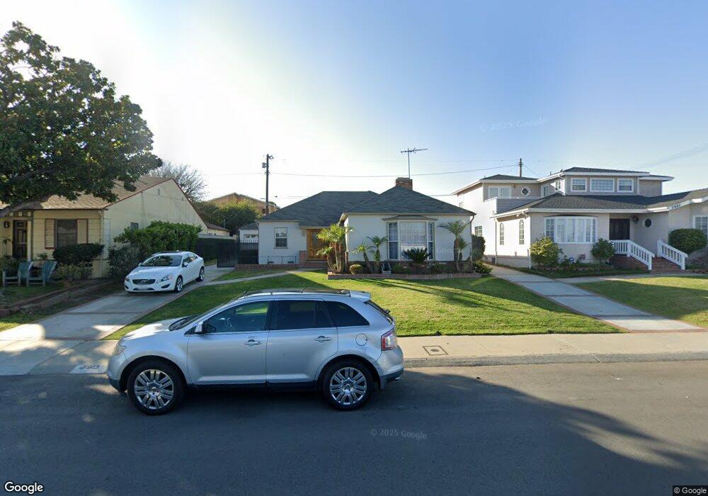
7913 Truxton Ave Los Angeles, CA 90045
Westchester NeighborhoodEstimated Value: $1,397,569 - $1,819,000
2
Beds
2
Baths
1,361
Sq Ft
$1,150/Sq Ft
Est. Value
About This Home
This home is located at 7913 Truxton Ave, Los Angeles, CA 90045 and is currently estimated at $1,565,642, approximately $1,150 per square foot. 7913 Truxton Ave is a home located in Los Angeles County with nearby schools including Westport Heights Elementary, Wright Middle School STEAM Magnet, and Westchester Enriched Sciences Magnets.
Ownership History
Date
Name
Owned For
Owner Type
Purchase Details
Closed on
Oct 9, 2018
Sold by
Ku Ihn U and Ku Yong Sook
Bought by
Ku Ihn U Ku and Ku Yong Sook
Current Estimated Value
Home Financials for this Owner
Home Financials are based on the most recent Mortgage that was taken out on this home.
Original Mortgage
$703,500
Interest Rate
4.6%
Mortgage Type
New Conventional
Purchase Details
Closed on
Nov 22, 2015
Sold by
Ku U Ihn and Ku Yong Sook
Bought by
U Ihn Ku & Yong Sook Ku Revocable Living
Create a Home Valuation Report for This Property
The Home Valuation Report is an in-depth analysis detailing your home's value as well as a comparison with similar homes in the area
Home Values in the Area
Average Home Value in this Area
Purchase History
| Date | Buyer | Sale Price | Title Company |
|---|---|---|---|
| Ku Ihn U Ku | -- | Ticor Title Company Of Calif | |
| U Ihn Ku & Yong Sook Ku Revocable Living | -- | None Available |
Source: Public Records
Mortgage History
| Date | Status | Borrower | Loan Amount |
|---|---|---|---|
| Previous Owner | Ku Ihn U Ku | $703,500 |
Source: Public Records
Tax History Compared to Growth
Tax History
| Year | Tax Paid | Tax Assessment Tax Assessment Total Assessment is a certain percentage of the fair market value that is determined by local assessors to be the total taxable value of land and additions on the property. | Land | Improvement |
|---|---|---|---|---|
| 2025 | $3,698 | $293,077 | $203,164 | $89,913 |
| 2024 | $3,698 | $287,331 | $199,181 | $88,150 |
| 2023 | $3,633 | $281,698 | $195,276 | $86,422 |
| 2022 | $3,475 | $276,176 | $191,448 | $84,728 |
| 2021 | $3,424 | $270,762 | $187,695 | $83,067 |
| 2019 | $3,325 | $262,733 | $182,129 | $80,604 |
| 2018 | $3,248 | $257,582 | $178,558 | $79,024 |
| 2016 | $3,098 | $247,581 | $171,625 | $75,956 |
| 2015 | $3,054 | $243,864 | $169,048 | $74,816 |
| 2014 | $3,073 | $239,088 | $165,737 | $73,351 |
Source: Public Records
Map
Nearby Homes
- 8101 Naylor Ave
- 7842 Croydon Ave
- 7832 Bleriot Ave
- 8210 Alverstone Ave
- 6322 W 78th Place
- 7840 Boeing Ave
- 8056 Kentwood Ave
- 6040 W 76th St
- 8008 El Manor Ave
- 8004 El Manor Ave
- 6410 W 84th Place
- 6411 W 85th St
- 6027 W 76th St
- 5966 Abernathy Dr
- 5988 W 76th St
- 8044 Cowan Ave
- 6017 W 75th St
- 6007 W 86th Place
- 8312 Barnsley Ave
- 7221 Arizona Ave
- 7907 Truxton Ave
- 7919 Truxton Ave
- 7901 Truxton Ave
- 7923 Truxton Ave
- 7912 Vicksburg Ave
- 7918 Vicksburg Ave
- 7906 Vicksburg Ave
- 7924 Vicksburg Ave
- 8001 Truxton Ave
- 7900 Vicksburg Ave
- 7912 Truxton Ave
- 7918 Truxton Ave
- 7906 Truxton Ave
- 8000 Vicksburg Ave
- 7900 Truxton Ave
- 8007 Truxton Ave
- 7893 Truxton Ave
- 8000 Truxton Ave
- 7896 Vicksburg Ave
- 8011 Truxton Ave