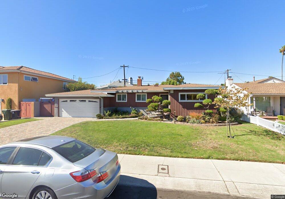
7921 Flight Ave Los Angeles, CA 90045
Westchester NeighborhoodEstimated Value: $1,265,413 - $1,650,000
2
Beds
2
Baths
1,226
Sq Ft
$1,163/Sq Ft
Est. Value
About This Home
This home is located at 7921 Flight Ave, Los Angeles, CA 90045 and is currently estimated at $1,425,853, approximately $1,163 per square foot. 7921 Flight Ave is a home located in Los Angeles County with nearby schools including Westport Heights Elementary, Wright Middle School STEAM Magnet, and Westchester Enriched Sciences Magnets.
Ownership History
Date
Name
Owned For
Owner Type
Purchase Details
Closed on
Sep 18, 2006
Sold by
Patanakuha Apichai
Bought by
The B & M Estate Trust
Current Estimated Value
Purchase Details
Closed on
Apr 30, 1999
Sold by
Lubin Jeffrey
Bought by
Panatakuha Apichai and Srivisatsak Malika
Home Financials for this Owner
Home Financials are based on the most recent Mortgage that was taken out on this home.
Original Mortgage
$239,200
Outstanding Balance
$61,191
Interest Rate
6.92%
Estimated Equity
$1,364,662
Purchase Details
Closed on
Nov 9, 1993
Sold by
Robinson David L
Bought by
Lubin Jeffrey and Lubin Leslie A
Home Financials for this Owner
Home Financials are based on the most recent Mortgage that was taken out on this home.
Original Mortgage
$203,150
Interest Rate
4.62%
Create a Home Valuation Report for This Property
The Home Valuation Report is an in-depth analysis detailing your home's value as well as a comparison with similar homes in the area
Home Values in the Area
Average Home Value in this Area
Purchase History
| Date | Buyer | Sale Price | Title Company |
|---|---|---|---|
| The B & M Estate Trust | -- | None Available | |
| Panatakuha Apichai | $299,000 | Fidelity National Title Co | |
| Lubin Jeffrey | $228,000 | North American Title Company |
Source: Public Records
Mortgage History
| Date | Status | Borrower | Loan Amount |
|---|---|---|---|
| Open | Panatakuha Apichai | $239,200 | |
| Previous Owner | Lubin Jeffrey | $203,150 |
Source: Public Records
Tax History Compared to Growth
Tax History
| Year | Tax Paid | Tax Assessment Tax Assessment Total Assessment is a certain percentage of the fair market value that is determined by local assessors to be the total taxable value of land and additions on the property. | Land | Improvement |
|---|---|---|---|---|
| 2025 | $5,648 | $468,717 | $374,985 | $93,732 |
| 2024 | $5,648 | $459,528 | $367,633 | $91,895 |
| 2023 | $5,542 | $450,519 | $360,425 | $90,094 |
| 2022 | $5,288 | $441,686 | $353,358 | $88,328 |
| 2021 | $5,216 | $433,027 | $346,430 | $86,597 |
| 2019 | $5,060 | $420,185 | $336,155 | $84,030 |
| 2018 | $4,991 | $411,947 | $329,564 | $82,383 |
| 2016 | $4,765 | $395,952 | $316,767 | $79,185 |
| 2015 | $4,695 | $390,005 | $312,009 | $77,996 |
| 2014 | $4,717 | $382,367 | $305,898 | $76,469 |
Source: Public Records
Map
Nearby Homes
- 7840 Boeing Ave
- 8312 Barnsley Ave
- 8332 Barnsley Ave
- 7832 Bleriot Ave
- 7842 Croydon Ave
- 7803 Flight Ave
- 8512 Belford Ave
- 6007 W 86th Place
- 5966 Abernathy Dr
- 5858 Abernathy Dr
- 8620 Belford Ave Unit 608
- 8620 Belford Ave Unit 604
- 8130 Grimsby Ave
- 8101 Naylor Ave
- 5600 W 78th St
- 5988 W 76th St
- 6040 W 76th St
- 8734 Airlane Ave
- 8650 Belford Ave Unit 116A
- 8710 Belford Ave Unit 106B
- 7928 Flight Place
- 7935 Flight Ave
- 7922 Flight Place
- 7911 Flight Ave
- 7918 Flight Place
- 7934 Flight Ave Unit 7934
- 7922 Flight Ave
- 7926 Flight Ave
- 7907 Flight Ave
- 7916 Flight Ave
- 7910 Flight Place
- 7932 Flight Ave
- 7912 Flight Ave
- 7906 Flight Place
- 7936 Flight Ave
- 7901 Flight Ave
- 7939 Flight Place
- 7906 Flight Ave
- 7941 Flight Place
- 7933 Flight Place