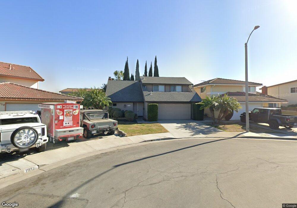
7922 Carolyn Cir La Palma, CA 90623
Estimated Value: $1,234,000 - $1,267,000
4
Beds
3
Baths
2,097
Sq Ft
$593/Sq Ft
Est. Value
About This Home
This home is located at 7922 Carolyn Cir, La Palma, CA 90623 and is currently estimated at $1,243,183, approximately $592 per square foot. 7922 Carolyn Cir is a home located in Orange County with nearby schools including Steve Luther Elementary School, Walker Junior High School, and John F. Kennedy High School.
Ownership History
Date
Name
Owned For
Owner Type
Purchase Details
Closed on
Jun 7, 2002
Sold by
Hall Sam L and Hall Teresa K
Bought by
Hall Sam L and Hall Teresa K
Current Estimated Value
Home Financials for this Owner
Home Financials are based on the most recent Mortgage that was taken out on this home.
Original Mortgage
$218,000
Interest Rate
6.74%
Purchase Details
Closed on
Jul 1, 2000
Sold by
Sam Hall and Sam Teresa Hall
Bought by
Hall Sam L and Hall Teresa K
Create a Home Valuation Report for This Property
The Home Valuation Report is an in-depth analysis detailing your home's value as well as a comparison with similar homes in the area
Home Values in the Area
Average Home Value in this Area
Purchase History
| Date | Buyer | Sale Price | Title Company |
|---|---|---|---|
| Hall Sam L | -- | Commonwealth Land Title | |
| Hall Sam L | -- | Commonwealth Land Title | |
| Hall Sam L | -- | -- |
Source: Public Records
Mortgage History
| Date | Status | Borrower | Loan Amount |
|---|---|---|---|
| Closed | Hall Sam L | $218,000 |
Source: Public Records
Tax History Compared to Growth
Tax History
| Year | Tax Paid | Tax Assessment Tax Assessment Total Assessment is a certain percentage of the fair market value that is determined by local assessors to be the total taxable value of land and additions on the property. | Land | Improvement |
|---|---|---|---|---|
| 2025 | $4,365 | $380,383 | $173,356 | $207,027 |
| 2024 | $4,365 | $372,925 | $169,957 | $202,968 |
| 2023 | $4,263 | $365,613 | $166,624 | $198,989 |
| 2022 | $4,210 | $358,445 | $163,357 | $195,088 |
| 2021 | $4,154 | $351,417 | $160,154 | $191,263 |
| 2020 | $4,136 | $347,814 | $158,512 | $189,302 |
| 2019 | $4,022 | $340,995 | $155,404 | $185,591 |
| 2018 | $3,967 | $334,309 | $152,357 | $181,952 |
| 2017 | $3,797 | $324,496 | $149,369 | $175,127 |
| 2016 | $3,691 | $311,555 | $146,440 | $165,115 |
| 2015 | $3,663 | $306,876 | $144,241 | $162,635 |
| 2014 | $3,471 | $300,865 | $141,415 | $159,450 |
Source: Public Records
Map
Nearby Homes
- 5072 Alder Ln
- 7862 Squaw Valley Way
- 8312 Bellhaven St
- 5212 Lena Dr
- 5201 La Luna Dr
- 8162 Gay St
- 12967 Moorshire Dr
- 4502 Petite Ln
- 4322 Fontainbleau Ave
- 19118 Martha Ave
- 4891 Grace Ave
- 8606 Belmont St
- 4372 Opal Ave
- 5166 Banbury Cir
- 5568 Ozawa Cir
- 4772 Grace Ave
- 8641 Belmont St Unit 2
- 19008 Jeffrey Ave
- 12711 Castleford Ln
- 5412 Bransford Dr
- 7932 Carolyn Cir
- 7912 Carolyn Cir
- 7921 Louise Ln
- 7911 Louise Ln
- 7931 Louise Ln
- 7942 Carolyn Cir
- 7901 Carolyn Cir
- 7901 Louise Ln
- 7941 Louise Ln
- 7952 Carolyn Cir
- 4812 Karen Cir
- 4802 Karen Cir
- 7891 Louise Ln
- 7911 Carolyn Cir
- 7921 Carolyn Cir
- 7931 Carolyn Cir
- 7951 Louise Ln
- 7941 Carolyn Cir
- 4792 Karen Cir
- 7881 Louise Ln