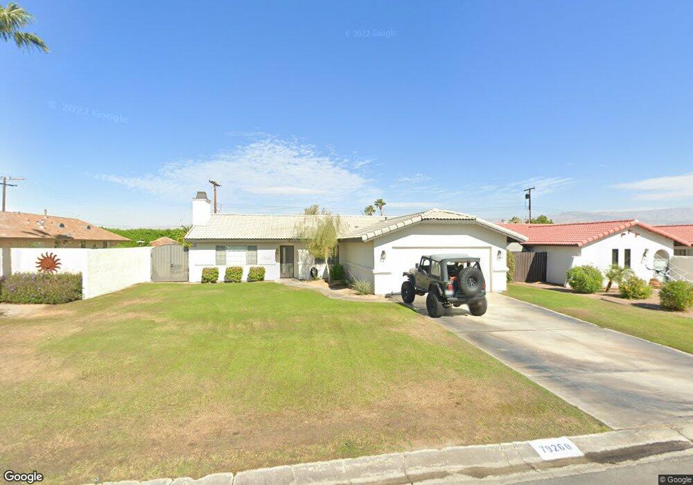
79260 Spalding Dr Bermuda Dunes, CA 92203
Estimated Value: $305,000 - $598,000
3
Beds
2
Baths
1,421
Sq Ft
$341/Sq Ft
Est. Value
About This Home
This home is located at 79260 Spalding Dr, Bermuda Dunes, CA 92203 and is currently estimated at $484,558, approximately $340 per square foot. 79260 Spalding Dr is a home located in Riverside County with nearby schools including James Monroe Elementary School, Colonel Mitchell Paige Middle School, and Palm Desert High School.
Ownership History
Date
Name
Owned For
Owner Type
Purchase Details
Closed on
May 17, 2016
Sold by
Ivy Keith and Ivy Amy
Bought by
The Ivy Family Trust
Current Estimated Value
Purchase Details
Closed on
Aug 6, 2001
Sold by
Isen Steve A and Isen Cheryl M
Bought by
Ivy Keith and Ivy Amy
Home Financials for this Owner
Home Financials are based on the most recent Mortgage that was taken out on this home.
Original Mortgage
$171,788
Interest Rate
6.91%
Mortgage Type
FHA
Create a Home Valuation Report for This Property
The Home Valuation Report is an in-depth analysis detailing your home's value as well as a comparison with similar homes in the area
Home Values in the Area
Average Home Value in this Area
Purchase History
| Date | Buyer | Sale Price | Title Company |
|---|---|---|---|
| The Ivy Family Trust | -- | None Available | |
| Ivy Keith | -- | Orange Coast Title |
Source: Public Records
Mortgage History
| Date | Status | Borrower | Loan Amount |
|---|---|---|---|
| Previous Owner | Ivy Keith | $171,788 |
Source: Public Records
Tax History Compared to Growth
Tax History
| Year | Tax Paid | Tax Assessment Tax Assessment Total Assessment is a certain percentage of the fair market value that is determined by local assessors to be the total taxable value of land and additions on the property. | Land | Improvement |
|---|---|---|---|---|
| 2025 | $3,043 | $257,756 | $64,430 | $193,326 |
| 2023 | $3,043 | $247,749 | $61,929 | $185,820 |
| 2022 | $2,923 | $242,892 | $60,715 | $182,177 |
| 2021 | $2,864 | $238,130 | $59,525 | $178,605 |
| 2020 | $2,809 | $235,689 | $58,915 | $176,774 |
| 2019 | $2,753 | $231,068 | $57,760 | $173,308 |
| 2018 | $2,697 | $226,538 | $56,629 | $169,909 |
| 2017 | $2,656 | $222,097 | $55,519 | $166,578 |
| 2016 | $2,656 | $217,743 | $54,431 | $163,312 |
| 2015 | $2,664 | $214,474 | $53,614 | $160,860 |
| 2014 | $2,619 | $210,275 | $52,565 | $157,710 |
Source: Public Records
Map
Nearby Homes
- 41855 Volare Ct
- 41868 Volare Ct
- 41879 Volare Ct
- 41891 Volare Ct
- 41880 Volare Ct
- 41892 Volare Ct
- 79361 Port Royal Ave
- 41252 Gaslight Ave
- 41740 Cambridge Ave
- 79381 Avenue 42
- 79040 Cliff St
- 79305 Bermuda Dunes Dr
- 42410 Adams St
- 0 Adams St Unit SW25056920
- 0 Adams St Unit 25578457PS
- 0 Adams St Unit 25578377PS
- 42505 Adams St
- 42533 Capri Dr
- 78900 Runaway Bay Dr
- 78650 Avenue 42 Unit 1514
- 79250 Spalding Dr
- 79270 Spalding Dr
- 79261 Bowden Dr
- 79271 Bowden Dr
- 41650 Hopewell Ave
- 79280 Spalding Dr
- 0 Hopewell Unit SB15122971
- 0 Hopewell Unit 219117354DA
- 0 Hopewell Unit 21433127DA
- 0 Hopewell Unit 21375100DA
- 79261 Spalding Dr
- 79281 Bowden Dr
- 79251 Spalding Dr
- 79290 Spalding Dr
- 79271 Spalding Dr
- 79291 Bowden Dr
- 79281 Spalding Dr
- 41740 Hopewell Ave
- 79300 Spalding Dr
- 79291 Spalding Dr