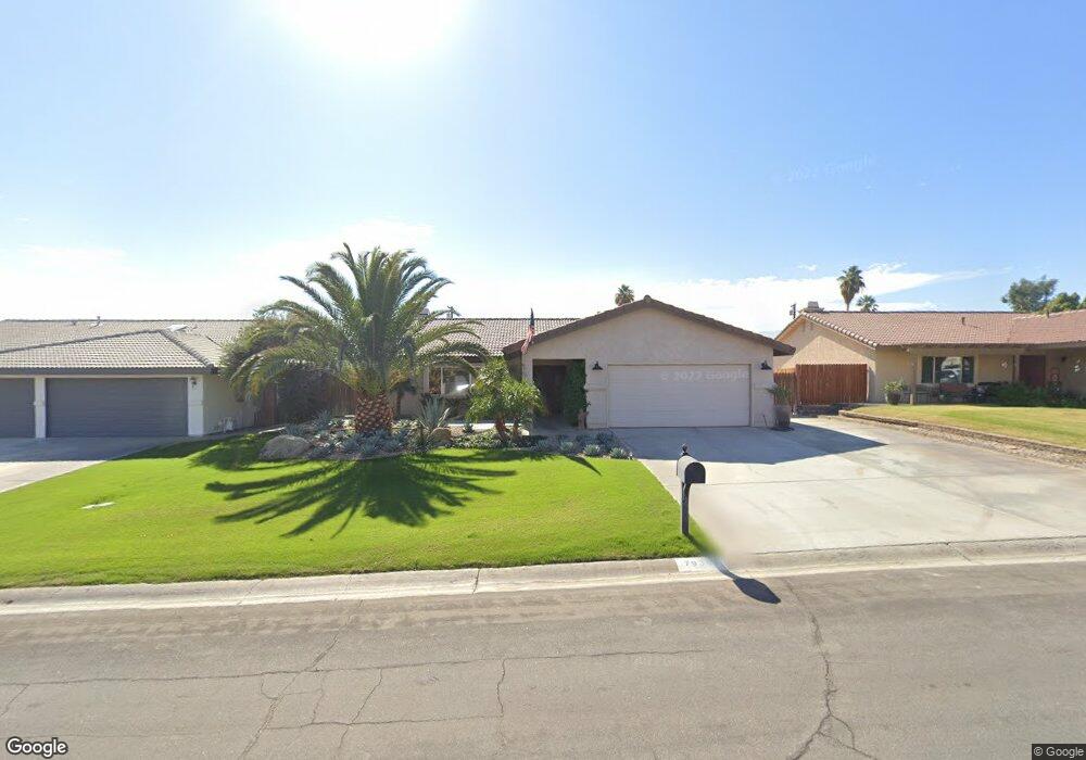
79301 Spalding Dr Bermuda Dunes, CA 92203
Estimated Value: $343,000 - $662,000
3
Beds
2
Baths
1,952
Sq Ft
$280/Sq Ft
Est. Value
About This Home
This home is located at 79301 Spalding Dr, Bermuda Dunes, CA 92203 and is currently estimated at $546,373, approximately $279 per square foot. 79301 Spalding Dr is a home located in Riverside County with nearby schools including James Monroe Elementary School, Colonel Mitchell Paige Middle School, and Palm Desert High School.
Ownership History
Date
Name
Owned For
Owner Type
Purchase Details
Closed on
Jun 17, 2003
Sold by
Thomson Kevin L and Thomson Terri A
Bought by
Thomson Kevin L and Thomson Terri A
Current Estimated Value
Home Financials for this Owner
Home Financials are based on the most recent Mortgage that was taken out on this home.
Original Mortgage
$131,500
Interest Rate
5.53%
Mortgage Type
Purchase Money Mortgage
Create a Home Valuation Report for This Property
The Home Valuation Report is an in-depth analysis detailing your home's value as well as a comparison with similar homes in the area
Home Values in the Area
Average Home Value in this Area
Purchase History
| Date | Buyer | Sale Price | Title Company |
|---|---|---|---|
| Thomson Kevin L | -- | New Century Title Company |
Source: Public Records
Mortgage History
| Date | Status | Borrower | Loan Amount |
|---|---|---|---|
| Closed | Thomson Kevin L | $131,500 |
Source: Public Records
Tax History
| Year | Tax Paid | Tax Assessment Tax Assessment Total Assessment is a certain percentage of the fair market value that is determined by local assessors to be the total taxable value of land and additions on the property. | Land | Improvement |
|---|---|---|---|---|
| 2025 | $920 | $246,968 | $64,367 | $182,601 |
| 2023 | $920 | $237,379 | $61,868 | $175,511 |
| 2022 | $1,047 | $232,725 | $60,655 | $172,070 |
| 2021 | $1,021 | $228,163 | $59,466 | $168,697 |
| 2020 | $1,036 | $225,825 | $58,857 | $166,968 |
| 2019 | $1,028 | $221,398 | $57,703 | $163,695 |
| 2018 | $1,032 | $217,058 | $56,573 | $160,485 |
| 2017 | $1,024 | $212,803 | $55,464 | $157,339 |
| 2016 | $2,461 | $208,631 | $54,377 | $154,254 |
| 2015 | $2,467 | $205,499 | $53,561 | $151,938 |
| 2014 | $2,424 | $201,475 | $52,513 | $148,962 |
Source: Public Records
Map
Nearby Homes
- 79281 Spalding Dr
- 79271 Spalding Dr
- 79361 Port Royal Ave
- 41868 Volare Ct
- 41867 Volare Ct
- 41879 Volare Ct
- 41856 Volare Ct
- 41880 Volare Ct
- 41796 Volare Ct
- 79221 Port Royal Ave
- 41750 Hermitage Dr
- 79211 Bermuda Dunes Dr
- 79070 Bermuda Dunes Dr
- 79040 Cliff St
- 42350 Adams St
- 42518 Capri Dr
- 42505 Adams St
- 78900 Runaway Bay Dr
- 42320 Baracoa Dr Unit 2
- 42320 Baracoa Dr Unit 20
- 79311 Spalding Dr
- 79291 Spalding Dr
- 79298 Aruba Ct
- 79304 Aruba Ct
- 79294 Aruba Ct
- 79331 Spalding Dr
- 79300 Spalding Dr
- 79310 Spalding Dr
- 79290 Spalding Dr
- 79320 Spalding Dr
- 79280 Spalding Dr
- 79310 Port Royal Ave
- 79290 Port Royal Ave
- 79320 Port Royal Ave
- 79341 Spalding Dr
- 79261 Spalding Dr
- 79280 Port Royal Ave
- 79330 Spalding Dr
- 79270 Spalding Dr
- 79330 Port Royal Ave
Your Personal Tour Guide
Ask me questions while you tour the home.