Estimated Value: $422,379 - $543,000
2
Beds
2
Baths
1,695
Sq Ft
$283/Sq Ft
Est. Value
About This Home
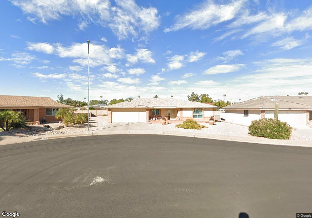
This home is located at 7938 E Kiowa Cir Unit me, Mesa, AZ 85209 and is currently estimated at $478,845, approximately $282 per square foot. 7938 E Kiowa Cir Unit me is a home located in Maricopa County with nearby schools including Boulder Creek Elementary School, Desert Ridge Jr. High School, and Desert Ridge High School.
Ownership History
Date
Name
Owned For
Owner Type
Purchase Details
Closed on
Dec 29, 2021
Sold by
Clawson James W and Clawson Mary M
Bought by
Demming Glen A and The Glen Demming Family Trust
Current Estimated Value
Home Financials for this Owner
Home Financials are based on the most recent Mortgage that was taken out on this home.
Original Mortgage
$130,000
Outstanding Balance
$119,811
Interest Rate
3.11%
Mortgage Type
New Conventional
Estimated Equity
$359,034
Purchase Details
Closed on
Jan 5, 2017
Sold by
Johnson Barbara M
Bought by
Clawson James W and Clawson Mary M
Home Financials for this Owner
Home Financials are based on the most recent Mortgage that was taken out on this home.
Original Mortgage
$160,000
Interest Rate
4.03%
Mortgage Type
New Conventional
Purchase Details
Closed on
Jan 27, 1999
Sold by
Stancil Joseph E and Stancil Doralee A
Bought by
Johnson Barbara M
Create a Home Valuation Report for This Property
The Home Valuation Report is an in-depth analysis detailing your home's value as well as a comparison with similar homes in the area
Home Values in the Area
Average Home Value in this Area
Purchase History
| Date | Buyer | Sale Price | Title Company |
|---|---|---|---|
| Demming Glen A | $460,000 | Lawyers Title Of Arizona Inc | |
| Clawson James W | $217,500 | Lawyers Title Of Arizona Inc | |
| Johnson Barbara M | $137,900 | Transnation Title Ins Co |
Source: Public Records
Mortgage History
| Date | Status | Borrower | Loan Amount |
|---|---|---|---|
| Open | Demming Glen A | $130,000 | |
| Previous Owner | Clawson James W | $160,000 |
Source: Public Records
Tax History Compared to Growth
Tax History
| Year | Tax Paid | Tax Assessment Tax Assessment Total Assessment is a certain percentage of the fair market value that is determined by local assessors to be the total taxable value of land and additions on the property. | Land | Improvement |
|---|---|---|---|---|
| 2025 | $1,462 | $19,743 | -- | -- |
| 2024 | $1,765 | $18,802 | -- | -- |
| 2023 | $1,765 | $29,470 | $5,890 | $23,580 |
| 2022 | $1,722 | $25,080 | $5,010 | $20,070 |
| 2021 | $2,203 | $23,000 | $4,600 | $18,400 |
| 2020 | $2,166 | $20,830 | $4,160 | $16,670 |
| 2019 | $2,026 | $18,550 | $3,710 | $14,840 |
| 2018 | $1,941 | $17,800 | $3,560 | $14,240 |
| 2017 | $1,884 | $17,480 | $3,490 | $13,990 |
| 2016 | $1,935 | $16,330 | $3,260 | $13,070 |
| 2015 | $1,774 | $15,870 | $3,170 | $12,700 |
Source: Public Records
Map
Nearby Homes
- 7929 E Lakeview Ave
- 8041 E Lakeview Ave
- 2064 S Farnsworth Dr Unit 39
- 2064 S Farnsworth Dr Unit 38
- 2064 S Farnsworth Dr Unit 98
- 2064 S Farnsworth Dr Unit 73
- 2064 S Farnsworth Dr Unit 41
- 2064 S Farnsworth Dr Unit 109
- 2311 S Farnsworth Dr Unit 94
- 2311 S Farnsworth Dr Unit 81
- 2310 S Farnsworth Dr Unit 16
- 8056 E Kiva Ave
- 7950 E Keats Ave Unit 118
- 7950 E Keats Ave Unit 148
- 7950 E Keats Ave Unit 194
- 7950 E Keats Ave Unit 147
- 7950 E Keats Ave Unit 134
- 7950 E Keats Ave Unit 150
- 8016 E Medina Ave
- 8020 E Keats Ave Unit 288
- 7938 E Kiowa Cir
- 7948 E Kiowa Cir
- 7930 E Kiowa Cir
- 7937 E Lindner Cir
- 7937 E Lindner Cir
- 7943 E Lindner Cir
- 7931 E Lindner Cir
- 7954 E Kiowa Cir
- 7949 E Lindner Cir
- 2147 S Gladiolus
- 7947 E Kiowa Cir
- 7941 E Kiowa Cir
- 2139 S Gladiolus
- 2155 S Gladiolus
- 7953 E Kiowa Cir
- 2127 S Gladiolus
- 7957 E Lindner Cir
- 7960 E Kiowa Cir
- 2163 S Gladiolus
- 7928 E Lindner Cir