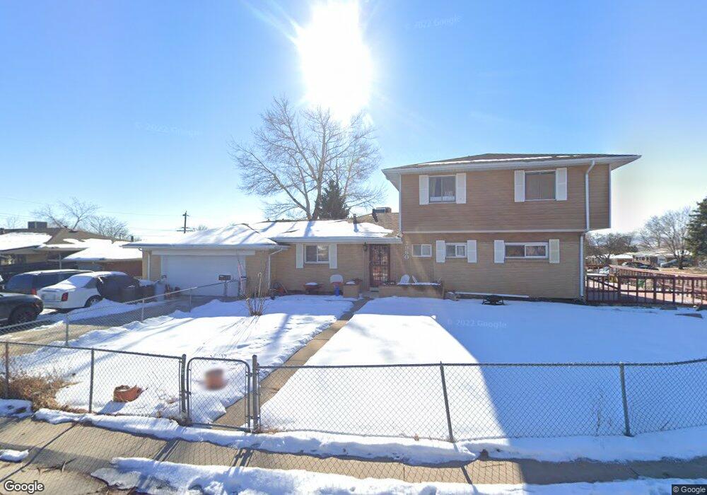
7960 Robin Ln Denver, CO 80221
Sherrelwood NeighborhoodEstimated Value: $476,000 - $663,000
4
Beds
2
Baths
2,784
Sq Ft
$198/Sq Ft
Est. Value
About This Home
This home is located at 7960 Robin Ln, Denver, CO 80221 and is currently estimated at $550,528, approximately $197 per square foot. 7960 Robin Ln is a home located in Adams County with nearby schools including Fairview PK-8, Iver C. Ranum Middle School, and Westminster High School.
Ownership History
Date
Name
Owned For
Owner Type
Purchase Details
Closed on
Aug 10, 2007
Sold by
Cruz Angel D
Bought by
Cruz Angel D and Cruz Mercy
Current Estimated Value
Purchase Details
Closed on
Jul 10, 2006
Sold by
Cruz Mercy
Bought by
Cruz Angel D
Purchase Details
Closed on
Jun 21, 1994
Sold by
Lofton Wendy L and Dowdle Patrick D
Bought by
Eoff James M and Eoff Evelyn B
Home Financials for this Owner
Home Financials are based on the most recent Mortgage that was taken out on this home.
Original Mortgage
$117,000
Interest Rate
7%
Purchase Details
Closed on
Mar 8, 1994
Sold by
Lofton Wendy L
Bought by
Dowdle Patrick D and Lofton Wendy L
Create a Home Valuation Report for This Property
The Home Valuation Report is an in-depth analysis detailing your home's value as well as a comparison with similar homes in the area
Home Values in the Area
Average Home Value in this Area
Purchase History
| Date | Buyer | Sale Price | Title Company |
|---|---|---|---|
| Cruz Angel D | -- | None Available | |
| Cruz Angel D | -- | None Available | |
| Eoff James M | $148,000 | -- | |
| Dowdle Patrick D | $55,000 | -- |
Source: Public Records
Mortgage History
| Date | Status | Borrower | Loan Amount |
|---|---|---|---|
| Previous Owner | Eoff James M | $117,000 |
Source: Public Records
Tax History
| Year | Tax Paid | Tax Assessment Tax Assessment Total Assessment is a certain percentage of the fair market value that is determined by local assessors to be the total taxable value of land and additions on the property. | Land | Improvement |
|---|---|---|---|---|
| 2025 | $3,399 | $35,430 | $5,850 | $29,580 |
| 2024 | $3,399 | $32,570 | $5,380 | $27,190 |
| 2023 | $3,394 | $38,830 | $5,550 | $33,280 |
| 2022 | $2,926 | $30,010 | $5,700 | $24,310 |
| 2021 | $2,881 | $30,010 | $5,700 | $24,310 |
| 2020 | $2,260 | $25,550 | $5,860 | $19,690 |
| 2019 | $2,353 | $25,550 | $5,860 | $19,690 |
| 2018 | $2,195 | $24,100 | $5,900 | $18,200 |
| 2017 | $2,719 | $24,100 | $5,900 | $18,200 |
| 2016 | $2,307 | $19,190 | $2,790 | $16,400 |
| 2015 | $2,296 | $19,190 | $2,790 | $16,400 |
| 2014 | $2,235 | $18,590 | $2,470 | $16,120 |
Source: Public Records
Map
Nearby Homes
- 2890 W 80th Ave
- 0 W 80th Ave
- 8064 Decatur Ct
- 7880 Valley View Dr
- 2840 Cottonwood Dr
- 2927 W 81st Ave Unit C
- 2929 W 81st Ave Unit A
- 7871 Grove St
- 2673 W 80th Place
- 7940 Hooker St
- 2941 W 81st Ave Unit F
- 2973 W 81st Ave Unit G
- 2682 Meadowbrook Dr
- 2612 Meadowbrook Dr
- 8005 Julian St
- 3360 Appleblossom Ln
- 2785 Skyline Dr
- 7620 Hooker St
- 2420 Cottonwood Dr
- 2500 Westchester Dr
Your Personal Tour Guide
Ask me questions while you tour the home.