797 E 1400 Rd Lawrence, KS 66046
Estimated Value: $570,000 - $686,000
4
Beds
4
Baths
3,757
Sq Ft
$164/Sq Ft
Est. Value
About This Home
This home is located at 797 E 1400 Rd, Lawrence, KS 66046 and is currently estimated at $616,007, approximately $163 per square foot. 797 E 1400 Rd is a home located in Douglas County with nearby schools including Billy Mills Middle School and Lawrence High School.
Ownership History
Date
Name
Owned For
Owner Type
Purchase Details
Closed on
Oct 29, 2018
Sold by
Ames Street Apartments Llc
Bought by
Cecil Ryan L
Current Estimated Value
Home Financials for this Owner
Home Financials are based on the most recent Mortgage that was taken out on this home.
Original Mortgage
$312,550
Outstanding Balance
$279,111
Interest Rate
4.6%
Mortgage Type
New Conventional
Estimated Equity
$305,737
Purchase Details
Closed on
Sep 13, 2013
Sold by
White Scott M and Craig Alice Anne
Bought by
Ames Street Apartments Llc
Purchase Details
Closed on
Apr 19, 2006
Sold by
Thomsen Charles W and Thomsen Sue V
Bought by
White Scott M and White Alice C
Home Financials for this Owner
Home Financials are based on the most recent Mortgage that was taken out on this home.
Original Mortgage
$239,000
Interest Rate
6.36%
Mortgage Type
New Conventional
Create a Home Valuation Report for This Property
The Home Valuation Report is an in-depth analysis detailing your home's value as well as a comparison with similar homes in the area
Home Values in the Area
Average Home Value in this Area
Purchase History
| Date | Buyer | Sale Price | Title Company |
|---|---|---|---|
| Cecil Ryan L | -- | Continental Title | |
| Ames Street Apartments Llc | -- | None Available | |
| White Scott M | -- | Kansas Secured Title |
Source: Public Records
Mortgage History
| Date | Status | Borrower | Loan Amount |
|---|---|---|---|
| Open | Cecil Ryan L | $312,550 | |
| Previous Owner | White Scott M | $294,000 | |
| Previous Owner | White Scott M | $50,000 | |
| Previous Owner | White Scott M | $239,000 | |
| Previous Owner | White Scott M | $239,000 | |
| Previous Owner | Thomsen Charles W | $210,000 | |
| Previous Owner | Thomsen Charles W | $100,000 |
Source: Public Records
Tax History Compared to Growth
Tax History
| Year | Tax Paid | Tax Assessment Tax Assessment Total Assessment is a certain percentage of the fair market value that is determined by local assessors to be the total taxable value of land and additions on the property. | Land | Improvement |
|---|---|---|---|---|
| 2024 | $6,405 | $57,430 | $16,543 | $40,887 |
| 2023 | $6,594 | $56,934 | $15,680 | $41,254 |
| 2022 | $6,357 | $54,405 | $15,288 | $39,117 |
| 2021 | $5,202 | $43,362 | $13,457 | $29,905 |
| 2020 | $4,714 | $39,871 | $13,457 | $26,414 |
| 2019 | $4,484 | $37,973 | $8,627 | $29,346 |
| 2018 | $5,083 | $43,024 | $8,568 | $34,456 |
| 2017 | $5,116 | $42,938 | $8,568 | $34,370 |
| 2016 | $4,684 | $40,814 | $5,762 | $35,052 |
| 2015 | $4,768 | $43,517 | $5,762 | $37,755 |
| 2014 | $4,723 | $40,823 | $5,762 | $35,061 |
Source: Public Records
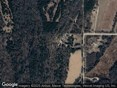
Map
Nearby Homes
- 0 N 750 Rd Unit HMS2549757
- 20 Acres N 750 Rd
- 1282 N 900 Rd
- 618 E 1450 Rd
- 125 E 1296 Rd
- 125 Acres E 1296 Rd
- 982 E 1338 Rd
- 1072 E 1466 Rd
- 1173 N 1000 Rd
- 1633 N 600 Rd
- 1036 E 1700 Rd
- 1020 E 1700 Rd
- 0 E 1600 Rd Unit HMS2484714
- x N 579 Rd
- 1580 N 100 Rd
- 1560 N 100 Rd
- 124 E 1550 Rd
- 1580 N 100 Rd Unit Parcel 3
- 1756 N 300 Rd
- 1752 N 300 Rd
- 797 E 1400 Rd
- 797 E 1400 Rd
- 1402 N 800 Rd
- 1398 N 800 Rd
- 1404 N 800 Rd
- 1415 N 800 Rd
- 769 E 1400 Rd
- 1441 N 800 Rd
- 849 E 1450 Rd
- 849 E 1450 Rd Unit (38 Acres)
- RDP #2 E 1450 Rd Unit 9.77 Acres in 18-14-
- RDP #1 E 1450 Rd Unit 7.22 acres in 18-14-
- RDP #2 E 1450 Rd
- RDP #1 E 1450 Rd
- N 800 E 1450 Rd
- N 800 Rd E 1450 Rd
- 800* E 1450 Rd
- 781 E 1450 Rd
- 0 E 1450 Rd Unit 2125493
- RDP #2 E 1450 Unit 9.77 Acres in 18-14-