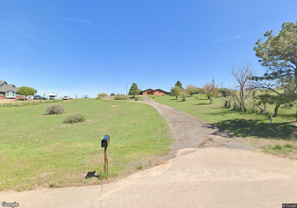
7995 E Robin Rd Parker, CO 80138
Estimated Value: $582,000 - $730,680
3
Beds
2
Baths
1,800
Sq Ft
$351/Sq Ft
Est. Value
About This Home
This home is located at 7995 E Robin Rd, Parker, CO 80138 and is currently estimated at $632,420, approximately $351 per square foot. 7995 E Robin Rd is a home located in Douglas County with nearby schools including Pine Lane Elementary School, Sierra Middle School, and Chaparral High School.
Ownership History
Date
Name
Owned For
Owner Type
Purchase Details
Closed on
Apr 23, 1997
Sold by
Parisi Joseph Daniel Trustee
Bought by
Cooper Mark S
Current Estimated Value
Home Financials for this Owner
Home Financials are based on the most recent Mortgage that was taken out on this home.
Original Mortgage
$185,120
Interest Rate
10%
Purchase Details
Closed on
Apr 18, 1997
Sold by
Cooper Mark
Bought by
Wood Michael J and Wood Cathlene E
Home Financials for this Owner
Home Financials are based on the most recent Mortgage that was taken out on this home.
Original Mortgage
$185,120
Interest Rate
10%
Purchase Details
Closed on
Jan 18, 1996
Sold by
Morganari Claryce H
Bought by
Parisi Joseph Daniel
Purchase Details
Closed on
Dec 20, 1995
Sold by
Estate Of Frank Angelo Morganari
Bought by
Morganari Claryce H
Create a Home Valuation Report for This Property
The Home Valuation Report is an in-depth analysis detailing your home's value as well as a comparison with similar homes in the area
Purchase History
| Date | Buyer | Sale Price | Title Company |
|---|---|---|---|
| Cooper Mark S | $190,000 | North American Title | |
| Wood Michael J | $155,000 | North American Title | |
| Parisi Joseph Daniel | -- | -- | |
| Morganari Claryce H | -- | -- |
Source: Public Records
Mortgage History
| Date | Status | Borrower | Loan Amount |
|---|---|---|---|
| Closed | Wood Michael J | $185,120 |
Source: Public Records
Tax History
| Year | Tax Paid | Tax Assessment Tax Assessment Total Assessment is a certain percentage of the fair market value that is determined by local assessors to be the total taxable value of land and additions on the property. | Land | Improvement |
|---|---|---|---|---|
| 2025 | $4,164 | $42,690 | $26,140 | $16,550 |
| 2024 | $4,164 | $53,560 | $28,400 | $25,160 |
| 2023 | $4,210 | $53,560 | $28,400 | $25,160 |
| 2022 | $3,071 | $38,070 | $18,530 | $19,540 |
| 2021 | $3,198 | $38,070 | $18,530 | $19,540 |
| 2020 | $3,039 | $37,050 | $15,650 | $21,400 |
| 2019 | $3,050 | $37,050 | $15,650 | $21,400 |
| 2018 | $2,914 | $34,780 | $13,730 | $21,050 |
| 2017 | $2,697 | $34,780 | $13,730 | $21,050 |
| 2016 | $2,434 | $30,730 | $15,120 | $15,610 |
| 2015 | $2,496 | $30,730 | $15,120 | $15,610 |
| 2014 | $2,389 | $26,300 | $12,340 | $13,960 |
Source: Public Records
Map
Nearby Homes
- 11346 Canary Ln
- 10720 Mount Antero Way
- 7390 Sagebrush Dr
- 7372 Talon Trail
- 11001 Cardinal Dr
- 7330 Centennial Dr
- 10880 Longs Peak Ln
- 21814 Saddlebrook Dr
- 20720 Parker Vista Rd
- 10896 Omaha Ln
- 11865 Barrentine Loop
- 9050 Mary Clarke Place
- 11733 Crestop Way Unit B
- 6844 Bethany Dr
- 22077 Day Star Dr
- 6906 Longpark Dr
- 22013 Day Star Dr
- 22082 Day Star Dr
- 6810 Sea Oats Dr
- 23085 Blackwolf Way
- 7973 E Robin Rd
- 8034 Homestead Rd
- 7964 Homestead Rd
- 11443 N Cottontail Ln
- 7974 E Robin Rd
- 7906 Homestead Rd
- 11481 Cottontail Ln
- 11405 Cottontail Ln
- 7935 E Robin Rd
- 11559 Cottontail Ln
- 11365 Cottontail Ln
- 7891 E Robin Rd
- 11327 Cottontail Ln
- 11324 N Thrush Dr
- 11327 N Cottontail Ln
- 7842 Homestead Rd
- 11359 N Thrush Dr
- 11560 N Cottontail Ln
- 11476 Cottontail Ln
- 11438 Cottontail Ln
Your Personal Tour Guide
Ask me questions while you tour the home.