
Seller's Agent in 2012
Lisa Marie
RE/MAX Advantage Realty
(302) 753-8367
14 in this area
113 Total Sales
Estimated Value: $250,000 - $401,123
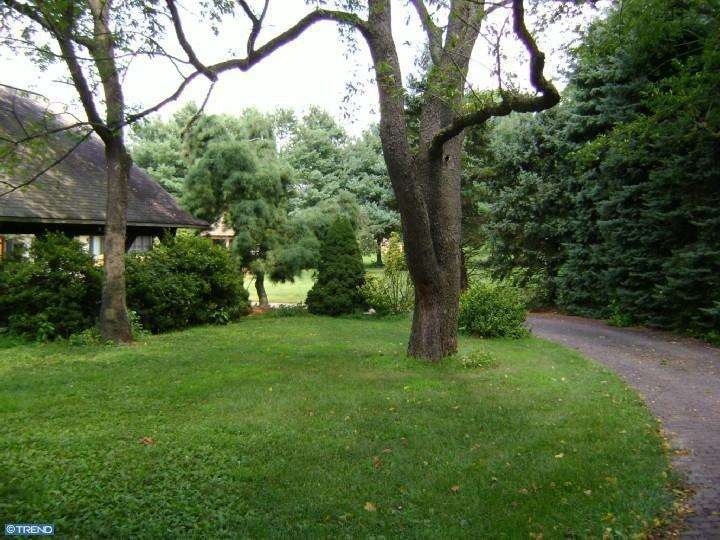
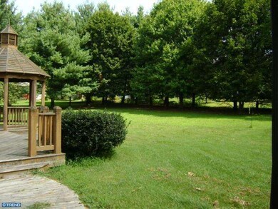
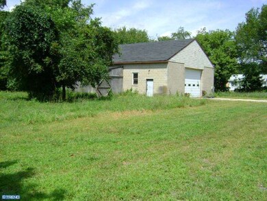
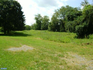
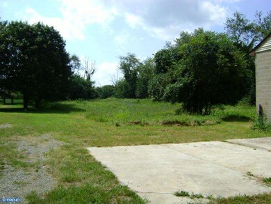
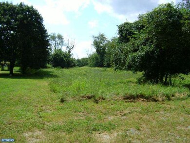
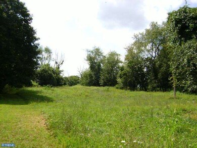
Unique opportunity in Southeast St. Georges. Parcel(s) total 2.62 acres located immediately South of the Canal, in the vicinity *opposite* of popular new construction along Lorewood Grove Rd (Southwest of rt 13/St. G). Tucked back & secluded 2.62 acres of (4) (yet some may say "5") previously subdivided lots. Original home, victim of fire, was placed in the center of the 2 most southeast lots, permits are being pulled to demo the home. DO NOT ENTER/OR WALK NEAR HOME. Tax ID #'s are as follows: Lot 8&9 #1203520029 & #1203520028 (home), Lot 7 #1203520027 (vacant), Lot 6 #1203520033(garage). All lot dimensions as stated in listing are approximate as the combination of the (4)lot(s) are irregular. Block garage may be accessed with owner only and is currently full. Unaware of any deed restrictions. It has been suggested that a home may be re-built in original footprint if desired, however not manditory. Well & septic were certified/passed inspection in 2010, however currently abandoned due to fire to home.
Last Agent to Sell the Property
(302) 378-8700 tinyshomes4u@aol.com RE/MAX Advantage Realty License #RS-0018248 Listed on: 03/16/2012
Last Buyer's Agent
(302) 633-1985 tyrone@smallsrealestate.com Smalls Real Estate Company
| Date | Buyer | Sale Price | Title Company |
|---|---|---|---|
| Money Richard Phillip | -- | None Available | |
| Money Richard Phillip | $140,000 | None Available | |
| Diangelo Jesse C | -- | -- |
| Date | Event | Price | List to Sale | Price per Sq Ft |
|---|---|---|---|---|
| 08/20/2012 08/20/12 | Sold | $140,000 | -15.2% | $87 / Sq Ft |
| 06/06/2012 06/06/12 | Pending | -- | -- | -- |
| 03/16/2012 03/16/12 | For Sale | $165,000 | -- | $102 / Sq Ft |
| Year | Tax Paid | Tax Assessment Tax Assessment Total Assessment is a certain percentage of the fair market value that is determined by local assessors to be the total taxable value of land and additions on the property. | Land | Improvement |
|---|---|---|---|---|
| 2024 | $1,264 | $37,900 | $21,200 | $16,700 |
| 2023 | $1,146 | $37,900 | $21,200 | $16,700 |
| 2022 | $1,202 | $37,900 | $21,200 | $16,700 |
| 2021 | $1,202 | $37,900 | $21,200 | $16,700 |
| 2020 | $1,210 | $37,900 | $21,200 | $16,700 |
| 2019 | $1,207 | $37,900 | $21,200 | $16,700 |
| 2018 | $1,185 | $37,900 | $21,200 | $16,700 |
| 2017 | $1,107 | $37,900 | $21,200 | $16,700 |
| 2016 | $989 | $37,900 | $21,200 | $16,700 |
| 2015 | $989 | $37,900 | $21,200 | $16,700 |
| 2014 | $990 | $37,900 | $21,200 | $16,700 |
Seller's Agent in 2012
Lisa Marie
RE/MAX Advantage Realty
(302) 753-8367
14 in this area
113 Total Sales
Buyer's Agent in 2012
Tyrone Righter
Smalls Real Estate Company
(302) 293-2956
18 Total Sales
Source: Bright MLS
MLS Number: 1003888084
APN: 12-035.20-029
Disclaimer: Certain information contained herein is derived from information provided by parties other than Homes.com. All information provided is deemed reliable, but is not guaranteed to be accurate and should be independently verified.
![]() The data relating to real estate for sale on this website appears in part through the BRIGHT Internet Data Exchange program, a voluntary cooperative exchange of property listing data between licensed real estate brokerage firms, and is provided by BRIGHT through a licensing agreement.
The data relating to real estate for sale on this website appears in part through the BRIGHT Internet Data Exchange program, a voluntary cooperative exchange of property listing data between licensed real estate brokerage firms, and is provided by BRIGHT through a licensing agreement.
Listing information is from various brokers who participate in the Bright MLS IDX program and not all listings may be visible on the site.
The property information being provided on or through the website is for the personal, non-commercial use of consumers and such information may not be used for any purpose other than to identify prospective properties consumers may be interested in purchasing.
Some properties which appear for sale on the website may no longer be available because they are for instance, under contract, sold or are no longer being offered for sale.
Property information displayed is deemed reliable but is not guaranteed.
Copyright 2026 Bright MLS, Inc.
Ask me questions while you tour the home.