Estimated Value: $147,000 - $235,000
3
Beds
3
Baths
1,200
Sq Ft
$173/Sq Ft
Est. Value
About This Home
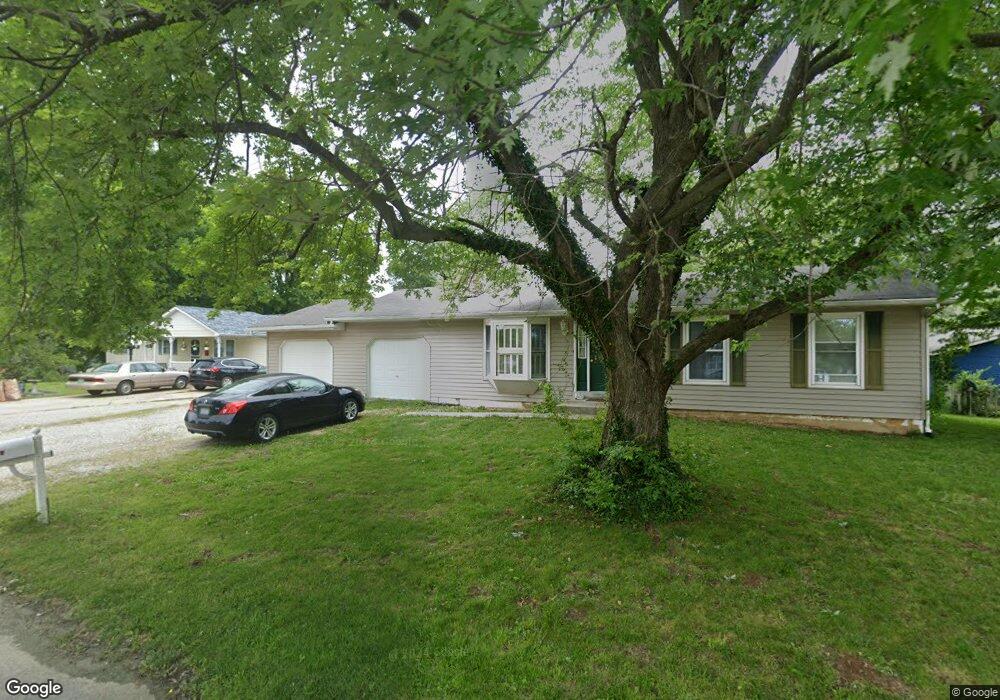
This home is located at 8 Caesar Dr, Troy, MO 63379 and is currently estimated at $207,139, approximately $172 per square foot. 8 Caesar Dr is a home located in Lincoln County with nearby schools including Main Street Elementary School, Troy Middle School, and Troy Buchanan High School.
Ownership History
Date
Name
Owned For
Owner Type
Purchase Details
Closed on
Jun 14, 2013
Sold by
Clark Linda N
Bought by
Pollard Brent L and Pollard Timi L
Current Estimated Value
Home Financials for this Owner
Home Financials are based on the most recent Mortgage that was taken out on this home.
Original Mortgage
$35,000
Outstanding Balance
$24,775
Interest Rate
3.38%
Mortgage Type
Future Advance Clause Open End Mortgage
Estimated Equity
$182,364
Create a Home Valuation Report for This Property
The Home Valuation Report is an in-depth analysis detailing your home's value as well as a comparison with similar homes in the area
Home Values in the Area
Average Home Value in this Area
Purchase History
| Date | Buyer | Sale Price | Title Company |
|---|---|---|---|
| Pollard Brent L | -- | None Available |
Source: Public Records
Mortgage History
| Date | Status | Borrower | Loan Amount |
|---|---|---|---|
| Open | Pollard Brent L | $35,000 |
Source: Public Records
Tax History
| Year | Tax Paid | Tax Assessment Tax Assessment Total Assessment is a certain percentage of the fair market value that is determined by local assessors to be the total taxable value of land and additions on the property. | Land | Improvement |
|---|---|---|---|---|
| 2025 | $1,426 | $22,695 | $2,658 | $20,037 |
| 2024 | $1,326 | $20,712 | $1,773 | $18,939 |
| 2023 | $1,318 | $20,712 | $1,773 | $18,939 |
| 2022 | $1,256 | $19,650 | $1,773 | $17,877 |
| 2021 | $1,263 | $103,420 | $0 | $0 |
| 2020 | $1,100 | $89,930 | $0 | $0 |
| 2019 | $1,102 | $89,930 | $0 | $0 |
| 2018 | $1,139 | $17,452 | $0 | $0 |
| 2017 | $1,142 | $17,452 | $0 | $0 |
| 2016 | $947 | $14,083 | $0 | $0 |
| 2015 | $1,007 | $14,083 | $0 | $0 |
| 2014 | $571 | $15,109 | $0 | $0 |
| 2013 | -- | $13,975 | $0 | $0 |
Source: Public Records
Map
Nearby Homes
- 945 Countryside Dr
- 145 Ellis Ave
- 11 Fire Oak Ct
- 2489 Oak Forest Dr
- 904 2nd St
- 0 John Unit MIS26012180
- 101 Kensington Palace Dr
- 340 Kemper St
- 20 Sydnorville Rd
- 21 Sydnorville Rd
- 530 Hall St
- 151 Colonial Ln
- 11 Oakview Ct
- 7 Oakview Ct - Lot 2
- 23 Oakview Ct - Lot 6
- 8 Oakview Ct - Lot 16
- 12 Oakview Ct - Lot 15
- 15 Oakview Ct - Lot 4
- 4
- 27 Oakview Ct - Lot 7
Your Personal Tour Guide
Ask me questions while you tour the home.