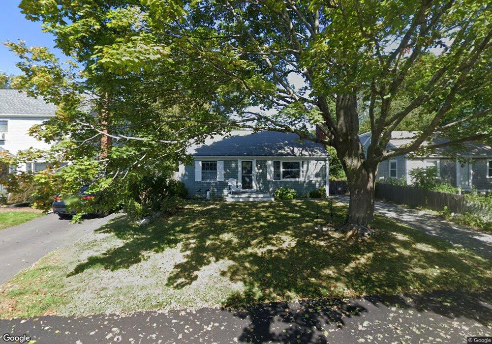
8 Ermine St Scituate, MA 02066
Estimated Value: $676,000 - $789,000
3
Beds
1
Bath
1,056
Sq Ft
$687/Sq Ft
Est. Value
About This Home
This home is located at 8 Ermine St, Scituate, MA 02066 and is currently estimated at $725,191, approximately $686 per square foot. 8 Ermine St is a home located in Plymouth County with nearby schools including Wampatuck Elementary School, Lester J. Gates Middle School, and Scituate High School.
Ownership History
Date
Name
Owned For
Owner Type
Purchase Details
Closed on
Sep 14, 2023
Sold by
Ennis David C and Ennis Elizabeth B
Bought by
Ennis
Current Estimated Value
Purchase Details
Closed on
Apr 29, 2005
Sold by
Mcculloch Mark E and Mcculloch Kirsten S
Bought by
Rutkowski Michael A and Rutkowski Carolyn M
Purchase Details
Closed on
Jun 30, 1999
Sold by
Loeb Frederick F and Loeb Christine
Bought by
Mcculloch Mark E and Mcculloch Kristen S
Home Financials for this Owner
Home Financials are based on the most recent Mortgage that was taken out on this home.
Original Mortgage
$164,400
Interest Rate
7.19%
Mortgage Type
Purchase Money Mortgage
Purchase Details
Closed on
Mar 28, 1994
Sold by
Robson Janice A
Bought by
Loeb Frederick F and Loeb Christine
Purchase Details
Closed on
Aug 13, 1990
Sold by
Robins Pamela J
Bought by
Robson Janice A
Create a Home Valuation Report for This Property
The Home Valuation Report is an in-depth analysis detailing your home's value as well as a comparison with similar homes in the area
Home Values in the Area
Average Home Value in this Area
Purchase History
| Date | Buyer | Sale Price | Title Company |
|---|---|---|---|
| Ennis | -- | None Available | |
| Rutkowski Michael A | $350,000 | -- | |
| Mcculloch Mark E | $172,000 | -- | |
| Loeb Frederick F | $130,000 | -- | |
| Robson Janice A | $120,000 | -- |
Source: Public Records
Mortgage History
| Date | Status | Borrower | Loan Amount |
|---|---|---|---|
| Previous Owner | Ennis David C | $310,800 | |
| Previous Owner | Rutkowski Michael A | $262,000 | |
| Previous Owner | Robins Pamela J | $281,400 | |
| Previous Owner | Mcculloch Mark E | $189,000 | |
| Previous Owner | Mcculloch Mark E | $185,000 | |
| Previous Owner | Robins Pamela J | $164,400 |
Source: Public Records
Tax History Compared to Growth
Tax History
| Year | Tax Paid | Tax Assessment Tax Assessment Total Assessment is a certain percentage of the fair market value that is determined by local assessors to be the total taxable value of land and additions on the property. | Land | Improvement |
|---|---|---|---|---|
| 2025 | $5,454 | $545,900 | $384,400 | $161,500 |
| 2024 | $5,262 | $507,900 | $349,500 | $158,400 |
| 2023 | $4,955 | $460,500 | $317,700 | $142,800 |
| 2022 | $4,955 | $392,600 | $259,400 | $133,200 |
| 2021 | $4,615 | $346,200 | $234,700 | $111,500 |
| 2020 | $4,427 | $327,900 | $225,600 | $102,300 |
| 2019 | $4,365 | $317,700 | $221,200 | $96,500 |
| 2018 | $4,417 | $316,600 | $239,000 | $77,600 |
| 2017 | $4,250 | $301,600 | $229,000 | $72,600 |
| 2016 | $3,983 | $281,700 | $209,100 | $72,600 |
| 2015 | $3,561 | $271,800 | $199,200 | $72,600 |
Source: Public Records
Map
Nearby Homes
- 36 Thelma Way Unit 36
- 5 Diane Terrace Unit 5
- 10 Benjamin Ln Unit 10
- 5 Brand Blvd Unit 5
- 24 Fay Rd
- 23 Lois Ann Ct Unit 23
- 337 Tilden Rd
- 50 Oceanside Dr
- 55 Seaside Rd
- 63 Seaside Rd
- 105 Turner Rd
- 14 Stanton Ln
- 15 Fieldstone Rd
- 85 Mann Hill Rd
- 119 Mann Hill Rd
- 17 Murphys Ln
- 32 Ann Vinal Rd
- 59 Captain Peirce Rd
- 290 Beaver Dam Rd
- 157 Branch St