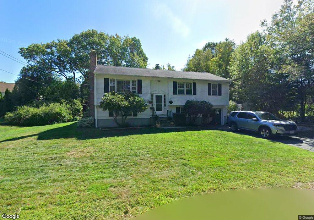
8 Gilbert Rd Gloucester, MA 01930
East Gloucester NeighborhoodEstimated Value: $598,000 - $974,000
3
Beds
2
Baths
1,144
Sq Ft
$691/Sq Ft
Est. Value
About This Home
This home is located at 8 Gilbert Rd, Gloucester, MA 01930 and is currently estimated at $790,833, approximately $691 per square foot. 8 Gilbert Rd is a home located in Essex County with nearby schools including East Gloucester Elementary School, Ralph B O'maley Middle School, and Gloucester High School.
Ownership History
Date
Name
Owned For
Owner Type
Purchase Details
Closed on
May 13, 2014
Sold by
Wisutskie Marjory J
Bought by
Wisutskie Kathryn L and Wisutskie John R
Current Estimated Value
Purchase Details
Closed on
Jun 15, 1998
Sold by
Aiello Toni A and Aiello Joseph L
Bought by
Nickerson Charles W
Home Financials for this Owner
Home Financials are based on the most recent Mortgage that was taken out on this home.
Original Mortgage
$119,000
Interest Rate
7.11%
Mortgage Type
Purchase Money Mortgage
Purchase Details
Closed on
Jul 1, 1968
Bought by
Wisutskie Marjory J
Create a Home Valuation Report for This Property
The Home Valuation Report is an in-depth analysis detailing your home's value as well as a comparison with similar homes in the area
Home Values in the Area
Average Home Value in this Area
Purchase History
| Date | Buyer | Sale Price | Title Company |
|---|---|---|---|
| Wisutskie Kathryn L | -- | -- | |
| Nickerson Charles W | $140,000 | -- | |
| Wisutskie Marjory J | -- | -- |
Source: Public Records
Mortgage History
| Date | Status | Borrower | Loan Amount |
|---|---|---|---|
| Previous Owner | Wisutskie Marjory J | $119,000 |
Source: Public Records
Tax History
| Year | Tax Paid | Tax Assessment Tax Assessment Total Assessment is a certain percentage of the fair market value that is determined by local assessors to be the total taxable value of land and additions on the property. | Land | Improvement |
|---|---|---|---|---|
| 2025 | $6,631 | $682,200 | $245,100 | $437,100 |
| 2024 | $6,789 | $697,700 | $233,400 | $464,300 |
| 2023 | $6,412 | $605,500 | $208,400 | $397,100 |
| 2022 | $5,949 | $507,200 | $177,200 | $330,000 |
| 2021 | $5,831 | $468,700 | $161,100 | $307,600 |
| 2020 | $5,635 | $457,000 | $161,100 | $295,900 |
| 2019 | $5,703 | $449,400 | $161,100 | $288,300 |
| 2018 | $5,406 | $418,100 | $161,100 | $257,000 |
| 2017 | $5,107 | $387,200 | $153,400 | $233,800 |
| 2016 | $5,011 | $368,200 | $153,900 | $214,300 |
| 2015 | -- | $351,600 | $153,900 | $197,700 |
Source: Public Records
Map
Nearby Homes
- 10 Seaview Rd
- 11 Ocean View Dr
- 15 Raven Ln Unit 15
- 1 Wonson St
- 73 Rocky Neck Ave Unit 2
- 197 E Main St Unit 1
- 60 Rocky Neck Ave Unit 202
- 30 Chapel St Unit B
- 87 Atlantic Rd Unit 2
- 100 Eastern Point Blvd
- 191 Main St Unit 3
- 191 Main St Unit 2A
- 3 Mondello Square
- 139A Prospect St
- 35 Middle St Unit 4
- 33 Middle St
- 15 Mount Vernon St
- 5 Wise Place
- 36 Eastern Ave
- 113 Pleasant St
- 6 Gilbert Rd
- 28 Saint Anthonys Ln
- 10 Gilbert Rd
- 32 Saint Anthonys Ln
- 4 Gilbert Rd
- 34 Saint Anthonys Ln
- 34 St Anthony's Ln
- 10 Hillside Rd
- 1 Gilbert Rd
- 16 Hillside Rd
- 11 Hillside Rd
- 31 Grapevine Rd
- 2 Gilbert Rd
- 2 Gilbert Rd Unit 1
- 23 Grapevine Rd
- 36 Saint Anthonys Ln
- 29 Grapevine Rd
- 25 Grapevine Rd
- 7 Hillside Rd Unit 2
- 15 Hillside Rd
Your Personal Tour Guide
Ask me questions while you tour the home.