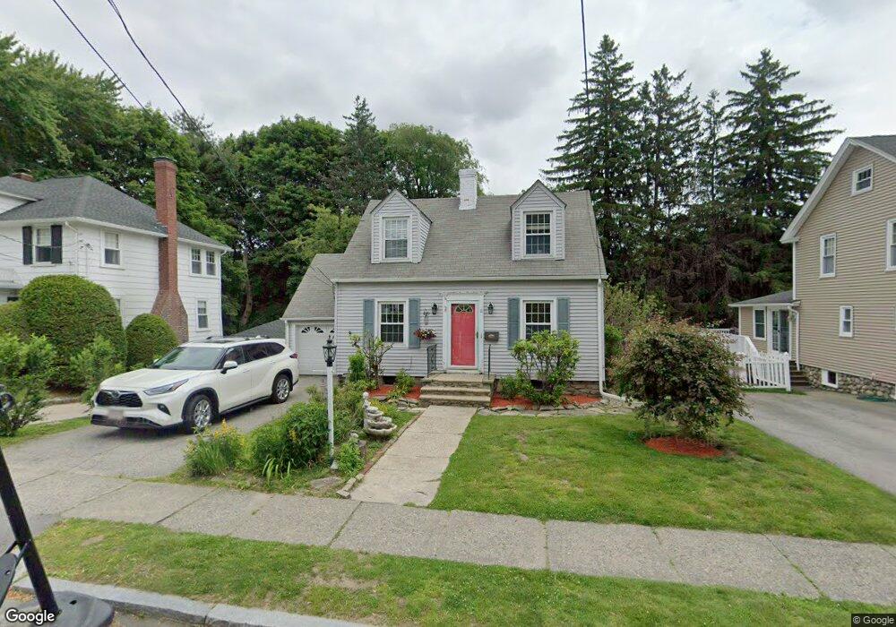
8 Lyndale Rd Worcester, MA 01606
Burncoat NeighborhoodEstimated Value: $395,000 - $439,000
3
Beds
2
Baths
1,248
Sq Ft
$328/Sq Ft
Est. Value
About This Home
This home is located at 8 Lyndale Rd, Worcester, MA 01606 and is currently estimated at $409,858, approximately $328 per square foot. 8 Lyndale Rd is a home located in Worcester County with nearby schools including Jacob Hiatt Magnet School, Chandler Magnet, and Thorndyke Road School.
Ownership History
Date
Name
Owned For
Owner Type
Purchase Details
Closed on
Jul 28, 2006
Sold by
Rudge Donald V and Rudge Dorothy A
Bought by
Gutierrez Keila and Bradford Maria
Current Estimated Value
Home Financials for this Owner
Home Financials are based on the most recent Mortgage that was taken out on this home.
Original Mortgage
$195,200
Outstanding Balance
$116,621
Interest Rate
6.67%
Mortgage Type
Purchase Money Mortgage
Estimated Equity
$293,237
Create a Home Valuation Report for This Property
The Home Valuation Report is an in-depth analysis detailing your home's value as well as a comparison with similar homes in the area
Home Values in the Area
Average Home Value in this Area
Purchase History
| Date | Buyer | Sale Price | Title Company |
|---|---|---|---|
| Gutierrez Keila | $244,000 | -- |
Source: Public Records
Mortgage History
| Date | Status | Borrower | Loan Amount |
|---|---|---|---|
| Open | Gutierrez Keila | $195,200 |
Source: Public Records
Tax History Compared to Growth
Tax History
| Year | Tax Paid | Tax Assessment Tax Assessment Total Assessment is a certain percentage of the fair market value that is determined by local assessors to be the total taxable value of land and additions on the property. | Land | Improvement |
|---|---|---|---|---|
| 2025 | $4,577 | $347,000 | $111,400 | $235,600 |
| 2024 | $4,495 | $326,900 | $111,400 | $215,500 |
| 2023 | $4,311 | $300,600 | $96,900 | $203,700 |
| 2022 | $3,955 | $260,000 | $77,500 | $182,500 |
| 2021 | $3,798 | $233,300 | $62,000 | $171,300 |
| 2020 | $3,709 | $218,200 | $62,000 | $156,200 |
| 2019 | $3,532 | $196,200 | $55,700 | $140,500 |
| 2018 | $3,546 | $187,500 | $55,700 | $131,800 |
| 2017 | $3,402 | $177,000 | $55,700 | $121,300 |
| 2016 | $3,357 | $162,900 | $41,600 | $121,300 |
| 2015 | $3,269 | $162,900 | $41,600 | $121,300 |
| 2014 | $3,183 | $162,900 | $41,600 | $121,300 |
Source: Public Records
Map
Nearby Homes