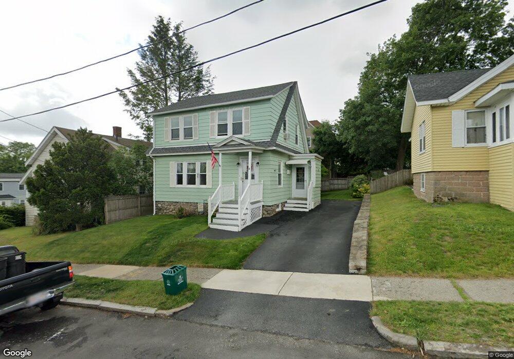
8 Merrill Rd Worcester, MA 01606
Indian Lake East NeighborhoodEstimated Value: $401,000 - $443,000
3
Beds
2
Baths
1,327
Sq Ft
$315/Sq Ft
Est. Value
About This Home
This home is located at 8 Merrill Rd, Worcester, MA 01606 and is currently estimated at $418,330, approximately $315 per square foot. 8 Merrill Rd is a home located in Worcester County with nearby schools including Francis J. McGrath Elementary School, Jacob Hiatt Magnet School, and Chandler Magnet.
Ownership History
Date
Name
Owned For
Owner Type
Purchase Details
Closed on
Mar 30, 1992
Sold by
Paluici Edgardo J and Paluci Maria
Bought by
Welch Robert E and Welch Cynthia
Current Estimated Value
Home Financials for this Owner
Home Financials are based on the most recent Mortgage that was taken out on this home.
Original Mortgage
$107,250
Interest Rate
8.66%
Mortgage Type
Purchase Money Mortgage
Create a Home Valuation Report for This Property
The Home Valuation Report is an in-depth analysis detailing your home's value as well as a comparison with similar homes in the area
Home Values in the Area
Average Home Value in this Area
Purchase History
| Date | Buyer | Sale Price | Title Company |
|---|---|---|---|
| Welch Robert E | $112,900 | -- |
Source: Public Records
Mortgage History
| Date | Status | Borrower | Loan Amount |
|---|---|---|---|
| Open | Welch Robert E | $103,900 | |
| Closed | Welch Robert E | $106,200 | |
| Closed | Welch Robert E | $107,250 |
Source: Public Records
Tax History Compared to Growth
Tax History
| Year | Tax Paid | Tax Assessment Tax Assessment Total Assessment is a certain percentage of the fair market value that is determined by local assessors to be the total taxable value of land and additions on the property. | Land | Improvement |
|---|---|---|---|---|
| 2025 | $4,491 | $340,500 | $99,600 | $240,900 |
| 2024 | $4,297 | $312,500 | $99,600 | $212,900 |
| 2023 | $4,131 | $288,100 | $86,600 | $201,500 |
| 2022 | $3,810 | $250,500 | $69,300 | $181,200 |
| 2021 | $3,674 | $225,700 | $55,500 | $170,200 |
| 2020 | $3,497 | $205,700 | $55,500 | $150,200 |
| 2019 | $3,359 | $186,600 | $49,900 | $136,700 |
| 2018 | $3,351 | $177,200 | $49,900 | $127,300 |
| 2017 | $3,206 | $166,800 | $49,900 | $116,900 |
| 2016 | $3,199 | $155,200 | $37,200 | $118,000 |
| 2015 | $3,115 | $155,200 | $37,200 | $118,000 |
| 2014 | $3,033 | $155,200 | $37,200 | $118,000 |
Source: Public Records
Map
Nearby Homes
- 44 Boardman St
- 89 W Boylston St Unit 4
- 6 Roald St
- 15 Ericsson St
- 577 Grove St
- 37 Kenwood Ave
- 0 Grove St
- 23 Dryden St
- 3 Shoreham St
- 39 Whitmarsh Ave
- 10 Dryden St Unit 7
- 667 Grove St
- 11 Hockanum Way
- 63 North St Unit A
- 63 North St Unit B
- 82 Holden St
- 27 Harlow St
- 18 Claffey Ave
- 40 Westwood Dr
- 28 Brooks St
- 35 Boardman St
- 10 Merrill Rd
- 31 Boardman St
- 12 Merrill Rd
- 12 Merrill Rd Unit 2
- 29 Boardman St
- 29 Boardman St Unit 3
- 29 Boardman St Unit 2
- 34 Boardman St
- 7 Merrill Rd
- 82 Tower St
- 82 Tower St Unit 3
- 82 Tower St Unit B
- 82 Tower St Unit 2
- LOT 29+30 Boardman
- 27 Boardman St
- 78 Tower St
- 78 Tower St Unit 2
- 5 Merrill Rd
- 30 Boardman St