Estimated Value: $399,000
Studio
--
Bath
--
Sq Ft
2,518,204
Sq Ft Lot
About This Home
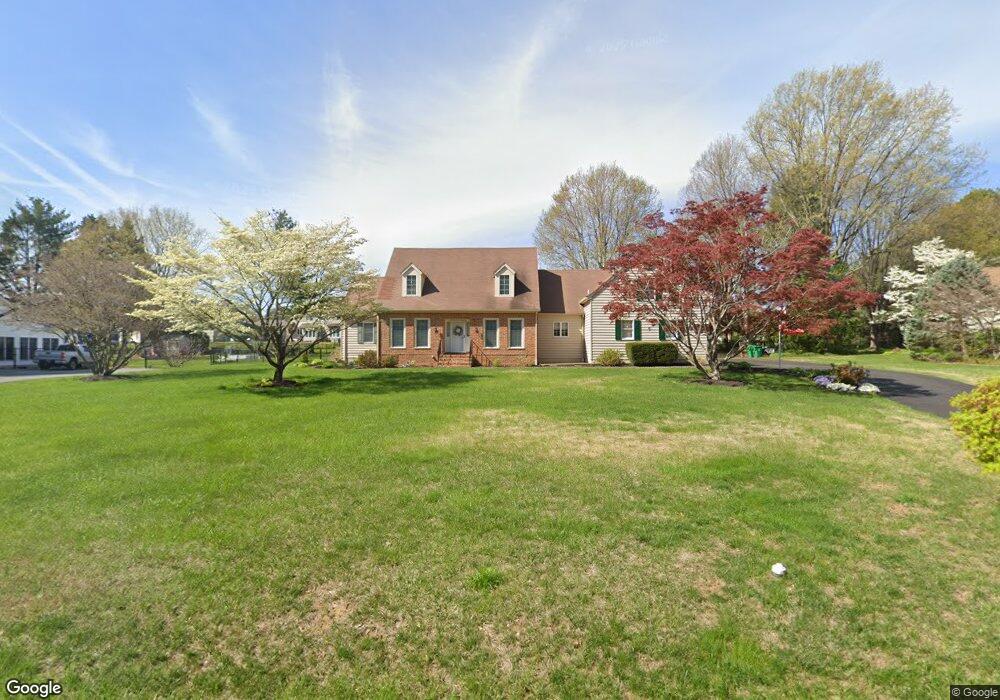
This home is located at 8 Stuart Dr, Dover, DE 19901 and is currently estimated at $399,000. 8 Stuart Dr is a home located in Kent County with nearby schools including Allen Frear Elementary School, F. Niel Postlethwait Middle School, and Caesar Rodney High School.
Ownership History
Date
Name
Owned For
Owner Type
Purchase Details
Closed on
Sep 29, 2025
Sold by
Smith Leslie M and Massey Michael J
Bought by
Massey Family Farms Llc
Current Estimated Value
Purchase Details
Closed on
Sep 9, 2024
Sold by
Kimmel Marilee
Bought by
Skelley Mark R
Home Financials for this Owner
Home Financials are based on the most recent Mortgage that was taken out on this home.
Original Mortgage
$356,250
Interest Rate
6.73%
Mortgage Type
New Conventional
Purchase Details
Closed on
Apr 19, 2012
Sold by
Massey Mildred L and Massey Louise P
Bought by
Smith Leslie M and Massey Michael J
Create a Home Valuation Report for This Property
The Home Valuation Report is an in-depth analysis detailing your home's value as well as a comparison with similar homes in the area
Home Values in the Area
Average Home Value in this Area
Purchase History
| Date | Buyer | Sale Price | Title Company |
|---|---|---|---|
| Massey Family Farms Llc | -- | None Listed On Document | |
| Skelley Mark R | $375,000 | None Listed On Document | |
| Smith Leslie M | -- | None Available |
Source: Public Records
Mortgage History
| Date | Status | Borrower | Loan Amount |
|---|---|---|---|
| Previous Owner | Skelley Mark R | $356,250 |
Source: Public Records
Tax History
| Year | Tax Paid | Tax Assessment Tax Assessment Total Assessment is a certain percentage of the fair market value that is determined by local assessors to be the total taxable value of land and additions on the property. | Land | Improvement |
|---|---|---|---|---|
| 2025 | $231 | $38,900 | $0 | $38,900 |
| 2024 | $223 | $38,900 | $0 | $38,900 |
| 2023 | $470 | $15,800 | $8,400 | $7,400 |
| 2022 | $455 | $15,800 | $8,400 | $7,400 |
| 2021 | $438 | $15,800 | $8,400 | $7,400 |
| 2020 | $424 | $15,800 | $8,400 | $7,400 |
| 2019 | $401 | $15,800 | $8,400 | $7,400 |
| 2018 | $366 | $15,800 | $8,400 | $7,400 |
| 2017 | $360 | $15,800 | $0 | $0 |
| 2016 | $361 | $15,800 | $0 | $0 |
| 2015 | -- | $15,800 | $0 | $0 |
| 2014 | -- | $15,800 | $0 | $0 |
Source: Public Records
Map
Nearby Homes
- 6 Crossley Dr
- 131 Jillian Ct
- 128 Jillian Ct
- 45 Mannering Dr
- 200 Beechwood Ave Unit 30
- 1810 Windswept Cir
- 1895 Windswept Cir
- 1679 S State St Unit A55
- 89 S Shore Dr
- 100 S Shore Dr
- 2158 S State St
- 135 N Fairfield Dr
- 89 Cooper Rd
- 7 Steele Rd
- 97 Glenda Rd
- 137 McBry Dr
- 1650 Cypress Branch Rd
- 207 Chenault Ct
- 5 Waterwheel Cir
- 238 S Governors Blvd
Your Personal Tour Guide
Ask me questions while you tour the home.