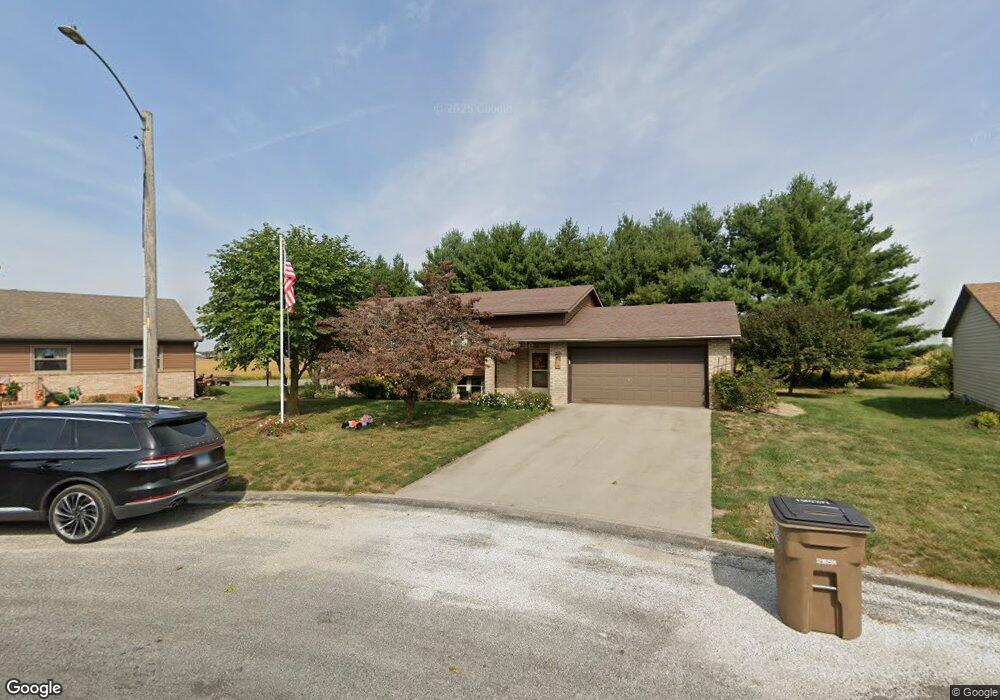
8 Toler Bend Franklin, IL 62638
Estimated Value: $83,000 - $171,691
Studio
--
Bath
--
Sq Ft
10,019
Sq Ft
About This Home
This home is located at 8 Toler Bend, Franklin, IL 62638 and is currently estimated at $131,173. 8 Toler Bend is a home located in Morgan County with nearby schools including Franklin East Grade School, Franklin Elementary School, and Alexander Elementary School.
Ownership History
Date
Name
Owned For
Owner Type
Purchase Details
Closed on
Jul 28, 2023
Sold by
Smith Rick W and Smith Susan L
Bought by
Nelson Brent A and Nelson Morgan B
Current Estimated Value
Home Financials for this Owner
Home Financials are based on the most recent Mortgage that was taken out on this home.
Original Mortgage
$128,000
Outstanding Balance
$122,869
Interest Rate
3.6%
Mortgage Type
New Conventional
Estimated Equity
$8,304
Purchase Details
Closed on
Feb 9, 2022
Sold by
Smith Rick W and Smith Susan L
Bought by
Smith Rick W and Smith Rick W
Create a Home Valuation Report for This Property
The Home Valuation Report is an in-depth analysis detailing your home's value as well as a comparison with similar homes in the area
Purchase History
| Date | Buyer | Sale Price | Title Company |
|---|---|---|---|
| Nelson Brent A | $160,000 | None Listed On Document | |
| Smith Rick W | -- | None Listed On Document |
Source: Public Records
Mortgage History
| Date | Status | Borrower | Loan Amount |
|---|---|---|---|
| Open | Nelson Brent A | $128,000 |
Source: Public Records
Tax History
| Year | Tax Paid | Tax Assessment Tax Assessment Total Assessment is a certain percentage of the fair market value that is determined by local assessors to be the total taxable value of land and additions on the property. | Land | Improvement |
|---|---|---|---|---|
| 2024 | $1,763 | $33,140 | $4,850 | $28,290 |
| 2023 | $2,059 | $30,130 | $4,410 | $25,720 |
| 2022 | $1,961 | $30,130 | $4,410 | $25,720 |
| 2021 | $1,170 | $29,800 | $4,410 | $25,390 |
| 2020 | $1,209 | $27,970 | $3,210 | $24,760 |
| 2019 | $1,157 | $26,790 | $3,210 | $23,580 |
| 2018 | $1,151 | $26,010 | $3,120 | $22,890 |
| 2017 | $1,060 | $26,010 | $3,120 | $22,890 |
| 2016 | $1,423 | $26,010 | $3,120 | $22,890 |
| 2015 | $1,413 | $25,010 | $3,000 | $22,010 |
| 2014 | $1,413 | $24,520 | $2,940 | $21,580 |
| 2013 | $1,391 | $24,520 | $2,940 | $21,580 |
Source: Public Records
Map
Nearby Homes
- 7 Centennial
- 110 Wyatt St
- 842 Flinn Rd
- 0 Crow Rd Unit Lot WP001 23042120
- 355 W Elm St
- 217 E Tremont St
- 475 S Pearl St
- 150 E Tanner St
- 403 W Old 36
- 2750 Nortonville Rd
- 102 Victory Dr
- 2113 Southbrooke Rd
- 112 Lonergan Ln
- 720 Molly Ln
- 160 Lebeau
- 406 S Benton Unit 1
- 712 E Birch St Unit 1
- 721 E Gibson St Unit 1
- Lots 2-4 Barton St
- 1637 Lakeview Terrace
Your Personal Tour Guide
Ask me questions while you tour the home.