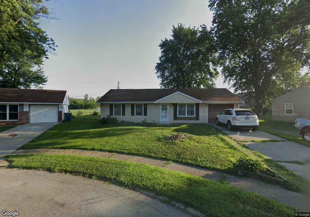
80 Bryant Ct Franklin, IN 46131
Estimated Value: $153,000 - $218,000
3
Beds
1
Bath
925
Sq Ft
$196/Sq Ft
Est. Value
About This Home
This home is located at 80 Bryant Ct, Franklin, IN 46131 and is currently estimated at $180,888, approximately $195 per square foot. 80 Bryant Ct is a home located in Johnson County with nearby schools including Northwood Elementary School, Franklin Community Middle School, and Custer Baker Intermediate School.
Ownership History
Date
Name
Owned For
Owner Type
Purchase Details
Closed on
Sep 5, 2018
Sold by
Kirk Amanda M
Bought by
Evans Joseph L
Current Estimated Value
Home Financials for this Owner
Home Financials are based on the most recent Mortgage that was taken out on this home.
Original Mortgage
$97,970
Outstanding Balance
$85,260
Interest Rate
4.5%
Mortgage Type
New Conventional
Estimated Equity
$95,628
Purchase Details
Closed on
Aug 2, 2006
Sold by
Walters Frances P
Bought by
Mitchell Amanda M
Home Financials for this Owner
Home Financials are based on the most recent Mortgage that was taken out on this home.
Original Mortgage
$15,980
Interest Rate
6.83%
Mortgage Type
Stand Alone Second
Create a Home Valuation Report for This Property
The Home Valuation Report is an in-depth analysis detailing your home's value as well as a comparison with similar homes in the area
Home Values in the Area
Average Home Value in this Area
Purchase History
| Date | Buyer | Sale Price | Title Company |
|---|---|---|---|
| Evans Joseph L | -- | Lenders Escrow & Title | |
| Mitchell Amanda M | -- | None Available |
Source: Public Records
Mortgage History
| Date | Status | Borrower | Loan Amount |
|---|---|---|---|
| Open | Evans Joseph L | $97,970 | |
| Previous Owner | Mitchell Amanda M | $15,980 | |
| Previous Owner | Mitchell Amanda M | $63,920 |
Source: Public Records
Tax History Compared to Growth
Tax History
| Year | Tax Paid | Tax Assessment Tax Assessment Total Assessment is a certain percentage of the fair market value that is determined by local assessors to be the total taxable value of land and additions on the property. | Land | Improvement |
|---|---|---|---|---|
| 2025 | $1,639 | $132,600 | $20,100 | $112,500 |
| 2024 | $1,159 | $115,100 | $20,100 | $95,000 |
| 2023 | $1,054 | $108,300 | $20,100 | $88,200 |
| 2022 | $903 | $94,700 | $20,100 | $74,600 |
| 2021 | $721 | $82,800 | $20,100 | $62,700 |
| 2020 | $674 | $80,000 | $17,900 | $62,100 |
| 2019 | $607 | $77,500 | $9,800 | $67,700 |
| 2018 | $508 | $69,400 | $9,800 | $59,600 |
| 2017 | $504 | $68,700 | $9,800 | $58,900 |
| 2016 | $480 | $67,400 | $9,800 | $57,600 |
| 2014 | $471 | $64,100 | $13,400 | $50,700 |
| 2013 | $471 | $66,700 | $13,500 | $53,200 |
Source: Public Records
Map
Nearby Homes
- 1624 Roberts Rd
- 315 Schoolhouse Rd
- 1450 Roberts Rd
- 2038 Bridlewood Dr
- 926 Walnut St
- 911 Cass Dr
- 2258 Bridlewood Dr
- 700 Johnson Ave
- 991 Ravine Dr
- 56 Central Ave
- 2103 Cedarmill Dr
- 1804 Acorn Rd
- 1081 Country Meadow Ct
- 651 Hamilton Ave
- 2230 Cedarmill Dr
- 1115 Cobra Dr
- 351 Cincinnati St
- 750 Hurricane St
- 698 Yandes St
- 2458 Bristol Dr