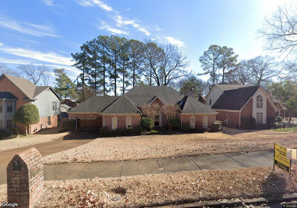
80 E Yates Rd N Memphis, TN 38120
East Memphis NeighborhoodEstimated Value: $418,000 - $472,000
3
Beds
3
Baths
2,991
Sq Ft
$148/Sq Ft
Est. Value
About This Home
This home is located at 80 E Yates Rd N, Memphis, TN 38120 and is currently estimated at $442,615, approximately $147 per square foot. 80 E Yates Rd N is a home located in Shelby County with nearby schools including Richland Elementary School, White Station Middle, and White Station High.
Ownership History
Date
Name
Owned For
Owner Type
Purchase Details
Closed on
Apr 26, 2023
Sold by
Evensky Sherry D
Bought by
Coward Sarah and Coward Kenderies
Current Estimated Value
Home Financials for this Owner
Home Financials are based on the most recent Mortgage that was taken out on this home.
Original Mortgage
$359,920
Outstanding Balance
$349,543
Interest Rate
6.6%
Mortgage Type
New Conventional
Estimated Equity
$93,072
Purchase Details
Closed on
Aug 29, 2012
Sold by
Evensky Maury
Bought by
Evensky Sherry D
Purchase Details
Closed on
Jul 30, 1999
Sold by
Sadler Bailey R and Sadler Gina R
Bought by
Evensky Maury and Evensky Sherry D
Home Financials for this Owner
Home Financials are based on the most recent Mortgage that was taken out on this home.
Original Mortgage
$150,000
Interest Rate
7.66%
Create a Home Valuation Report for This Property
The Home Valuation Report is an in-depth analysis detailing your home's value as well as a comparison with similar homes in the area
Home Values in the Area
Average Home Value in this Area
Purchase History
| Date | Buyer | Sale Price | Title Company |
|---|---|---|---|
| Coward Sarah | $449,900 | Home Surety Title & Escrow | |
| Evensky Sherry D | -- | None Available | |
| Evensky Maury | $262,500 | -- | |
| Evensky Maury | $262,500 | -- |
Source: Public Records
Mortgage History
| Date | Status | Borrower | Loan Amount |
|---|---|---|---|
| Open | Coward Sarah | $359,920 | |
| Previous Owner | Evensky Maury | $150,000 |
Source: Public Records
Tax History
| Year | Tax Paid | Tax Assessment Tax Assessment Total Assessment is a certain percentage of the fair market value that is determined by local assessors to be the total taxable value of land and additions on the property. | Land | Improvement |
|---|---|---|---|---|
| 2025 | $3,072 | $116,450 | $19,125 | $97,325 |
| 2024 | $3,072 | $90,625 | $19,125 | $71,500 |
| 2023 | $5,521 | $90,625 | $19,125 | $71,500 |
| 2022 | $5,521 | $90,625 | $19,125 | $71,500 |
| 2021 | $5,585 | $90,625 | $19,125 | $71,500 |
| 2020 | $5,521 | $76,200 | $15,900 | $60,300 |
| 2019 | $5,521 | $76,200 | $15,900 | $60,300 |
| 2018 | $5,521 | $76,200 | $15,900 | $60,300 |
| 2017 | $3,132 | $76,200 | $15,900 | $60,300 |
| 2016 | $2,894 | $66,225 | $0 | $0 |
Source: Public Records
Map
Nearby Homes
- 5681 Normandy Rd
- 50 Grove Dale St
- 5680 N Angela Rd
- 179 Richbriar St
- 5575 Walnut Grove Rd
- 5737 Buxbriar Ave
- 5704 Ashbriar Ave
- 248 N Yates Rd
- 99 Lynnfield St
- 5429 Walnut Grove Rd
- 5557 Mason Rd
- 5572 Mason Rd
- 5516 Sycamore Grove Ln
- 5385 Walnut Grove Rd
- 5330 Walnut Grove Rd
- 5347 Denwood Ave
- 377 Fountain Lake Dr
- 321 Shady Woods Cove
- 320 S Yates Rd
- 5524 Fountain Bay Dr
- 80 N East Yates Rd
- 90 E Yates Rd N
- 70 E Yates Rd N
- 81 E Yates Rd N
- 81 S Yates Rd
- 5703 Barfield Rd
- 5727 Barfield Cir Unit 10
- 5729 Barfield Cir Unit 11
- 5725 Barfield Cir Unit 9
- 5735 Barfield Cir Unit 13
- 5723 Barfield Cir
- 5710 Woodbriar Cove
- 5698 Normandy Rd
- 5698 Normandy Ave
- 5693 Barfield Rd
- 5739 Barfield Cir Unit 21
- 5731 Barfield Cir Unit 12
- 5721 Barfield Cir
- 5705 Normandy Ave
- 5705 Normandy Rd
Your Personal Tour Guide
Ask me questions while you tour the home.