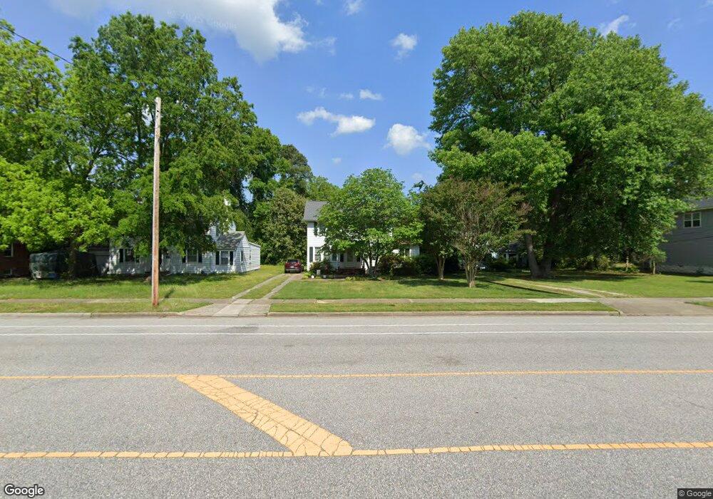
80 Lasalle Ave Hampton, VA 23661
Newtown-Crown Point NeighborhoodEstimated Value: $284,000 - $334,000
3
Beds
2
Baths
1,800
Sq Ft
$175/Sq Ft
Est. Value
About This Home
This home is located at 80 Lasalle Ave, Hampton, VA 23661 and is currently estimated at $315,307, approximately $175 per square foot. 80 Lasalle Ave is a home located in Hampton City with nearby schools including Hunter B. Andrews PK-8 School, C. Alton Lindsay Middle School, and Phoebus High School.
Ownership History
Date
Name
Owned For
Owner Type
Purchase Details
Closed on
Dec 6, 2023
Sold by
Messersmith David L
Bought by
David L Messersmith Jr Trust and Messersmith
Current Estimated Value
Purchase Details
Closed on
Jul 31, 2007
Sold by
Carter Marlon E
Bought by
Armstrong Earl Magnus
Home Financials for this Owner
Home Financials are based on the most recent Mortgage that was taken out on this home.
Original Mortgage
$160,000
Interest Rate
6.78%
Mortgage Type
New Conventional
Create a Home Valuation Report for This Property
The Home Valuation Report is an in-depth analysis detailing your home's value as well as a comparison with similar homes in the area
Home Values in the Area
Average Home Value in this Area
Purchase History
| Date | Buyer | Sale Price | Title Company |
|---|---|---|---|
| David L Messersmith Jr Trust | -- | None Listed On Document | |
| Armstrong Earl Magnus | $200,000 | -- |
Source: Public Records
Mortgage History
| Date | Status | Borrower | Loan Amount |
|---|---|---|---|
| Previous Owner | Armstrong Earl Magnus | $160,000 |
Source: Public Records
Tax History
| Year | Tax Paid | Tax Assessment Tax Assessment Total Assessment is a certain percentage of the fair market value that is determined by local assessors to be the total taxable value of land and additions on the property. | Land | Improvement |
|---|---|---|---|---|
| 2025 | $3,459 | $300,600 | $106,400 | $194,200 |
| 2024 | $3,195 | $277,800 | $106,400 | $171,400 |
| 2023 | $2,930 | $252,600 | $103,600 | $149,000 |
| 2022 | $2,857 | $242,100 | $98,000 | $144,100 |
| 2021 | $2,816 | $216,600 | $84,000 | $132,600 |
| 2020 | $2,661 | $214,600 | $84,000 | $130,600 |
| 2019 | $2,657 | $214,300 | $73,600 | $140,700 |
| 2018 | $2,751 | $214,300 | $73,600 | $140,700 |
| 2017 | $2,751 | $0 | $0 | $0 |
| 2016 | $2,751 | $214,300 | $0 | $0 |
| 2015 | $2,751 | $0 | $0 | $0 |
| 2014 | $2,741 | $214,300 | $73,600 | $140,700 |
Source: Public Records
Map
Nearby Homes
- 3829 Roads View Ave
- 106 Clyde St
- 144 Algonquin Rd
- 3308 Matoaka Rd
- 3503 Fairfax Dr
- 218 Alleghany Rd
- 138 Hampton Roads Ave
- 15 Victor St
- 4207 Chesapeake Ave
- 216 Manteo Ave
- 44 Henry St
- 2915 Chesapeake Ave
- 405 Seminole Rd
- 402 Melville Rd
- 39 W Sunset Rd
- 438 Highland Ave
- 502 Homestead Ave
- 135 Pochin Place
- 423 Shenandoah Rd
- 421 Glendale Rd
- 82 Lasalle Ave
- 76 Lasalle Ave
- 78 Lasalle Ave
- 92 Lasalle Ave
- 74 Lasalle Ave
- 105 Hanover Ave
- 100 Lasalle Ave
- 81 Lasalle Ave
- 109 Hanover Ave
- 83 Lasalle Ave
- 104 Lasalle Ave
- 60 Lasalle Ave
- 75 Lasalle Ave
- 3610 Spottswood Place
- 3703 Chesapeake Ave
- 3707 Chesapeake Ave
- 3701 Chesapeake Ave
- 105 Lasalle Ave
- 65 Lasalle Ave
- 113 Hanover Ave
Your Personal Tour Guide
Ask me questions while you tour the home.