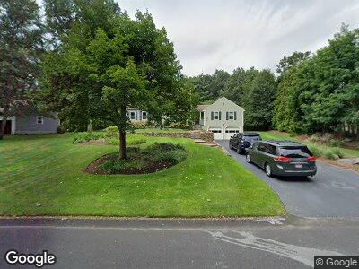
80 Lurie Cir Stoughton, MA 02072
Estimated Value: $731,381 - $846,000
3
Beds
3
Baths
2,442
Sq Ft
$323/Sq Ft
Est. Value
About This Home
This home is located at 80 Lurie Cir, Stoughton, MA 02072 and is currently estimated at $787,845, approximately $322 per square foot. 80 Lurie Cir is a home located in Norfolk County with nearby schools including Joseph R Dawe Jr Elementary School, O'Donnell Middle School, and Stoughton High School.
Ownership History
Date
Name
Owned For
Owner Type
Purchase Details
Closed on
Aug 28, 1998
Sold by
Bennett Steven C
Bought by
Tyer Steven J and Tyer Colleen F
Current Estimated Value
Home Financials for this Owner
Home Financials are based on the most recent Mortgage that was taken out on this home.
Original Mortgage
$196,000
Interest Rate
6.9%
Mortgage Type
Purchase Money Mortgage
Create a Home Valuation Report for This Property
The Home Valuation Report is an in-depth analysis detailing your home's value as well as a comparison with similar homes in the area
Home Values in the Area
Average Home Value in this Area
Purchase History
| Date | Buyer | Sale Price | Title Company |
|---|---|---|---|
| Tyer Steven J | $245,000 | -- | |
| Tyer Steven J | $245,000 | -- |
Source: Public Records
Mortgage History
| Date | Status | Borrower | Loan Amount |
|---|---|---|---|
| Open | Tyer Steven J | $200,000 | |
| Closed | Tyer Steven J | $160,000 | |
| Closed | Tyer Steven J | $170,000 | |
| Closed | Tyer Colleen F | $208,000 | |
| Closed | Tyer Steven J | $212,000 | |
| Closed | Bennett Steven C | $196,000 | |
| Previous Owner | Bennett Steven C | $40,000 |
Source: Public Records
Tax History Compared to Growth
Tax History
| Year | Tax Paid | Tax Assessment Tax Assessment Total Assessment is a certain percentage of the fair market value that is determined by local assessors to be the total taxable value of land and additions on the property. | Land | Improvement |
|---|---|---|---|---|
| 2025 | $8,376 | $676,600 | $262,200 | $414,400 |
| 2024 | $8,133 | $638,900 | $239,500 | $399,400 |
| 2023 | $7,855 | $579,700 | $218,800 | $360,900 |
| 2022 | $7,686 | $533,400 | $210,600 | $322,800 |
| 2021 | $7,450 | $493,400 | $185,800 | $307,600 |
| 2020 | $7,347 | $493,400 | $185,800 | $307,600 |
| 2019 | $7,213 | $470,200 | $185,800 | $284,400 |
| 2018 | $6,670 | $450,400 | $177,500 | $272,900 |
| 2017 | $6,066 | $418,600 | $175,500 | $243,100 |
| 2016 | $5,924 | $395,700 | $159,000 | $236,700 |
| 2015 | $5,861 | $387,400 | $150,700 | $236,700 |
| 2014 | $5,474 | $347,800 | $138,300 | $209,500 |
Source: Public Records
Map
Nearby Homes
- 111 E Vanston Rd
- 60 Brewster Rd Unit 60
- 349 Central St
- 15 Harwich Ln Unit 15
- 15 Harwich Ln
- 453 Turnpike St
- 53 Hollytree Rd
- 0 Old Maple St
- 121 Bassick Cir
- 45 Old Maple St
- 192 Corbett Rd
- 336 Lincoln St
- 393 Walnut St
- 31 7th St
- 600-R Pleasant St
- 631 Page St
- Lot 9 Lawler Ln
- 205 Pond St
- 20 Walnut Ct
- 710 Central St