80 N Dorr Way East Wakefield, NH 03830
Estimated Value: $806,000 - $928,000
3
Beds
2
Baths
2,354
Sq Ft
$366/Sq Ft
Est. Value
About This Home
This home is located at 80 N Dorr Way, East Wakefield, NH 03830 and is currently estimated at $861,266, approximately $365 per square foot. 80 N Dorr Way is a home located in Carroll County with nearby schools including Paul Elementary School.
Ownership History
Date
Name
Owned For
Owner Type
Purchase Details
Closed on
Aug 9, 2010
Sold by
Rich Bruce B and Rich Jennifer N
Bought by
Rousseau Edward R and Rousseau Donna L
Current Estimated Value
Home Financials for this Owner
Home Financials are based on the most recent Mortgage that was taken out on this home.
Original Mortgage
$255,000
Outstanding Balance
$173,435
Interest Rate
4.73%
Mortgage Type
Purchase Money Mortgage
Estimated Equity
$687,831
Create a Home Valuation Report for This Property
The Home Valuation Report is an in-depth analysis detailing your home's value as well as a comparison with similar homes in the area
Home Values in the Area
Average Home Value in this Area
Purchase History
| Date | Buyer | Sale Price | Title Company |
|---|---|---|---|
| Rousseau Edward R | $322,000 | -- |
Source: Public Records
Mortgage History
| Date | Status | Borrower | Loan Amount |
|---|---|---|---|
| Open | Rousseau Edward R | $255,000 |
Source: Public Records
Tax History Compared to Growth
Tax History
| Year | Tax Paid | Tax Assessment Tax Assessment Total Assessment is a certain percentage of the fair market value that is determined by local assessors to be the total taxable value of land and additions on the property. | Land | Improvement |
|---|---|---|---|---|
| 2024 | $6,435 | $855,700 | $419,800 | $435,900 |
| 2023 | $5,857 | $855,100 | $419,800 | $435,300 |
| 2022 | $5,014 | $409,300 | $159,100 | $250,200 |
| 2021 | $5,051 | $409,300 | $159,100 | $250,200 |
| 2020 | $5,083 | $410,600 | $159,100 | $251,500 |
| 2019 | $5,003 | $401,200 | $159,100 | $242,100 |
| 2018 | $4,518 | $401,200 | $159,100 | $242,100 |
| 2017 | $4,044 | $319,700 | $148,900 | $170,800 |
| 2016 | $4,137 | $319,700 | $148,900 | $170,800 |
| 2015 | $4,175 | $319,700 | $148,900 | $170,800 |
| 2014 | $4,073 | $319,700 | $148,900 | $170,800 |
| 2013 | $3,915 | $318,800 | $148,900 | $169,900 |
Source: Public Records
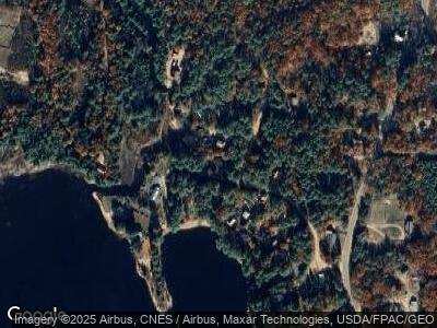
Map
Nearby Homes
- 0 Province Lake Rd Unit 5033962
- 152 Emerald Point
- 359 Gold Coast Dr
- Lot 6 Pick Pocket Rd
- 62 Ames Rd
- 63 Towle Farm Rd
- Lot 2 Leighton Corner Rd
- 00 N Desmond Dr
- 33 Point Rd
- 288 Bonnyman Rd
- 114 Point Rd
- 25 Demeritt Rd
- lot 10 Thomas Dr
- 00 Diane Place
- 47 Tuckaway Dr
- 190 Foggs Ridge Rd
- lot 37 David Dr
- 39 Lake Shore Dr
- 32 Bailey Rd
- 55 Foye Cove Rd
- 80 N Dorr Way
- 25 Pennsylvania Ave
- 22 Pennsylvania Ave
- 95 N Dorr Way
- 120 N Dorr Way
- * Pennsylvania Ave
- 53 N Dorr Way
- 85 S Dorr Way
- 54 N Dorr Way
- 35 Pennsylvania Ave
- 39 N Dorr Way
- 142 N Dorr Way
- 34 N Dorr Way
- 4229 Province Lake Rd
- 29 N Dorr Way
- 4207 Province Lake Rd
- 23 N Dorr Way
- 71 N Dorr Way
- 4261 Province Lake Rd
- 135 S Dorr Way