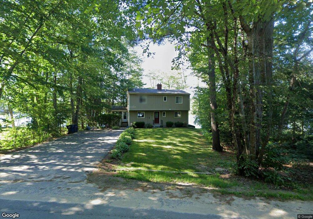
80 Varney Rd Center Barnstead, NH 03225
Estimated Value: $631,000 - $723,000
2
Beds
3
Baths
2,175
Sq Ft
$318/Sq Ft
Est. Value
About This Home
This home is located at 80 Varney Rd, Center Barnstead, NH 03225 and is currently estimated at $690,563, approximately $317 per square foot. 80 Varney Rd is a home with nearby schools including Barnstead Elementary School and Prospect Mountain High School.
Ownership History
Date
Name
Owned For
Owner Type
Purchase Details
Closed on
Feb 28, 2006
Sold by
Brown Ft
Bought by
Lakefront Brownies Llc
Current Estimated Value
Purchase Details
Closed on
Dec 19, 1997
Sold by
Lane Ami P
Bought by
Brown Clare G and Brown Clair J
Home Financials for this Owner
Home Financials are based on the most recent Mortgage that was taken out on this home.
Original Mortgage
$100,000
Interest Rate
7.14%
Create a Home Valuation Report for This Property
The Home Valuation Report is an in-depth analysis detailing your home's value as well as a comparison with similar homes in the area
Home Values in the Area
Average Home Value in this Area
Purchase History
| Date | Buyer | Sale Price | Title Company |
|---|---|---|---|
| Lakefront Brownies Llc | $245,000 | -- | |
| Brown Clare G | $141,000 | -- |
Source: Public Records
Mortgage History
| Date | Status | Borrower | Loan Amount |
|---|---|---|---|
| Previous Owner | Brown Clare G | $100,000 |
Source: Public Records
Tax History Compared to Growth
Tax History
| Year | Tax Paid | Tax Assessment Tax Assessment Total Assessment is a certain percentage of the fair market value that is determined by local assessors to be the total taxable value of land and additions on the property. | Land | Improvement |
|---|---|---|---|---|
| 2024 | $10,716 | $657,000 | $385,300 | $271,700 |
| 2023 | $9,428 | $657,000 | $385,300 | $271,700 |
| 2022 | $6,979 | $323,100 | $144,000 | $179,100 |
| 2021 | $7,095 | $323,100 | $144,000 | $179,100 |
| 2020 | $7,464 | $323,100 | $144,000 | $179,100 |
| 2019 | $7,374 | $323,000 | $144,000 | $179,000 |
| 2018 | $7,187 | $323,000 | $144,000 | $179,000 |
| 2017 | $7,786 | $269,400 | $137,400 | $132,000 |
| 2016 | $7,341 | $269,400 | $137,400 | $132,000 |
| 2015 | $7,314 | $269,400 | $137,400 | $132,000 |
| 2014 | $7,135 | $297,800 | $157,500 | $140,300 |
| 2013 | $6,998 | $297,800 | $157,500 | $140,300 |
Source: Public Records
Map
Nearby Homes
- 96 Damsite Rd
- 0 Andover Dr Unit 106 5059711
- 24 Danbury Rd
- 0 Crescent Dr Unit 5026960
- 0 Corner North Shore Dr Unit 446 5054482
- 28 Dalton Dr
- 248 Varney Rd
- O N Shore Dr
- 7 Brenton Ln
- 21 Shelburne Ln
- 9 Nutter Cir
- Lot 33 Ridge Rd
- 8 Brookwood Dr
- 17 Prospect Mountain Rd
- 418 Narrows Rd
- 16 Ridge Rd
- M10 L26-3 Valley Dam Rd
- 956 N Barnstead Rd
- Lot 30-2-1 North Rd
- 25 Vail Rd