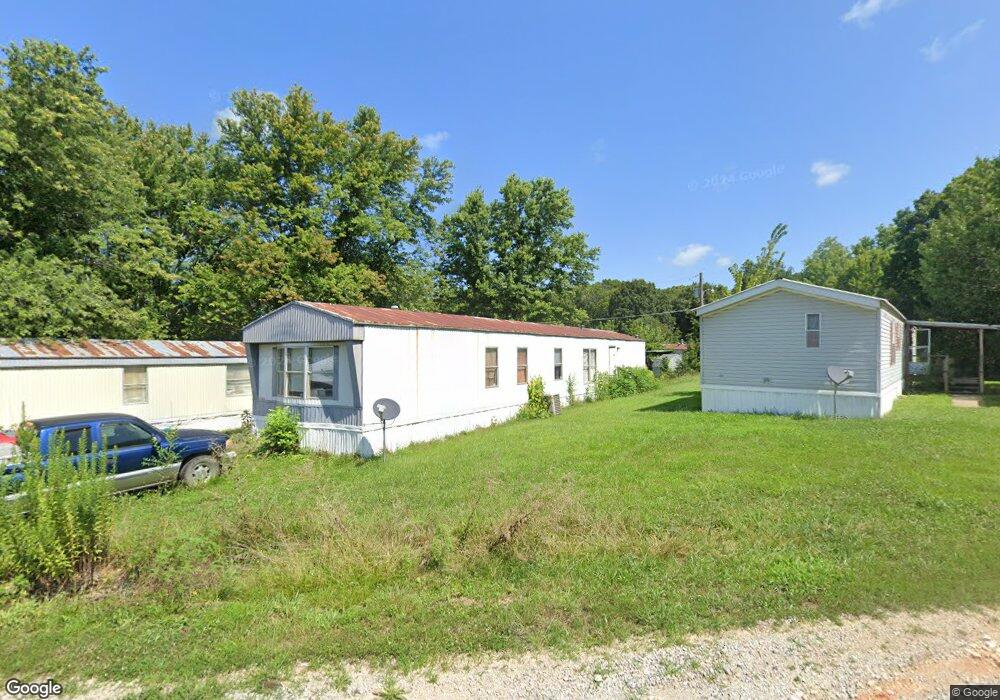
800 Lanton Rd West Plains, MO 65775
Estimated Value: $115,000 - $439,822
--
Bed
--
Bath
--
Sq Ft
21.56
Acres
About This Home
This home is located at 800 Lanton Rd, West Plains, MO 65775 and is currently estimated at $234,607. 800 Lanton Rd is a home located in Howell County with nearby schools including West Plains Senior High School, Ozarks Christian Academy, and Faith Assembly Christian School.
Ownership History
Date
Name
Owned For
Owner Type
Purchase Details
Closed on
Jun 22, 2018
Sold by
Beauchamp Ii Roger and Beauchamp Sharon
Bought by
Fackler Jessica Dawn
Current Estimated Value
Home Financials for this Owner
Home Financials are based on the most recent Mortgage that was taken out on this home.
Original Mortgage
$53,910
Outstanding Balance
$46,623
Interest Rate
4.5%
Mortgage Type
Future Advance Clause Open End Mortgage
Estimated Equity
$187,984
Purchase Details
Closed on
Jul 13, 2016
Sold by
Schroeder Sam M and Schroeder Diana
Bought by
Ramos Ventures Llc
Create a Home Valuation Report for This Property
The Home Valuation Report is an in-depth analysis detailing your home's value as well as a comparison with similar homes in the area
Home Values in the Area
Average Home Value in this Area
Purchase History
| Date | Buyer | Sale Price | Title Company |
|---|---|---|---|
| Fackler Jessica Dawn | -- | Brill Title Co | |
| Ramos Ventures Llc | -- | None Available |
Source: Public Records
Mortgage History
| Date | Status | Borrower | Loan Amount |
|---|---|---|---|
| Open | Fackler Jessica Dawn | $53,910 |
Source: Public Records
Tax History Compared to Growth
Tax History
| Year | Tax Paid | Tax Assessment Tax Assessment Total Assessment is a certain percentage of the fair market value that is determined by local assessors to be the total taxable value of land and additions on the property. | Land | Improvement |
|---|---|---|---|---|
| 2025 | $3,055 | $73,760 | $32,000 | $41,760 |
| 2024 | $3,037 | $65,860 | -- | -- |
| 2023 | $3,037 | $65,860 | $0 | $0 |
| 2022 | $3,019 | $65,580 | $0 | $0 |
| 2021 | $3,007 | $65,580 | $0 | $0 |
| 2020 | $3,007 | $63,780 | $0 | $0 |
| 2019 | $3,122 | $63,780 | $0 | $0 |
| 2018 | $3,122 | $63,780 | $0 | $0 |
| 2017 | $3,110 | $63,780 | $0 | $0 |
| 2015 | -- | $67,710 | $0 | $0 |
| 2014 | -- | $67,910 | $0 | $0 |
| 2013 | -- | $67,910 | $0 | $0 |
Source: Public Records
Map
Nearby Homes
- 1236 Aldridge St
- 620 Johnson St
- 000 S Thayer Ave
- 426 S Thayer Ave
- 000 Tanglewood Place
- 000 Bill Virdon
- 639 Lanton Rd
- 312 E Maple St
- 315 Walker St
- 130 N Howell Ave
- 742 Olive St
- 1029 S Aid Ave
- 000 Us Highway 63
- 209 S Aid Ave
- 203 S Aid Ave
- 204 Bartley St
- 413 Cherry St
- 101 W Main St
- 1011 County Road 8270
- 415 Farrell St
- 1214 Aldridge St
- 1213 Aldridge St
- 1224 Aldridge St
- 1228 Aldridge St
- 446 Lanton Rd
- 1232 Aldridge St
- 1227 Aldridge St
- 436 Lanton Rd
- 434 Lanton Rd
- 606 Lanton Rd
- 1233 Aldridge St
- 1240 Aldridge St
- 1237 Aldridge St
- 426 Lanton Rd
- 1243 Aldridge St
- 331 S Thayer Ave
- 336 S Thayer Ave
- 325 S Thayer Ave
- 1110 Lambert Ln
- 1108 Lambert Ln