Estimated Value: $50,479 - $160,000
--
Bed
--
Bath
1,104
Sq Ft
$80/Sq Ft
Est. Value
About This Home
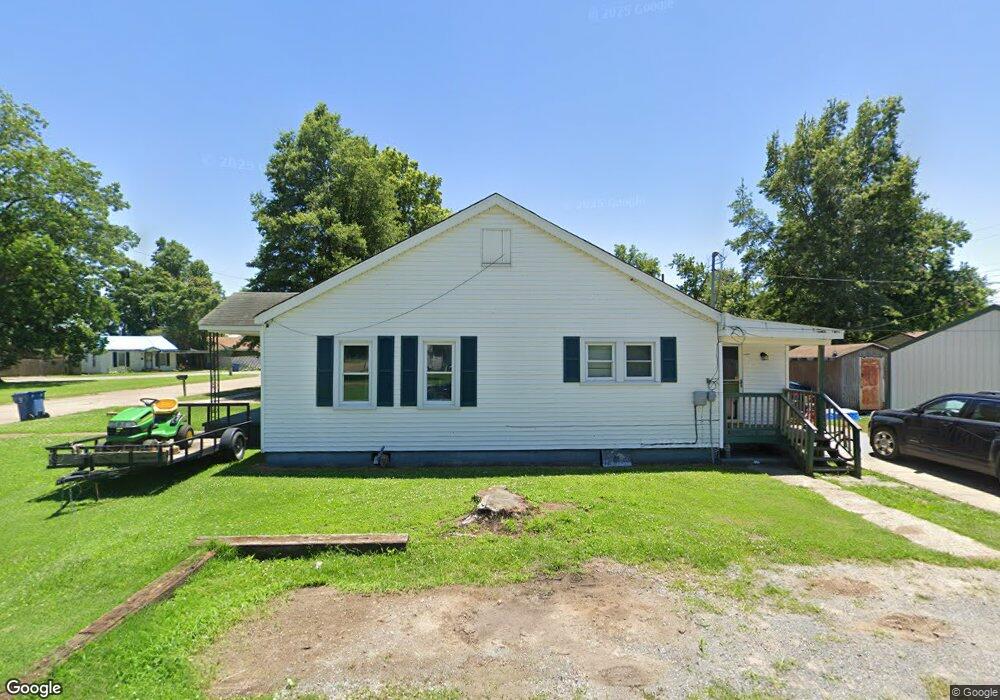
This home is located at 801 S 4th St, Hayti, MO 63851 and is currently estimated at $88,370, approximately $80 per square foot. 801 S 4th St is a home with nearby schools including Mathis Elementary School, Wallace Elementary School, and Hayti High School.
Ownership History
Date
Name
Owned For
Owner Type
Purchase Details
Closed on
Aug 31, 2023
Sold by
Khourie Robert L and Khourie Salema
Bought by
Khouries Rental Property Llc
Current Estimated Value
Purchase Details
Closed on
Mar 28, 2019
Sold by
Jpmorgan Chase Bank National Association
Bought by
Khourie Robert L and Khourie Salema P
Purchase Details
Closed on
Jan 24, 2019
Sold by
Mcnabb Jason S
Bought by
Jpmorgan Chase Bank National Assoication
Purchase Details
Closed on
Apr 16, 2010
Sold by
Todd Jerry and Todd Carol
Bought by
Mcnabb Jason
Home Financials for this Owner
Home Financials are based on the most recent Mortgage that was taken out on this home.
Original Mortgage
$66,545
Interest Rate
4.9%
Mortgage Type
New Conventional
Create a Home Valuation Report for This Property
The Home Valuation Report is an in-depth analysis detailing your home's value as well as a comparison with similar homes in the area
Home Values in the Area
Average Home Value in this Area
Purchase History
| Date | Buyer | Sale Price | Title Company |
|---|---|---|---|
| Khouries Rental Property Llc | -- | None Listed On Document | |
| Khouries Rental Property Llc | -- | None Listed On Document | |
| Khourie Robert L | -- | First State Title | |
| Jpmorgan Chase Bank National Assoication | $32,680 | None Available | |
| Mcnabb Jason | -- | None Avaliable |
Source: Public Records
Mortgage History
| Date | Status | Borrower | Loan Amount |
|---|---|---|---|
| Previous Owner | Mcnabb Jason | $66,545 |
Source: Public Records
Tax History Compared to Growth
Tax History
| Year | Tax Paid | Tax Assessment Tax Assessment Total Assessment is a certain percentage of the fair market value that is determined by local assessors to be the total taxable value of land and additions on the property. | Land | Improvement |
|---|---|---|---|---|
| 2024 | $452 | $7,450 | $0 | $0 |
| 2023 | $434 | $7,450 | $0 | $0 |
| 2022 | $396 | $6,810 | $0 | $0 |
| 2021 | $393 | $6,810 | $0 | $0 |
| 2020 | $393 | $6,810 | $0 | $0 |
| 2019 | $388 | $6,810 | $0 | $0 |
| 2018 | $374 | $6,810 | $0 | $0 |
| 2017 | $374 | $6,810 | $0 | $0 |
| 2016 | -- | $6,810 | $0 | $0 |
| 2015 | -- | $7,260 | $0 | $0 |
| 2013 | -- | $6,800 | $0 | $0 |
Source: Public Records
Map
Nearby Homes
- 1014 S Klinkhardt St
- 0 Highway 412
- . W Washington St
- 600 E Reed St
- 301 E Jackson St
- 604 N 3rd St
- 0 County Road 406
- 0 County Road 263 Unit MIS25048822
- 1206 Zaida Ave
- 1209 Zaida Ave
- 1212 Collins Ave
- 0 State Highway U
- 802 Beckwith Ave
- 707 Beckwith Ave
- 1200 Grand Ave
- 406 W 4th St
- 607 Cotton Ave
- 313 W 11th St
- 311 W 11th St
- 700 Carleton Ave